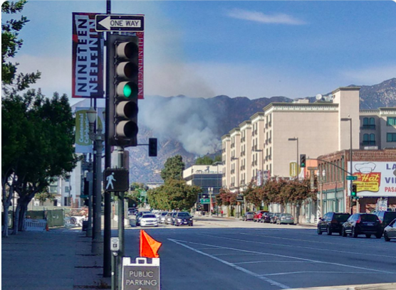
Brush Fire LACOFD 12s (Altadena) at Loma Alta Park, E12 on scene reporting 4 acres in medium fuels running up hill with no immediate structure threat, requesting full first alarm brush.
Showing on Mt Harvard Cam: http://www.alertwildfire.org/orangecoca/index.html
ANF has this listed as the Lowe Fire, I’m not sure if it is unified or not. Mt. Lowe Rd. x /Chaney Trail
ANF Units assigned. BC-11 BC-22 CRW-4 ENG-13 ENG-28 ENG-310 ENG-311 ENG-324 ENG-326 ENG-34 PAT-25 PAT-34 WT-10 WT-222
The fire is running up hill. ANF BC-11 requesting 3 additional type 1 federal handcrews for a total of 4 & an additional type 1 copter.
Issues with agencies getting on the same comm plan, what’s the ANF comm plan?
I don’t have the ANF Com plan, this must be ANF but LACO E-12 was first on scene. This is above Altadena.
ANF E-311 reports fire is now about 8 acres in light-medium brush, power lines in the area. College Peak Cam now has a good shot. Same link as above.
10+ acres, moving uphill. Looks like the Scoopers from LACoFD are there now.
100% in FRA. Potential for 50 acres. Moving to the east with potential threat to LAC/IAZ.
South Ops just requested a type 1 hotshot crew from the Lopez incident.
Lots of confusion on the comm plan. The fire is all on the ANF, but LAC was on scene first on their comm plan. IC is trying to manage both right now.
ANF comm plan is ANF forest net, NIFC T2, V-Fire 23, A/G 59. Victor has been changed twice. Unsure what is now.
1 Like