State ID: CA
3 letter designator: ANF
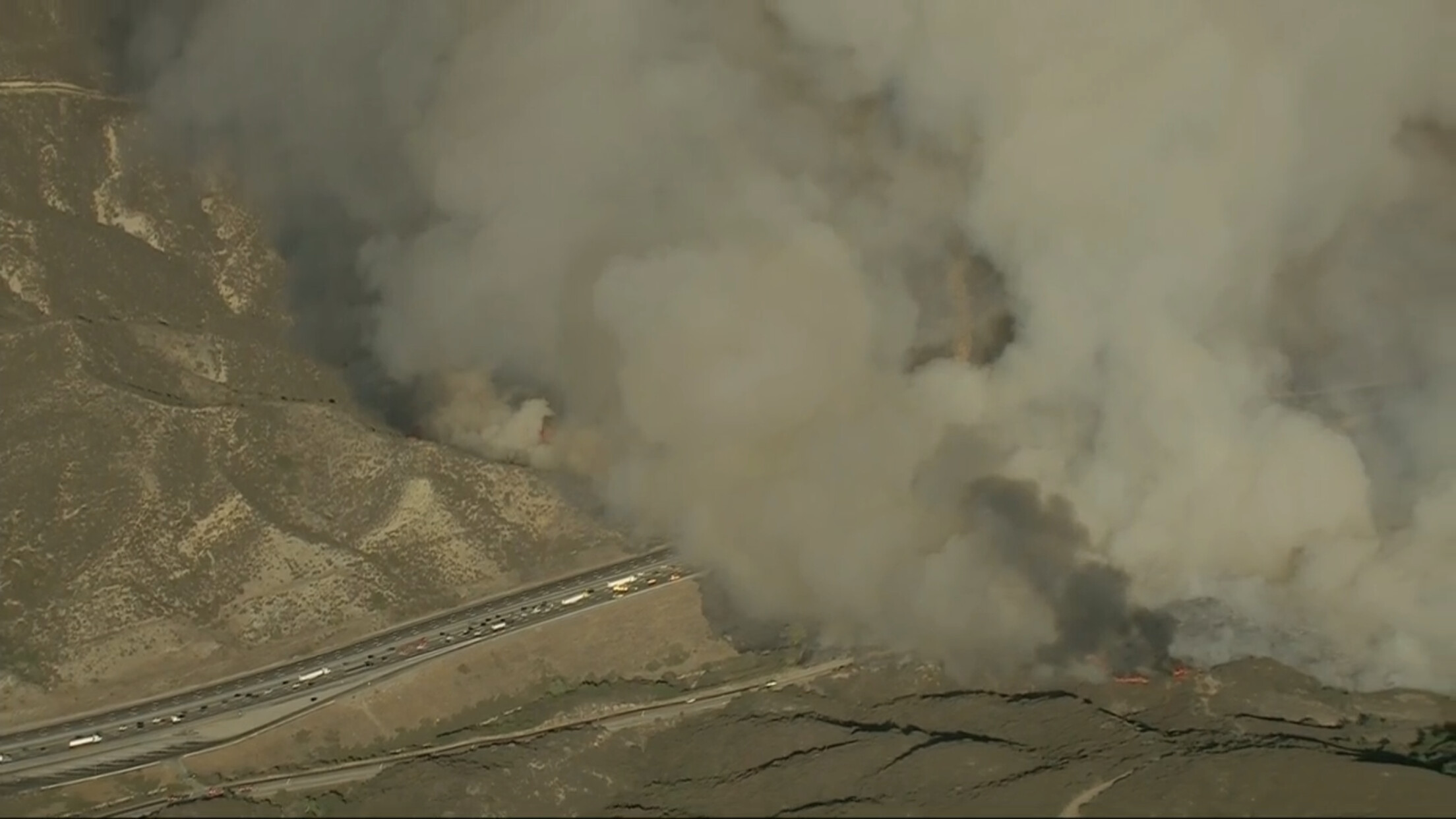
Fire name: Route
Location: SB 5 Fwy, S/O Templin Hwy
Reported acres: 50
Rate of spread: NR
Report on Conditions: Fire on both sides of the freeway. 2nd alarm being requested from LAC for structure defense mission.
Structure threat: Yes
Resources: 2nd alarm LAC, ANF BC-12 CRW-63 DIV-3 DOZ-12 DVD-1 ED-11 ENG-13 ENG-310 ENG-311 ENG-314 ENG-315 ENG-317 ENG-32 ENG-333 PAT-11 PAT-12 WT-212 WT-237
Hazards: Power lines
Weather: Temp 85 degrees, RH 23%, Winds SSE 10 mph, gusts to 22 mph
Radio channels: LAC Blue 12, V-5 and LAC A/G
Scanner link: LAC Los Angeles County Fire - Blue 12 and V-5 Live Audio Feed, ANF Angeles National Forest - North with Bobcat coverage Live Audio Feed
Webcam link:Camp Nine 2Gorman 2Loop 1
Agency Website:
Live video: Crews battling brush fire in Santa Clarita near 5 Freeway
Well established across the freeway to the east!!
AA requesting additional fixed wing. 1 additional VLAT for total of 2 and 4 LATs if available.
LAC Admin being switched to Blue 11 from Blue 12.
http://beta.alertwildfire.org/tile-display/viewer/?cams=Axis-Gorman2&cams=Axis-Loop1&cams=Axis-Loop2
Tile display for easier watching.
Good photo and video on Twitter: https://twitter.com/hashtag/RouteFire?src=hashtag_click
New start 5 miles north of this fire on the 5, vehicle fire with spread to the brush and an acre already active. EDIT: Vehicle and brush handled by 2 ANF and 1 LAC engine.
Also, ANF asking for 3 additional Type 3 STEN and six additional crews. Structure threat on the north side, Paradise.
Structures: https://goo.gl/maps/xH2kJXoYQhRVvuoX8
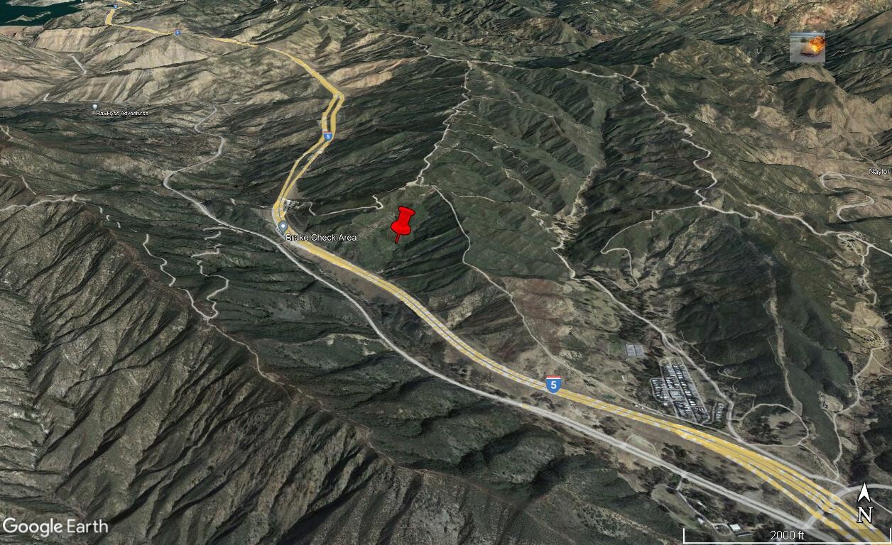
Note: Initial report above stated it was S/O Templin Hwy. Templin is the interchange in the lower right corner. This shot is based upon the live video feed from the copter. i.e. it’s a guestimate…
AA spoke of possible threat to communications equipment on Whittaker Peak.
392 acres.
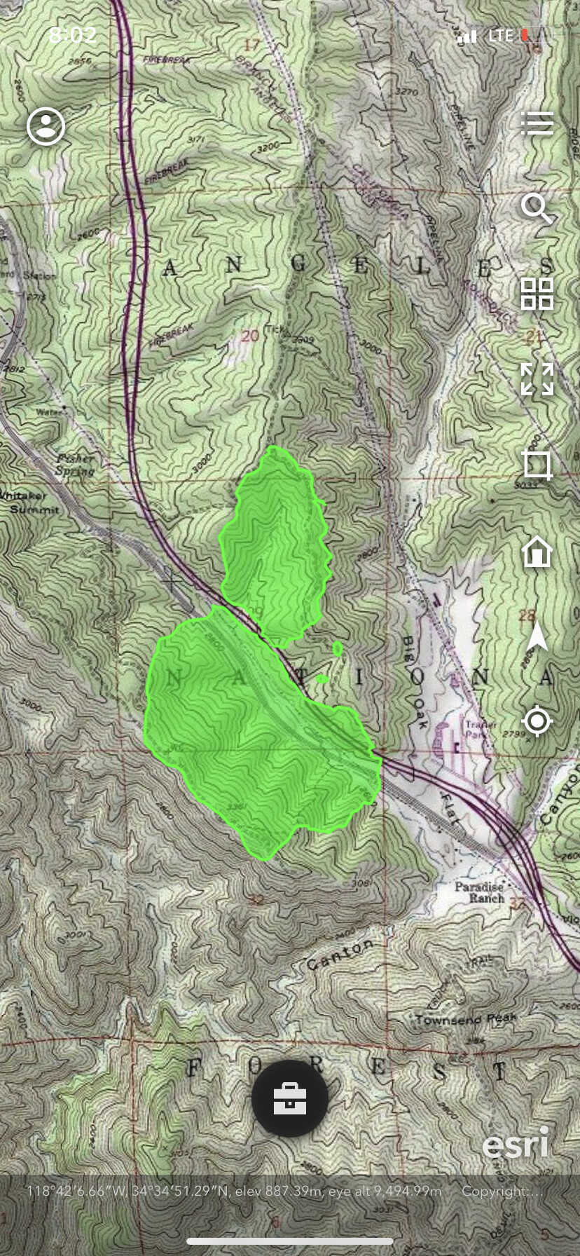
392 acres and looking a lot improved per FIRIS Intel 24 and retardant line and dozer line around most of the south side of the freeway (not sure which Div that was named) with a little active heat SW corner. The east side of the freeway being held with existing road system. D35ruc70 map is accurate with rotor wing working the spot fires on the east side.
Burn injuries occurred and not reported fully till now: https://wildfiretoday.com/2021/12/11/dozens-of-firefighters-were-nearly-entrapped-on-the-route-fire-in-southern-california/?fbclid=IwAR1qNlSIKRO4TzM5k_Loiqq78uvBvDbyjBRXUpWsgbprEEqF417l48RPfSk