Spotted this on the cameras . Not toned out yet. Looks to be NB-15 near Blue Cut
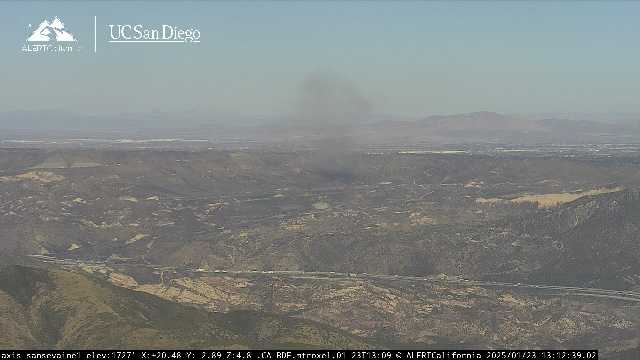

Spotted this on the cameras . Not toned out yet. Looks to be NB-15 near Blue Cut
Looks like top of the pass
1 acre wind driven, potential for 100 acres.
That’s very optimistic
I get it, just reporting what was said.
Additionally, smoke showing on Dunlap acres cam, any info?
Edit…Fire near the base of HWY 330.
acre and half in highland
WildCAD has it as the Highland IC, 34.135905, -117.190604
Baldy Incident in high desert
Highland incident in Highland
Highland Fire is on the Dunlap Acres cam, different location.
The cams put it just above the I-15 split going Northbound, just past the on/off ramps for HWY 138.
appears to be on the West side of the freeway.
edit: On the East side of the freeway just after the split South bound. 
Baldy is up by station 305
Morman Rocks ?
The Summit, 395/15 area, Baldy Mesa
Highland fire has a line around it,