State ID: CA
3 letter designator:BDF
Fire name: Easton
Location: Hwy 330 X Highland
Reported acres: 10-15
Rate of spread: Rapid
Report on Conditions: Running Up Hill
Structure threat: yes
Resources: 1st and 2nd Alarms from BDF
Full response from BDC
Hazards:
Weather:
Radio channels:
Scanner link: I’m listening to “San Bernardino National Forest” with the Scanner Radio app. You can listen to it here: https://scannerradio.app/?l=NjUzODQ
Webcam link:
Agency Website:
3 air tankers and 2 type one helps requested
http://www.alertwildfire.org/inlandempire/index.html?camera=Axis-Crestline1&v=81e003f
Reche Canyon and Heaps Peak has it also.
2 Type 1 crews on FS mission
2 BDC Water Tender on MMA
5 closet type 3 engines
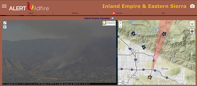
http://www.alertwildfire.org/inlandempire/index.html?camera=Axis-SargentOrchards1&v=81e003f
Pretty good vantage point
564 Fire is running a live Periscope broadcast if anyone has access to Periscope and would like to see a ground level view.
3 additional tankers any type and two additional type 1 helos
25 acres Rapid ROS
0 containment
Per IC. 50 acres making progress WITH GROUND CREWS AND AIRCFRAFT
Watching this from my front yard. Looking at the smoke, the aircraft are getting it pretty well knocked down. They hit it hard before it could get into alignment with the steeper part of Harrison Mtn.

