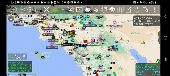
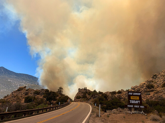
State ID: CA
3 letter designator: BDF
Fire name: Flats
Location: 64749 Pinyon Drive near Pinyon Flat Campground; Pinyon Pines, CA
Reported acres: 5
Rate of spread: rapid
Report on Conditions: dangerous-critical rate of spread, potential for 1,000+ acres
Structure threat: yes
Resources: BDF: BC 33 BC 52 BRAVO 73 CREW 5 E334 E339 E35 E353 E356 E50 E51 E54 E5R E7372 HT 1CK PT58* WT56, RRU
AA310, T40, T71, T72, T78, T100, T105, HC301, HC305
Hazards: excessive heat, steep terrain
Weather: sunny, with a high near 98. North wind 5 to 10 mph becoming west in the afternoon. NWS Forecast
Pinyon RAWS
Radio channels:
Scanner link: San Bernardino National Forest Live Audio Feed
http://bigbearscanner.com/
Cal Fire and Riverside County Fire - West Live Audio Feed
Webcam link: Toro Peak 1
Toro Peak 2
Sage Brush Flats
Toro Peak - HPWREN
Thousand Palms
Agency Website: San Bernardino National Forest - Home
Highway 74 - InciWeb the Incident Information System
CAL Fire - Flats
2 Additional Tankers for a total of 4.
2 more additional Tankers with at least one a LAT. This will make 6 for now.
T78 out of Porterville + a VLAT on order
The fire is now bumping Hwy 74, I don’t know if it has crossed yet.
Edit, multiple spots across Hwy 74 now.
25 acres moderate ROS, heading NE, established across 74
The fire has crossed Scenic drive per the camera view.
IC requesting 3 T2 handcrews (prefer T1) + 3 T3 Strike teams, & 4 WT’S
60+ acres, moving hard to the NE. Lots of additional resources being ordered.
Wind driven ?
Here is a map for discussion. It is based on remote sensing and is only an estimate. Looks to be 65 acres. Buring up to Sugarloaf Mountain.
Looks like the wind in changing and aligning with the steeper slope up the mountain.
IC requesting RRU 10 closest T1 engines immediate need for structure protection.
Update to the map estimate. Looks more like 75-80 acres and well established and moving up Sugarloaf Mountain also pushing to the SE some to the head of Deep Canyon.
Evacuation warning for Pinyon and Alpine Village
⁃ Highway 74 closed b/w Palowet Dr. and Ribbonwood Dr.
Updated map estimate. Rough acres150-175 acres. Well positioned to wrap around Sugarloaf and threaten more of the 74. Map is an estimate use for reference and discussion.
T914 diverted to a new start out of state. AA still needs T1 airtanker to replace this request.
Sounds like T914 is headed to my neighborhood in Northern AZ.
Last update of estimated map. Estimated at 230-250 acres. Still very smoky and difficult to get a good look at northern flank. FIRIS INTEL on scene shortly will give much better mapping product.
https://caltopo.com/p/7S73


