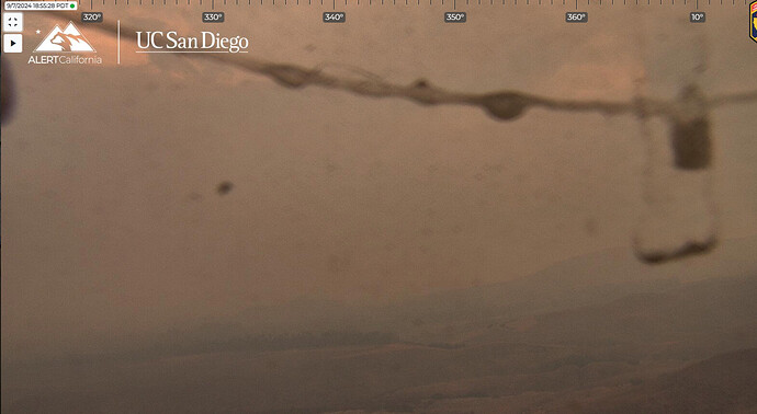
HWY 330 is impassable, units advised to use HWY 18.
Sep 7 at 4:53 PM
Per the San Bernardino County Sheriff Office an Evacuation Order is now in effect for all of the communities of Running Springs and Arrow Bear Lake.
Better add Green Valley Lake to that
Isn’t there only one paved road to there? Eeesh
Live video streams from Running Springs:
More monsoonal moisture with t-storm development possible again today. From NWS SDX Forecast Discussion:
In terms of storm activity, today looks to be the most active,
impacting the most number of our fair citizens. An inverted trough
over NW MEX will provide light east flow aloft with continued
monsoonal moisture. Highest confidence for storm development is
along the mountains drifting into the high desert and Inland
Empire again today per latest HRRR/WRF models. Some storms may
drift into the eastern valleys of San Diego county as well. We can
**expect the heaviest rain to fall over mountain areas with rates **
over one half inch possible and a moderate risk of localized flash
**flooding. Some downburst winds from these storms could be quite **
strong as well, so watch for wind if traveling or in the vicinity
of a storm. As the trough looms to the north and the high weakens,
monsoonal moisture becomes significantly less, which may trigger
storms across the mountain crests by Monday afternoon.
Steady increasing East wind here in Cherry Valley, was dead calm at 6am
Is there a better scanner channel? Not much about the fire on San Bernardino County valley scanner
Been listening to this one. Still not much traffic though.
https://scancalifornia.com/live/baldwin/
The wildland scanner coverage in this area is scant. BDC Valley will not have any CDF/USFS traffic, that is the County’s 800mhz feed
Fire is approaching (backing down to) Hwy 38 in the Morton Peak area. Additional resources requested to that side to attempt & hold 38 - most likely will close the highway. (@ 38 x Bryant for northbound) Change Angeles Oaks & Mountain Home to Evac order.
SB County Sheriff now adding all of Big Bear Valley to an Evacuation Warning.
https://x.com/sbcountysheriff/status/1833274468074156359
This mornings mapping flight puts it at 26510 acres.
Yah @MVUFirePhotographer …initial was @ 4000 acres at 11 a.m. Then afternoon update was 26K 6 hours later.
Per WD…there are currently 65,600 structures threatened. This includes 13,300 under evac orders and 52,300 under evac warnings.
That’s the Bridge fire stats.
9/11 0500 Info:
34659 Acres @ 17% Contained
EVAC and Threat Info:
This morning, San Bernardino County reported combined evacuation counts
for both the Line and Bridge fire:
- 20,700 people and 18,800 structures within evac order
- 75,100 people and 54,200 structures within evac warning
The numbers below are for the Line fire only. They were reported last night.
65,600 SF Residences Threatened
Evac ORDERS (12,900 people impacted):
- The area of Big Bear from the dam east to Wildrose Lane and the south
shoreline south to Bluff Lake Basin - Green Valley Lake north from Highway 18 along Green Valley Lake Road
- San Bernardino issued Forest Order NO. 05-12-00-24-09, creating a Forest
Closure Area around the Line Fire. All National Forest lands, trails, and roads
are closed to the public within that zone. - The area east of Orchard Road to Cloverhill from Highland Avenue north to
the foothills - All undeveloped land east of Highway 330 to Summertrail Place and north
of Highland Avenue - Communities of Running Springs and Arrowbear Lake
- Community of Forest Falls
- Community of Mountain Home Village
- Communities of Angelus Oaks, Seven Oaks, and all campgrounds and
cabins in the area - Areas North of Highland Avenue and East of Palm Avenue to Highway 330
Critical Resource Needs for the Line Fire:
25 STA
14 STC
3 STF
17 STG
6 IHC
5 CRW2
6 STL
12 DOZ1 or DOZ2
23 W/T Type 1 or Type 2
2 OPBD
10 DIVS
20 HEQB
3,179 Personnel Assigned
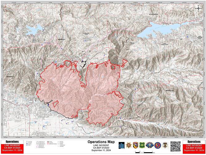
9/11 Ops Map:


