Air Attack 12, Lead Kilo 5. Air Tankers 16, 103 are now engaging. Visibility is slightly better.
6 Likes

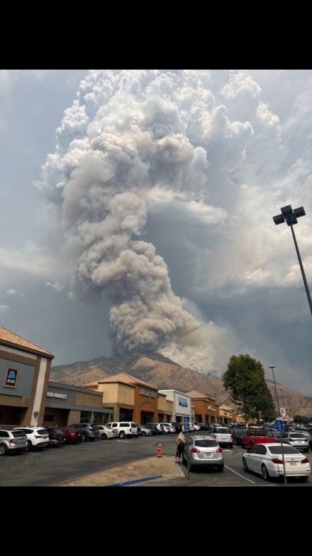
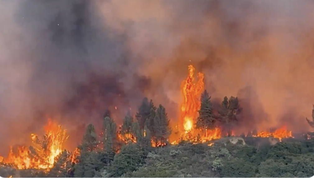
Fire Photo Girl (Brandy) was just live on 330, The fire is absolutely blowing up and was chugging up hill across 330. She ended the stream to leave as fire behavior was extremely erratic. The wind was blowing in multiple directions. May be outflow.
6 Likes
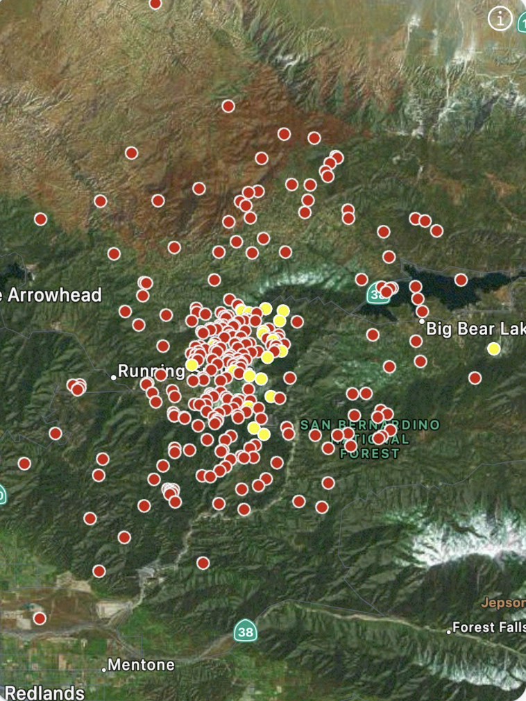
It’s hit 1N09 (shooting range access road) below Running Springs. That is a trigger point. 25 engines requested immediate need for structure defense.
Watch Duty stating the fire jumped the 330 and making a hard run to the north.
Image courtesy of SoCalMtns.com from Highland and 330.
10 Likes
Link please?
1 Like
She is not live now but its Firephotogirl on twitter or X.
5 Likes
think that shot was from the X video of firephotogirl?
https://x.com/FirePhotoGirl/status/1832554508385468496
Mod-Note. Correct
8 Likes
HWY 330 is impassable, units advised to use HWY 18.
3 Likes
Sep 7 at 4:53 PM
Per the San Bernardino County Sheriff Office an Evacuation Order is now in effect for all of the communities of Running Springs and Arrow Bear Lake.
2 Likes
Better add Green Valley Lake to that
5 Likes
Isn’t there only one paved road to there? Eeesh
1 Like
A post was merged into an existing topic: CA-BDF-Line ???
3 posts were merged into an existing topic: CA-BDF-Line ???
Live video streams from Running Springs:
5 Likes
More monsoonal moisture with t-storm development possible again today. From NWS SDX Forecast Discussion:
In terms of storm activity, today looks to be the most active,
impacting the most number of our fair citizens. An inverted trough
over NW MEX will provide light east flow aloft with continued
monsoonal moisture. Highest confidence for storm development is
along the mountains drifting into the high desert and Inland
Empire again today per latest HRRR/WRF models. Some storms may
drift into the eastern valleys of San Diego county as well. We can
**expect the heaviest rain to fall over mountain areas with rates **
over one half inch possible and a moderate risk of localized flash
**flooding. Some downburst winds from these storms could be quite **
strong as well, so watch for wind if traveling or in the vicinity
of a storm. As the trough looms to the north and the high weakens,
monsoonal moisture becomes significantly less, which may trigger
storms across the mountain crests by Monday afternoon.
5 Likes
Steady increasing East wind here in Cherry Valley, was dead calm at 6am
3 Likes
Is there a better scanner channel? Not much about the fire on San Bernardino County valley scanner
3 Likes