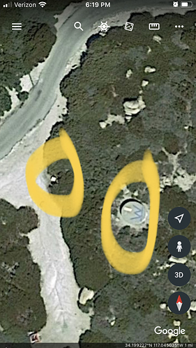
Glad to see the big W on them. I’m sure AA saw them as well. The valves were in concrete boxes with yellow lids along the roadway.
Those would have not been maintained then. They are not visible from the road and the brush is around 8+ feet in areas and full of Manzanita which is not fun to try and get through.
I goggle mapped those coordinates and never seen it from the road
fire is looking good. good work by air folks and by 1800 hrs. long night for ground folks. be safe and have fun. rough terrain
Found the one closet to the peak. Looks pretty well cleared. Circled the tank and valve box. Would love to see a road view.
The fire is actually in the 2007 Slide fire scar that butts up against the 2003 old fire.
Also, the cisterns are hit and miss as far as being maintained. The one in the pic that you identified from google earth is pretty visible from Keller peak road. Just saw it last week. Not sure if it’s topped off right now.
We are very intentional about the way we order resources. BDF/BDU/BDC have a pretty good working relationship but try to make all our lives easier and indetify the specifics behind most requests for when the cost share conversation occurs.
Proud of all agencies today. As stated this could have gone to the top. Thankful it was in a young fuel bed with above average fuel moistures. History says when it gets to the top we have a momentary fire fight, but for the most part they get picked up fairly quickly when they hit the ridge.
Put this to bed. The area is experiencing very high rec use. Chances high of more large fires this weekend.
It was in the Plunge Fire scar from the early 2000’s.
Plunge fire was in 2006. Just the point of origin and the “flats” at the base of the Mount R fire are within the plunge scar. Another fun fire, wind driven in January.
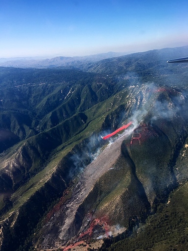
Attached is a pic from air attack, available on the BDF Twitter
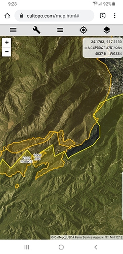
Attached is a fire history overlay. A little hard to read at glance. But the large orange line on the left is 2007 Slide. Large yellow line on right is Old fire 2003. The medium sized Klingon warship looking polygon in the center is Plunge. Small polygon is 330 fire in 2003. The area has been beat up badly the last 20 years.
The powder keg with minimal fire history is further to the East on 1N09 from basically Bear creek to Seven oaks and rally beyond in the Santa Ana drainage. Thankfully this didn’t start somewhere over there. Even more difficult access with a much older fuel bed.


