
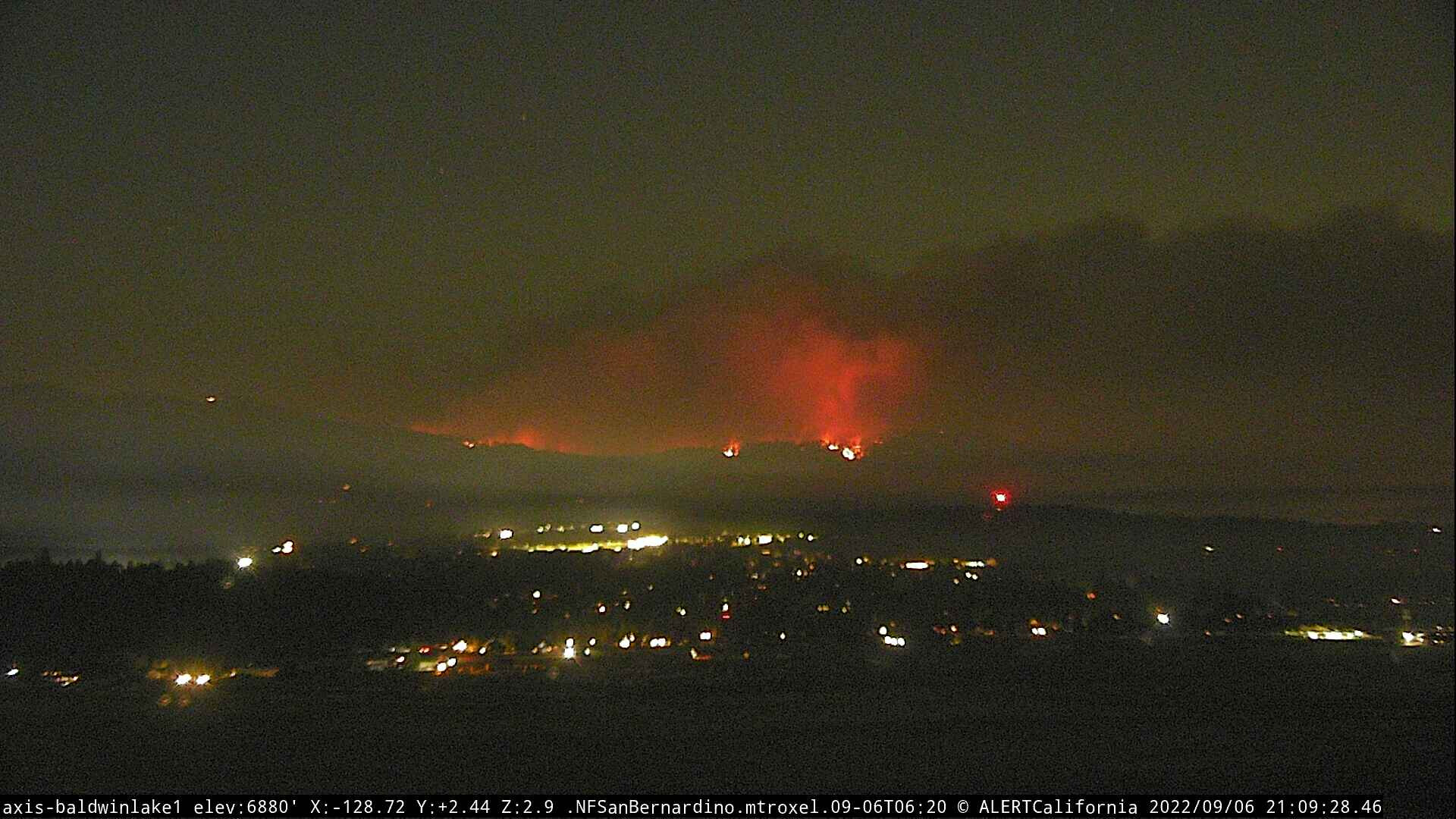
The overall flow has changed too. Everything seems to be leaning toward Big Bear Lake community.
2 Likes


Looks like the fire is coming over the ridge into Big Bear proper, as seen on the Deadman camera.
1 Like
Based on what I am seeing on the Bear North Cam, I believe the fire is moving down into Snow Summit in the timber. Not what I had hoped for.

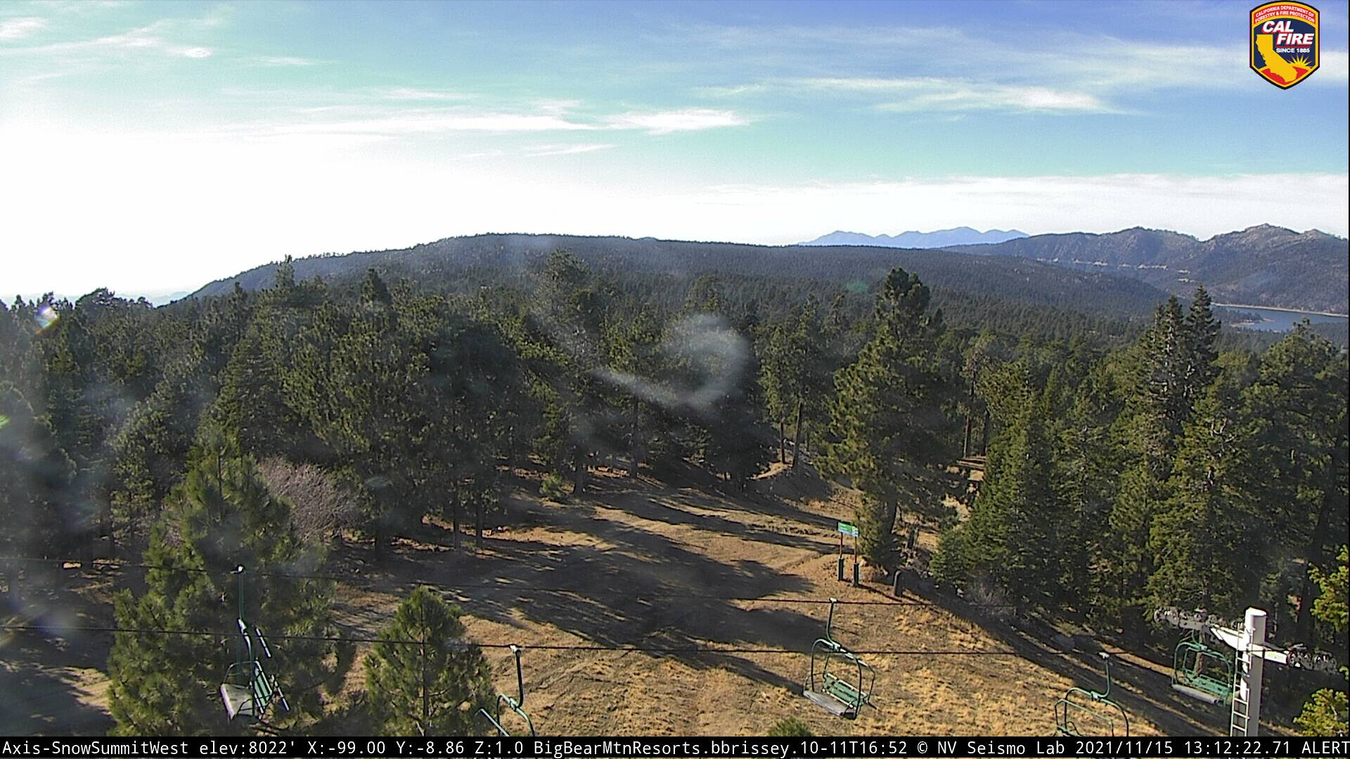
Edit. here is a before shot, not likely to see the same again:
Worse yet, odd, seems no fire on the south side, it is all in the timber on the Big Bear side, from Keller Peak:

4 Likes
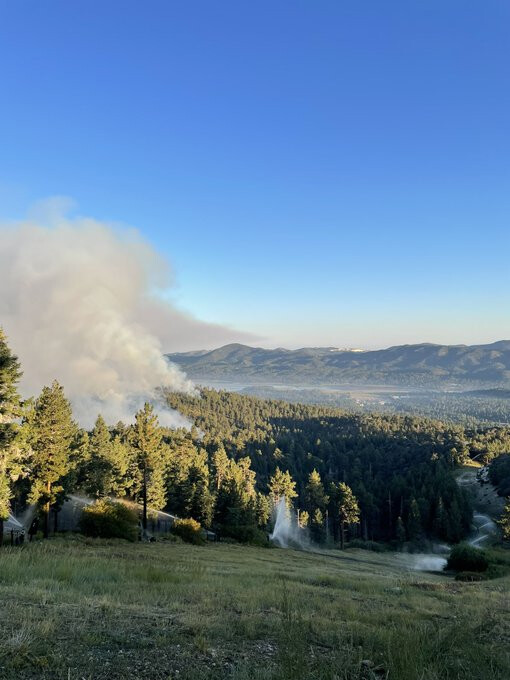
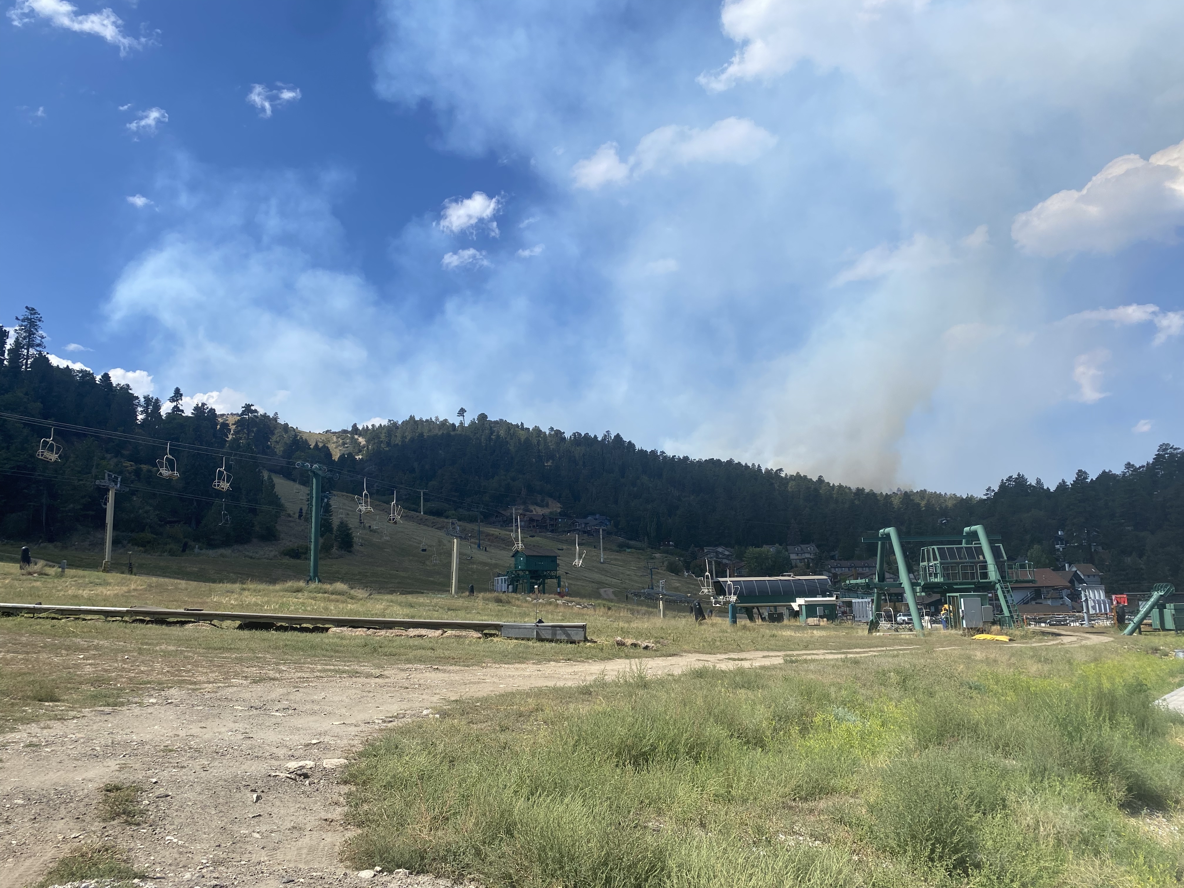
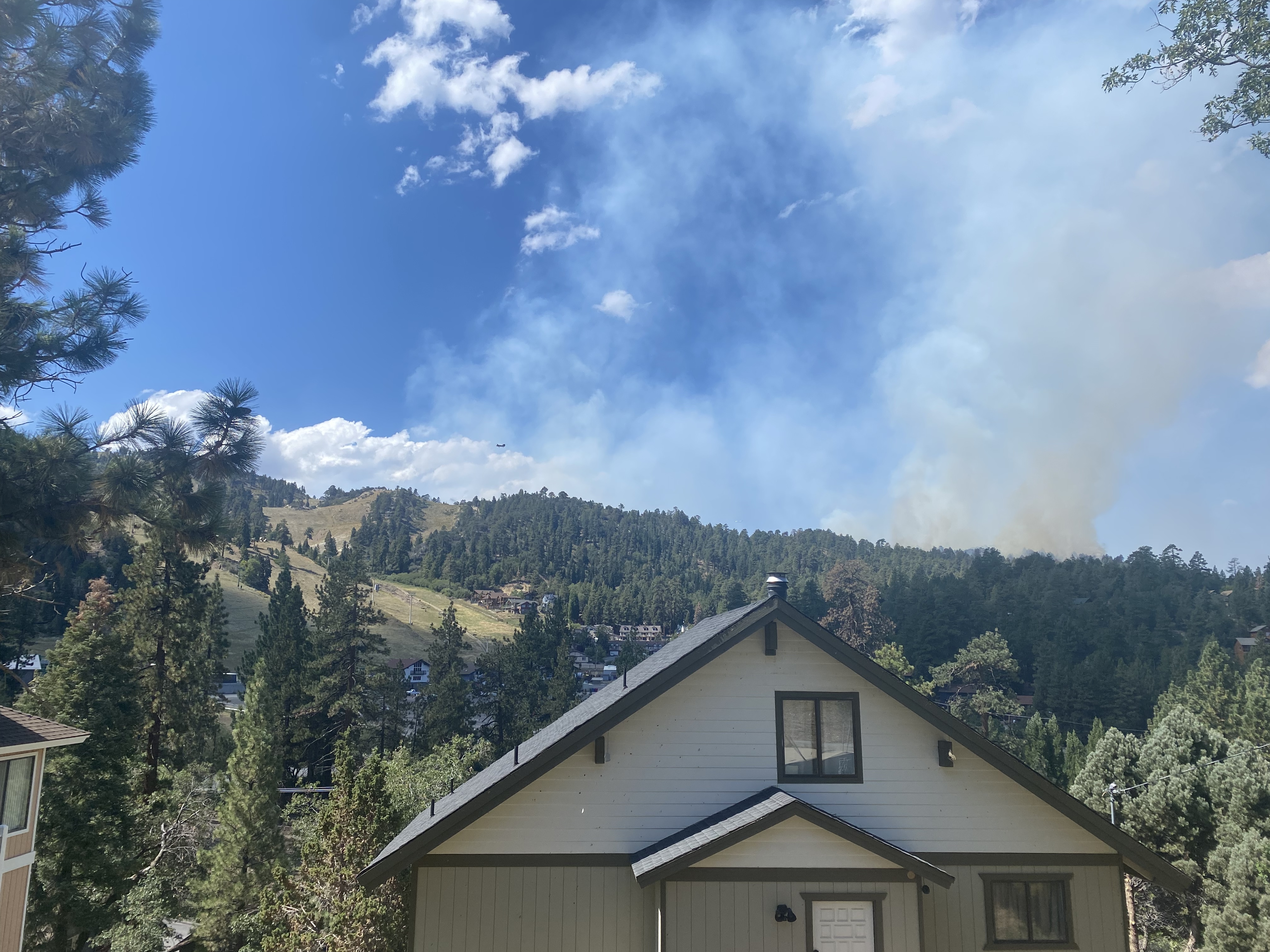
Looks like the sno guns (sprinklers) did their job overnight. Ski areas look okay. Fire moving downslope through timber beteeen Moonridge subdivision and Summit, upslope from Pineknot camground.
2 Likes
Addl victor assigned 126.275
Addl A/G assigned 168.325
2 Likes
@GonzoNick I was aware of the picture not being 'today." It was to be used as a before and after if the sno blowers did not handle the progression.
3 Likes
The fire backing down from Bear Mountain, east side of fire, into Moonridge subdivision. Courtesy of SFamiano, an employee working at Bear Mtn.
8 Likes
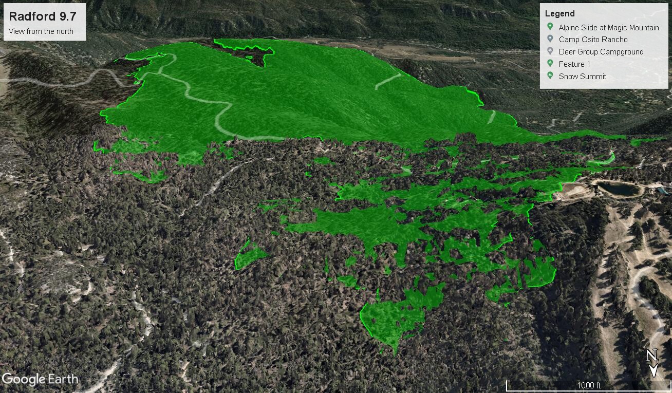
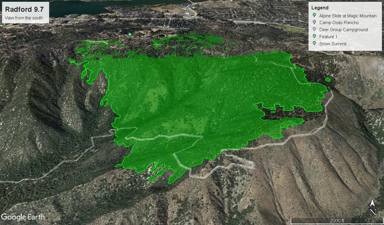
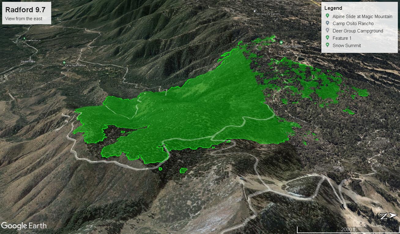
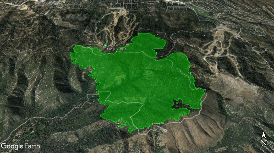
Mapped last night at 1085 acres, so little increase in size and containment is only 2%. Most heat still showing on the north side of the ridge, in the timber, between Summit and Bear Mountains. Weather will make things interesting as a flood watch is now in effect for Friday morning through Saturday evening as remnants of Kay spin up over southern California. NWS forecast office in San Diego is warning of high winds in all areas around the San Bernardino mountains, but does not include the mountains for some reason. Winds seem likely to impact the Fairview though. Heavy rain is possible over these fires Friday and Saturday, and temps will cool significantly, and stay that way into next week.
Edit: Bands of showers already moving through the area at @0800.
3 Likes
Possibly the reason for the upcoming wind and rain event.
You can zoom in on your chosen fire for conditions.
1 Like
2 Likes
1088 acres this morning and 59% contained. Temps in the 60’s and humidity in the 60’s as well. Some wind, but nothing significant yet. No real rain yet either. Hwy 38 is open again.
6 Likes
1 Like
And…UPDATE: #RadfordFire was tested by strong easterly winds this afternoon and remained well within the control lines. There was no fire movement or increase in acreage. The fire remains at 1,088 acres and 59% containment. https://twitter.com/SanBernardinoNF/status/1568460852516503553?s=20&t=Kuu9PchB8o4WDuKtZXtssA
5 Likes
Acreage downgraded to 1079 acres. 65% contained as of today. .33 inches of rain fell on the fire area yesterday. Suppression repair has begun and mopping up hot spots in process. Estimated containment is set for September 30.
4 Likes