Good guess, but no run. See what anvilhead posted in the IA forum:
3 Likes
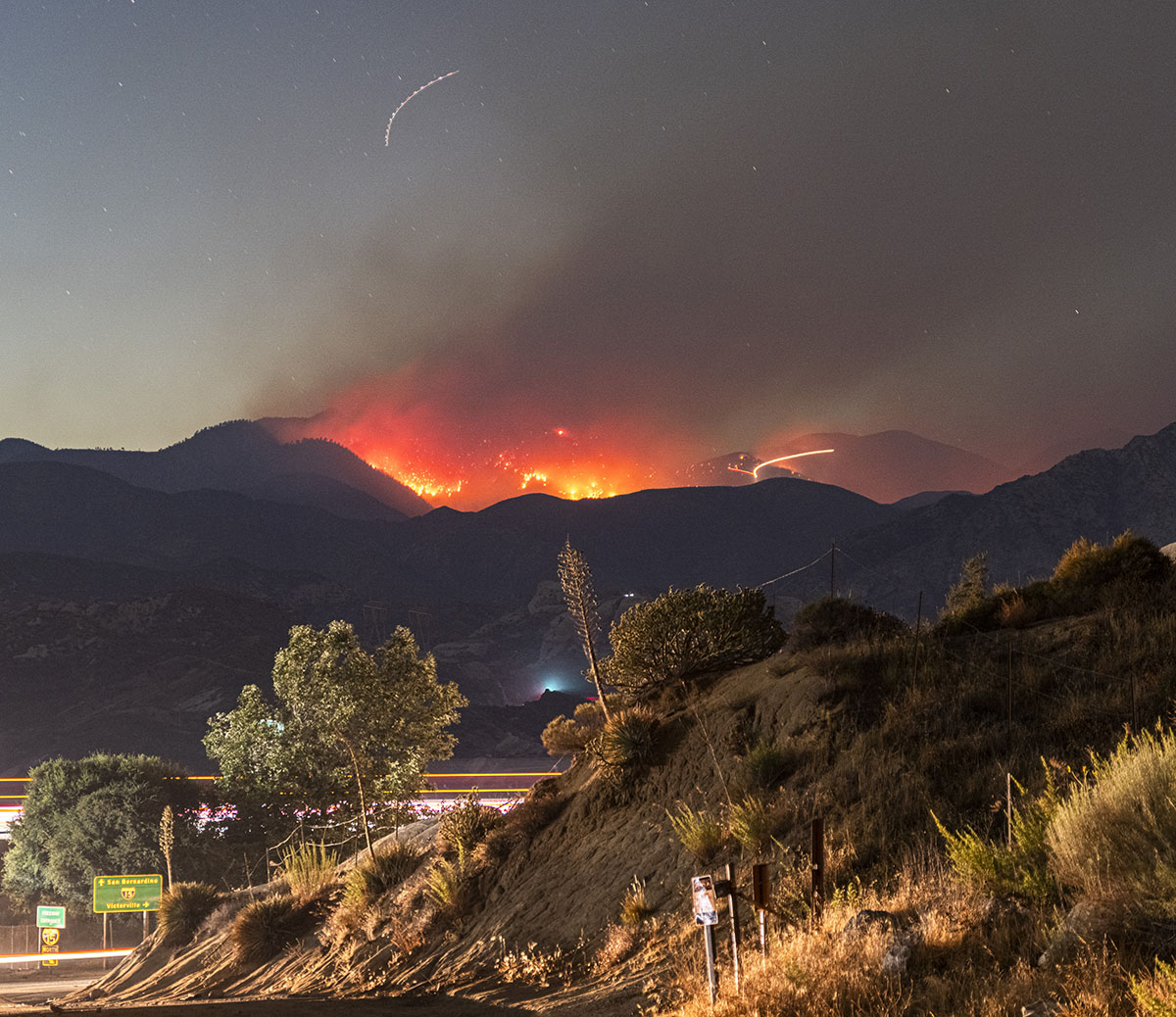
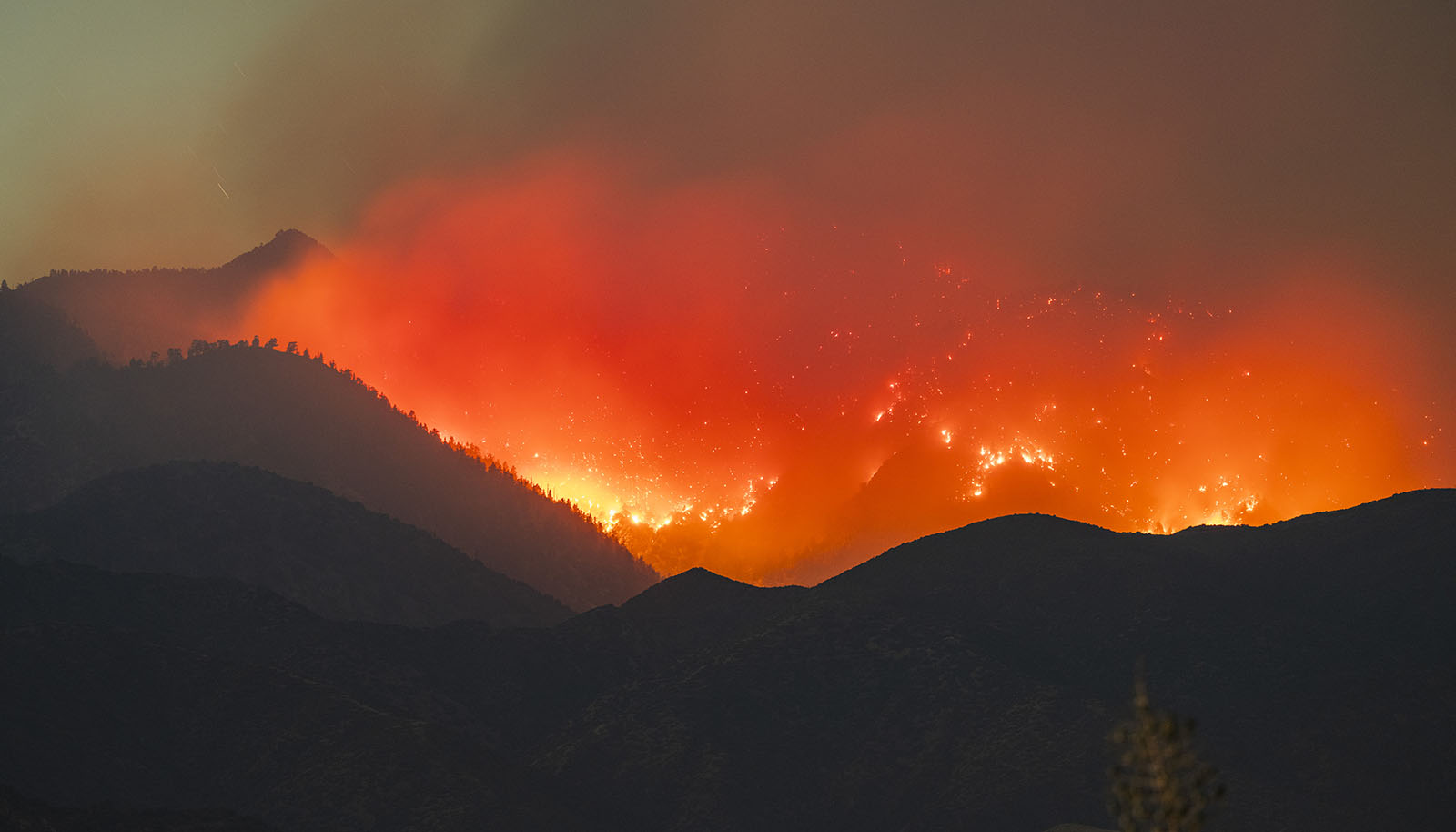
Vista Fire late last night from Cleghorn and the 15. You can see the nav light trail of what I’m guessing is one of the QRF ships over the fire. Would come by every 10-15 minutes or so. Good amount of smoke was settled into the Fontana area. Definitely gave me chills from the Blue Cut which I photographed, standing on the empty 15 freeway back then was very Mad-Max. This one, while always a concern in that area, felt a little less chaotic.
Edited post to resize image and add a panorama.
11 Likes
is that right in that canyon below the ski lifts on the other side?
2 Likes
Not entirely sure, given my lower elevation perspective and having to zoom in, perspective is a little skewed. I’d defer to the ops map for today or IR.
2 Likes
Yes. Just below the notch. Maps are in IA thread
4 Likes
Does anyone have flight aware or can say what aircraft over fire…last little flare up other than Coulsan’s CH47???
1 Like
Looks like a CH-47 and an S-61 currently over the fire.
2 Likes
AA-310 as ATGS earlier today…
4 Likes
4 Likes
Update from last night, 2810 acres, 17%contained. Weather was overcast with subtropical flow (higher RH) and the fire bumped into higher terrain features aiding in slowing the fires progress. Minor smoke production yesterday on Bailey Peak 1 cam, no smoke this morning.
EDIT: Fire Weather Watch in effect for the area due to possibility of high based thunderstorms with dry lightning possible and 45-60 mph outflow. Could create challenges.
9 Likes