In Lytle Creek:
6 Likes
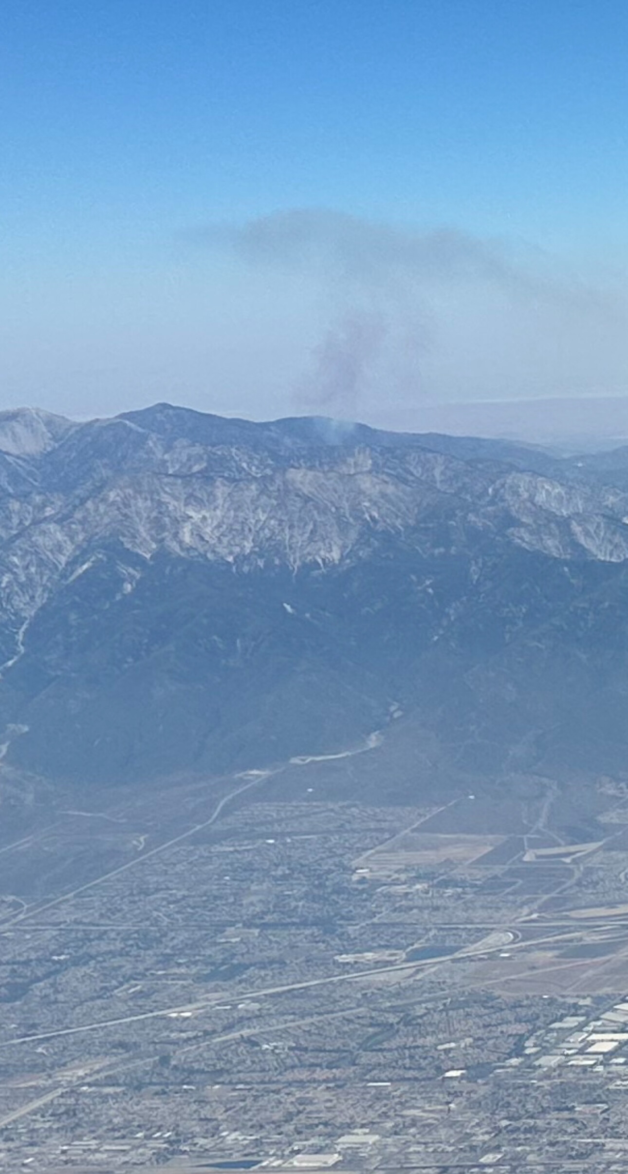
Friend on a flight into LAX just sent these pics to me from the air, for location reference.
Fire being on a southerly slope exposed to an entire day of sunlight, during a long day, in a heatwave, on that slope, is a bit concerning. However fuels are getting sparser at that altitude and I see some granite breaking things up. Does anyone have experience with fire at higher altitudes on the BDF?
5 Likes
Aircraft assigned: AA12, K5, T70, T71, T72, T73, T101, T137, T163, 2CH, H608, H554
4 Likes
SO requested to do local evacs of campers in the area.
5 Likes
2-3 acres now with slow rate of spread with difficult acess…
3 Likes
Ground crews expected on scene in 15-20 minutes.
3 Likes
Looks like it’s grown a bit
2 Likes
5.2 acres now
2 Likes
Additional tankers and copters ordered (2 LAT’s, 2 Type 1 copters)
Tankers: T137, T163
Copters: HT-9PJ, HT-37S
3 Likes
From my experiences back in the day there Lytle Creek is infamous for crazy unpredictable and ever changing fire behavior. The whole area from Cleghorn summit west. I remember one year there was quite a firefight to save the FS LC station. Every time the tones went off for LC everyone would just cringe.
6 Likes
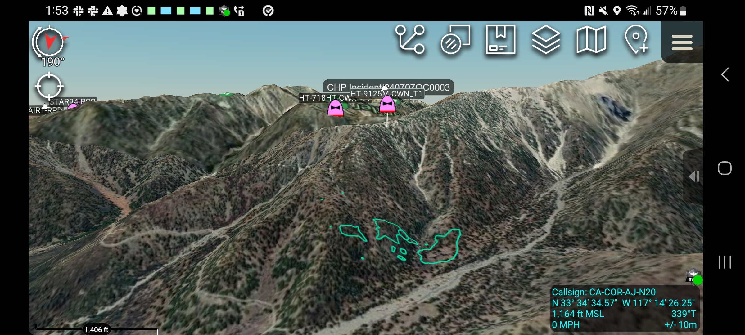
Fire is just west of Stockton Flats, off Baldy Road. Firis mapped it at 9 acres with some roll out showing up.
6 Likes
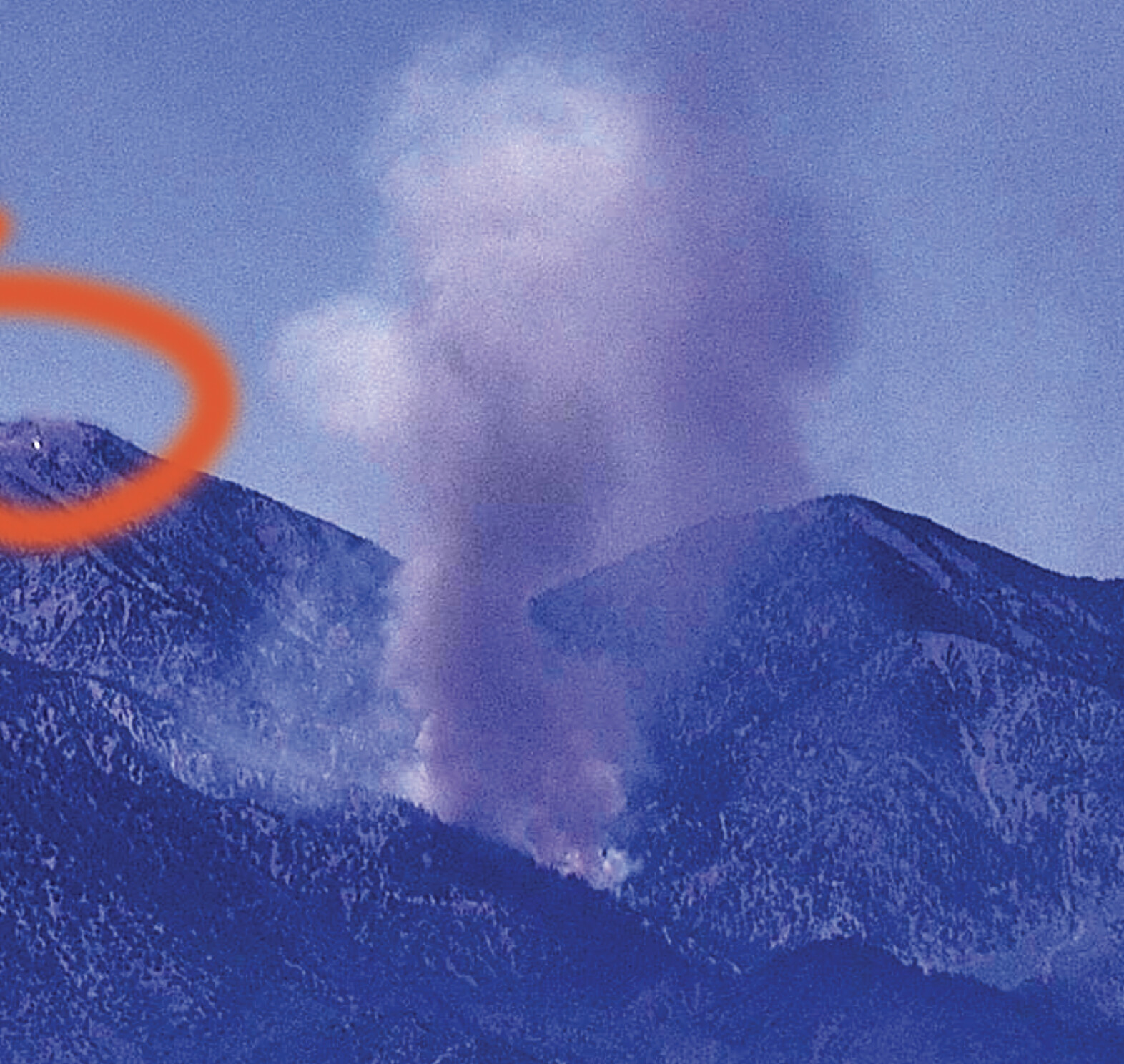
Still a patch of snow up on the peak as well. Fire and ice… image contrast enhanced to show the snow.
6 Likes
Fire keeps throwing embers from the torching and creating short range spotting outside of their lines. She’s being stubborn today.
4 Likes
Here’s the other link that lets you go live or playback:
https://cameras.alertcalifornia.org/?pos=34.2805_-117.5530_10&id=Axis-BaileyPeak1
2 Likes
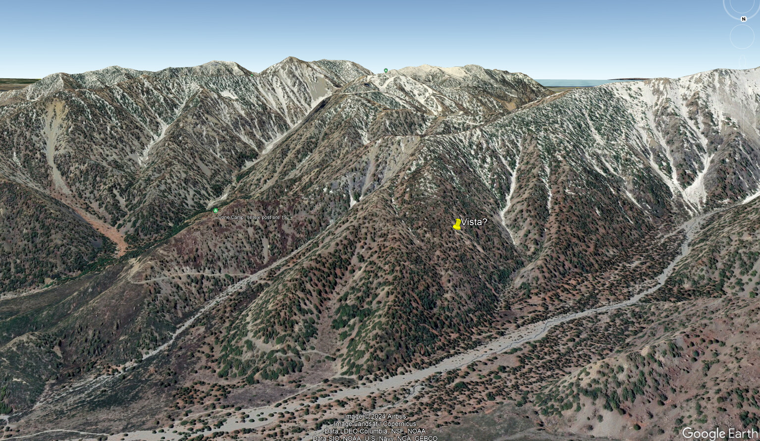
Fuels are a mix of scrub and Big Cone Doug Fir @6400 ft. elevation. I have ridden and hiked the road to and from Baldy Notch many times. Very rough and rocky roads. High clearance vehicles only. Very slow in and out from the bottom of Lytle Creek. Possible location with yellow pin from Google Earth below.
5 Likes
AA has placed order for 1 VLAT
4 Likes
From the aerial perspective as an ATGS, most fires up there are challenging due to turbulence across ridges. Also limited ground access with long hiking for crews.
4 Likes
I imagen they will loose a few tankers to the new start in RRU with a structure threat.
2 Likes
I would be hard pressed to believe that is snow. No way on the south facing aspect with no cover after the temps we have had.
7 Likes