Isn’t it 1500 at the last update?
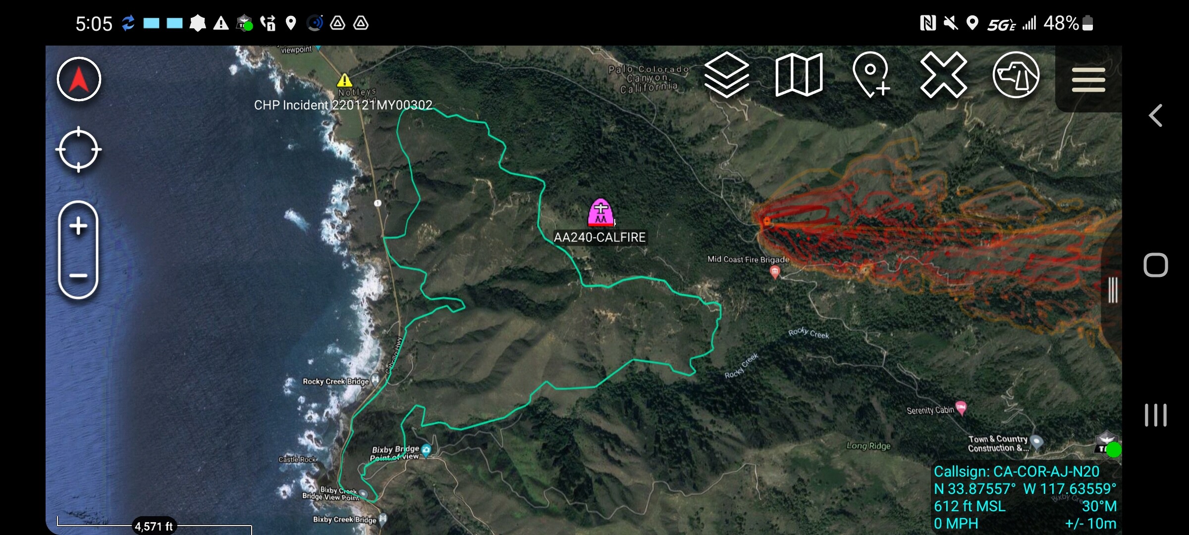
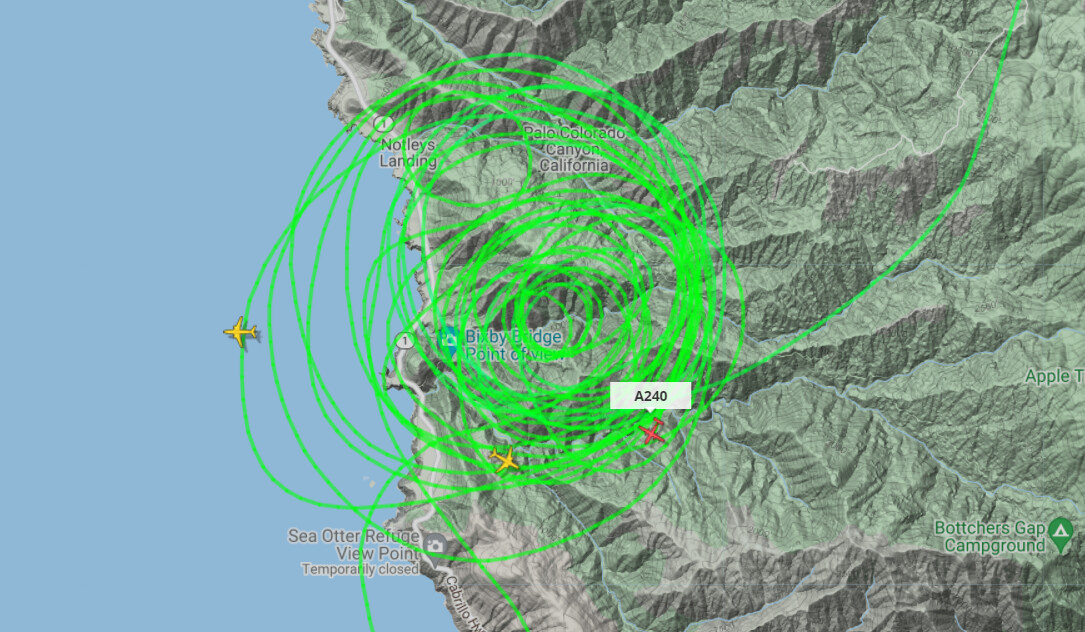
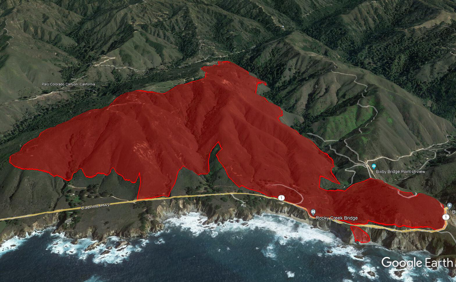
Here is a good pic that shows spatial resolution and accuracy.
Red is FIRIS flight from manned aircraft. The Cyan color is fireguard from space which is all we had to start with.
AA with a tanker working a slopover at the heel right now. Now 4 tankers 73,86,91,& 96.
Air Tactics 166.6125
Rotor Vic 123.175
A/G 159.270 (tac15)
Because of course there’s extended attack in January. 
 Doesn’t bode well
700 acres and 35% contained.
700 acres and 50% contained. Make sure those embers from your burn pile are drowned.
65% contained.
706 acres and 98% contained. Full containment expected on the 2nd.
Edit 2/2 100% contained.
Oh, I waS COVERING THIS ON MY BLOG, ON FB, WHERE MOST LOCALS HANG OUT, AND MY TWITTER FEED. Sorry for caps lock. Info was coming my way so fast it was all I could do to keep up that first night, and frankly, forgot about this forum. Won’t happen again.
Apology accepted  we’ll let it slide this time!
Look at the Fuels report specialist go and chew ass:rofl:
Thank you BSK for all you do and provide on the central coast
Go sharpen the blade in the dozer zackattack:rofl: