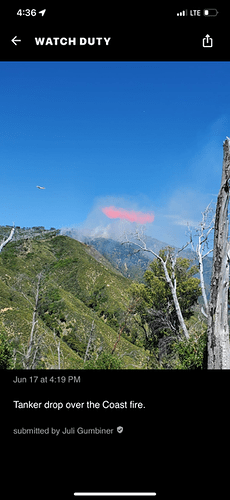
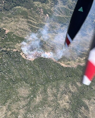
New start. 3+ acres, heavy brush, potential for 200
AA-460 overhead and provided that size up
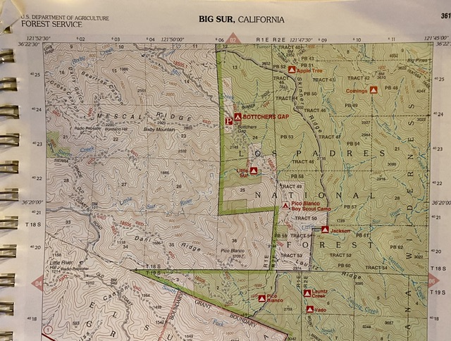
Access up Palo Colorado Canyon Rd through the Botcher’s Gap Trailhead at end of Palo Colorado. Update: At Gotcher’s Gap Campground. Slow rate of spread.
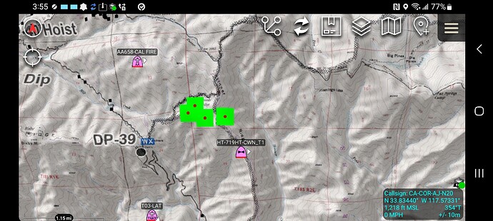
Fire along Skinner Ridge. Good hike up to it. I’ve fought IA up there. 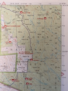
Was up there in January 2022, for a veg fire. We were getting water where that creek runs along Palo Colorado by Botchers Gap Trailhead. Beautiful country back there but quite rugged. Not sure they can trailer in dozers, if they get used, it’s a long climb tracking in.
Terrible dozer history
Can link isn’t showing any smoke. Any update from folks listening in?
It’s Wilderness so NO dozers unless they get a WUFSA by Forest Supervisor.
Definitely no engine access. Handcrew and helo country! Fought the Skinner fire in 2007. 20 minute hike up if you are fast (we were) and then it’s all brush country. No engine or dozers here. Wilderness. LPF Engines will form a hand crew and cut line. Not for the faint of heart at all! We sucked down our water within IA and a few folks had a hard time keeping up with the hotline. I imagine that’s what will happen here too. Good news is MRD 10 hour fuel moistures were still in 80% range earlier this month.
Mark there is water at Botchers Gap but NOT up at Skinner Ridge where the fire is. It is a 20-30 minute hike in and up to hit Skinner’s Ridge. I’ve backpacked and fought lots of fires all over this area. The hike to Ventana Double Cone is great! Good times! I’m guessing my husband is IC right now. He is Div1. Got the text when they got the tone out. FYI: Closest spring that I know of from backpacking is at Pat Springs and it’s just a little trickle for backpackers to filter.
Thanks for the reply and clarification. I figured it became protected at some point. Mid Coast had set up a pump in the creek and a water tender at that spot which was quite convenient for filling water tenders. All of our work was up the road behind Mid Coast fire station. We had a stellar view of the Bixby Bridge and the ocean up there. Is it all “wilderness area” beyond that point or just the trails from the roadway up there?
Mark,
LPF starts just east of the upper Mill Creek Crossing just before Botcher Gap Camp Ground. The Pico Blanco Boys Camp is an inholding just south of the Campground behind a locked gate that goes down into the Little Sur River. That inholding is NOT Wilderness but everything east of the Upper Mill Creek River crossing is Wilderness for a ways. The map I posted in this thread shows a green area and a white. The green is Wilderness. I will send the map again for reference.