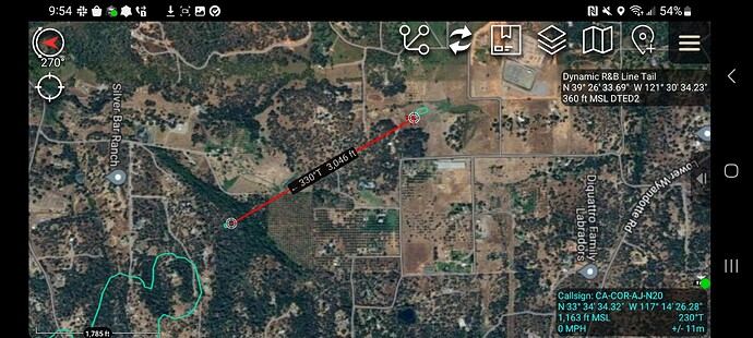
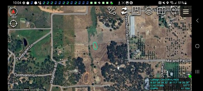
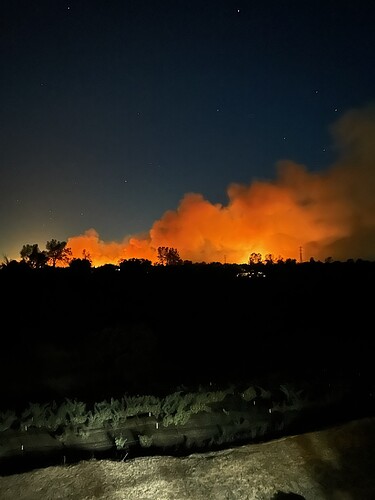
30-40 acres over Grubbs rd, New spot 2 acres across dunstone dr?
Looking at direction of spread, I don’t think we’d get a spot across Dunstone unless someone lit it.
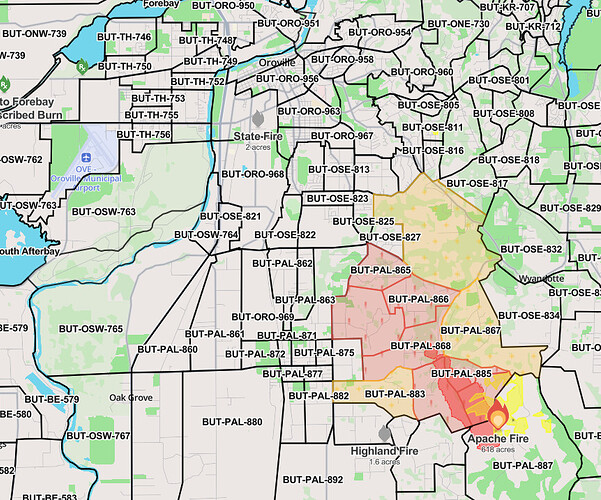
Per Watch Duty
he fire has now been mapped at 618 acres by FIRIS Intel 12. Their latest perimeter can be viewed on the Watch Duty map.
Note that perimeters are preliminary and do not reflect structure protection efforts by firefighters.
There is a 2 acre spot fire between Drescher Track Rd and Ardeth Ct, approx 1/2 mile out in front of the main fire - per radio traffic.
From North Valley Animal Disaster Group:
Attention, community!**
We are now accepting animals at both of our shelters tonight until 11pm.
Small Animals:
Del Oro County Hospital building
2279 Del Oro Ave, Oroville
Large Animals:
Camelot Equestrian Park
1985 Clark Road, Butte Valley
Spread the word and help us provide safe havens for them.
I’m driving now… Anybody able to start an IA thread?
No night aircraft available per North OPs.
New spot being reported off Canary CT.
Sounds like crews are reporting some slop over heading towards she yo ln.
Interestingly there is a new start approx 3 miles SE of the Apache, West of Bangor on Bangor Park Rd. Units en route, showing on La Porte Cam. Being run as the Park fire
439 Bangor park, believe I heard .5 acre slowe rate of spread with structures threatened. Was originally toned out as a spot from this incident but IC said not possible.
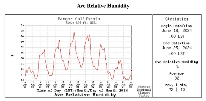
The fire looks pretty subdued on the webcams at the moment. Bangor weather station shows humidity never got above 32% overnight, and temp only dropped to 71 degrees. The 7-day graph shows how dry the recent nights have been, in comparison.
As a side note, the PG&E weather snooper site I use is stuck showing conditions from 14:00 yesterday. Anyone have an alternate URL for PG&E wx data?
https://pgewam.lovelytics.info/pge_weather_app/
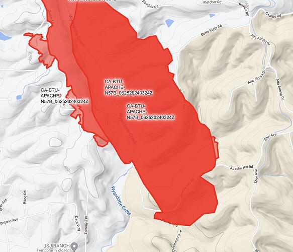
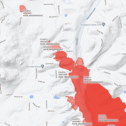
Here are some closeups of perimeter maps flown at 4am, 6/24/2024. Source: FIRIS
https://mesowest.utah.edu/ with network set to “Utilities” lets you view by station. No snooper function that I’m aware of, but might aid in checking if it’s a station issue or a more widespread outage.
Edit to add that you have to click your state of interest and then you’ll see the network selector on the upper left side of the screen. No login required to view data.
Don’t have RAWS data, but here in So. Nevada County getting light sprinkles making it to the ground, despite 30% RH. Curious how the the exit of Tropical Storm Alberto will affect this thing as it rolls through
