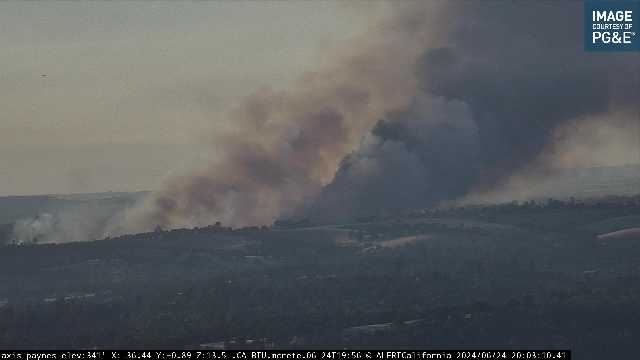
30 acres, critical rate of spread.
Structures threatened.
South of Lake Oroville
30 acres, critical rate of spread.
Structures threatened.
South of Lake Oroville
https://ops.alertcalifornia.org/cam-console/1618
https://ops.alertcalifornia.org/cam-console/1695
Tankers 88, 93, 102, Helo 514 On scene
AA ordering 2 additional type 3 tankers and 2 additional copters.
Scanner Link Here:

Camera cross puts it here: https://maps.app.goo.gl/oPdtp7jB9BibFdyp9
Before yesterday, RHs have been spiking hard after sunset.
Last two days have been exceptionally dry.
AA put in an order for either night HELCO or 3 night Op Helos, sounded like night HELCO was UTF
Evacuation orders for BUT-PAL 884. 885. 886.
Yes she is - moving into the heavy live oak/brush/gray pine belt.
Per Watch Duty:
The fire is now 465 acres with a Potential for 800 acres tonight
465 acres. BUT -PAL orders 886. 887a. 885. 884a.
Warning. 867a. 884b
10 Acre spot outside the line, working on new evac orders
This view might show the spot on the far left
https://ops.alertcalifornia.org/cam-console/13502
Perimeter of the #ApacheFire, at 9pm, 6/24/2024.
Much of the initial area burned by the fire is on a property that the landowner wanted to burn for habitat improvement. We looked at it with Butte RCD/PBA a couple years ago and told him it might be safer to wait for a wildfire to do it instead…
Source: FIRIS
Play the last 15 minutes on the “Chinese Wall” cam and I think it’s visible there.