Are you using a online scanner and if so, which one
1 Like
Here’s a view west over Humbug Road, which runs down thru middle of Tasmam Koyom (Humbug Valley). The valley was owned (stolen?) by PG&E for about 100 years, now has been returned to Maidu Tribe. Tons of arch sites and current cultural uses there. Hoping we can keep dozers out of the meadow and a light touch around the area. PG&E salvage logged heavily after Chips and really caused a lot grief for locals and natives.
White lines show 24 and 48 hr growth.
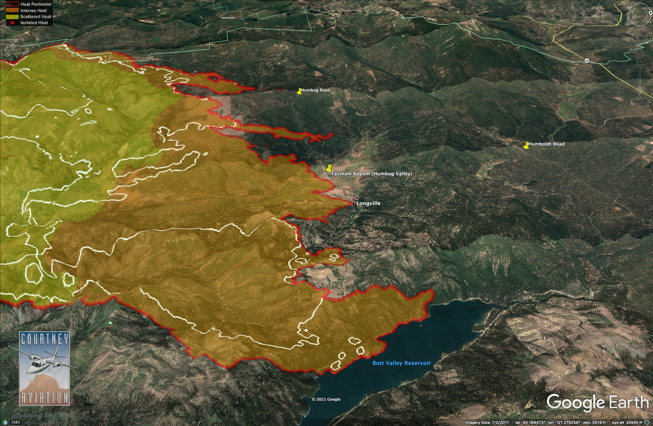
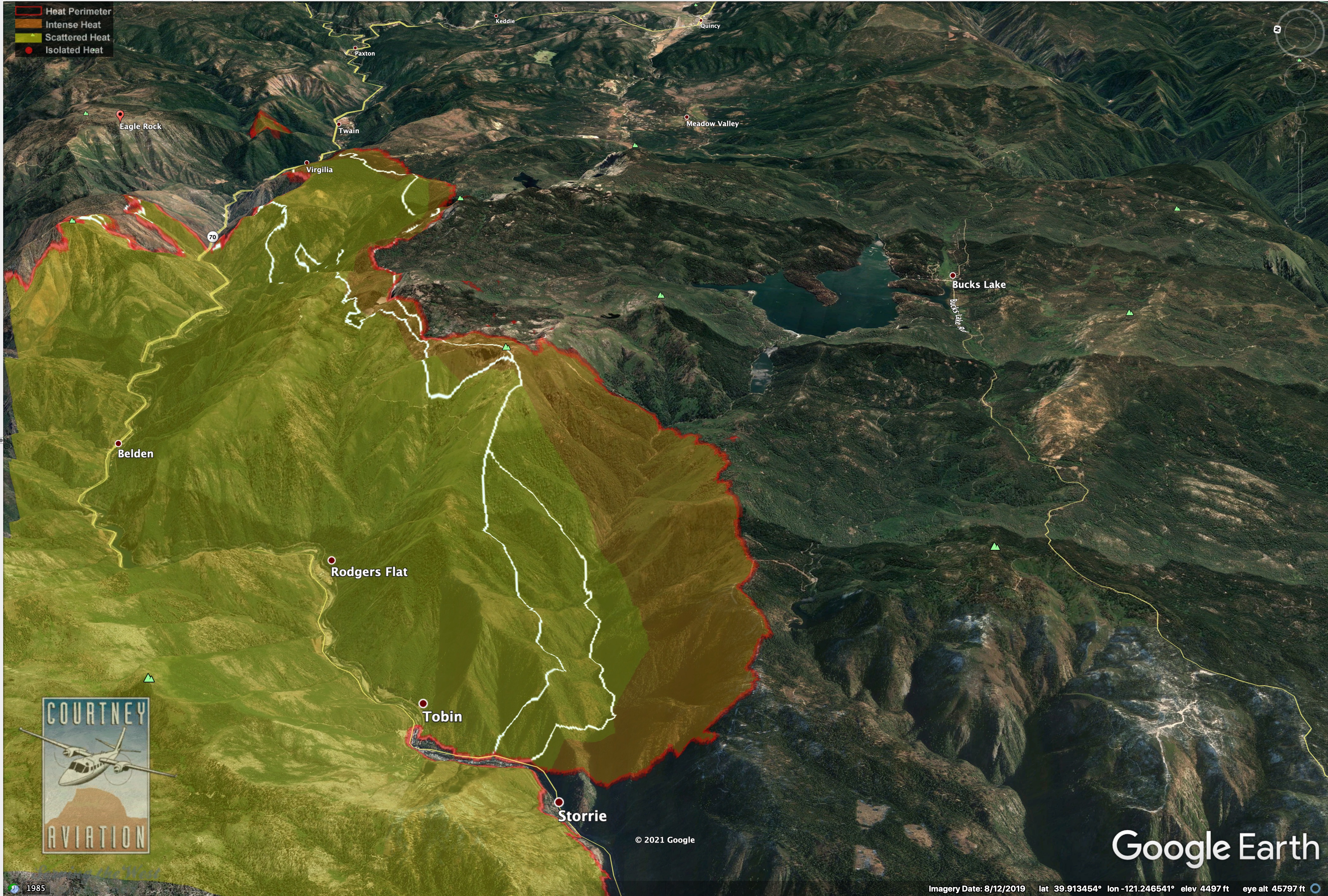
Looks like fire has impacted the plantations on private lands put in following the 2000 Storrie Fire. These are SW of Tasmam Koyom. There was a big emphasis on protecting these during Chips Fire.
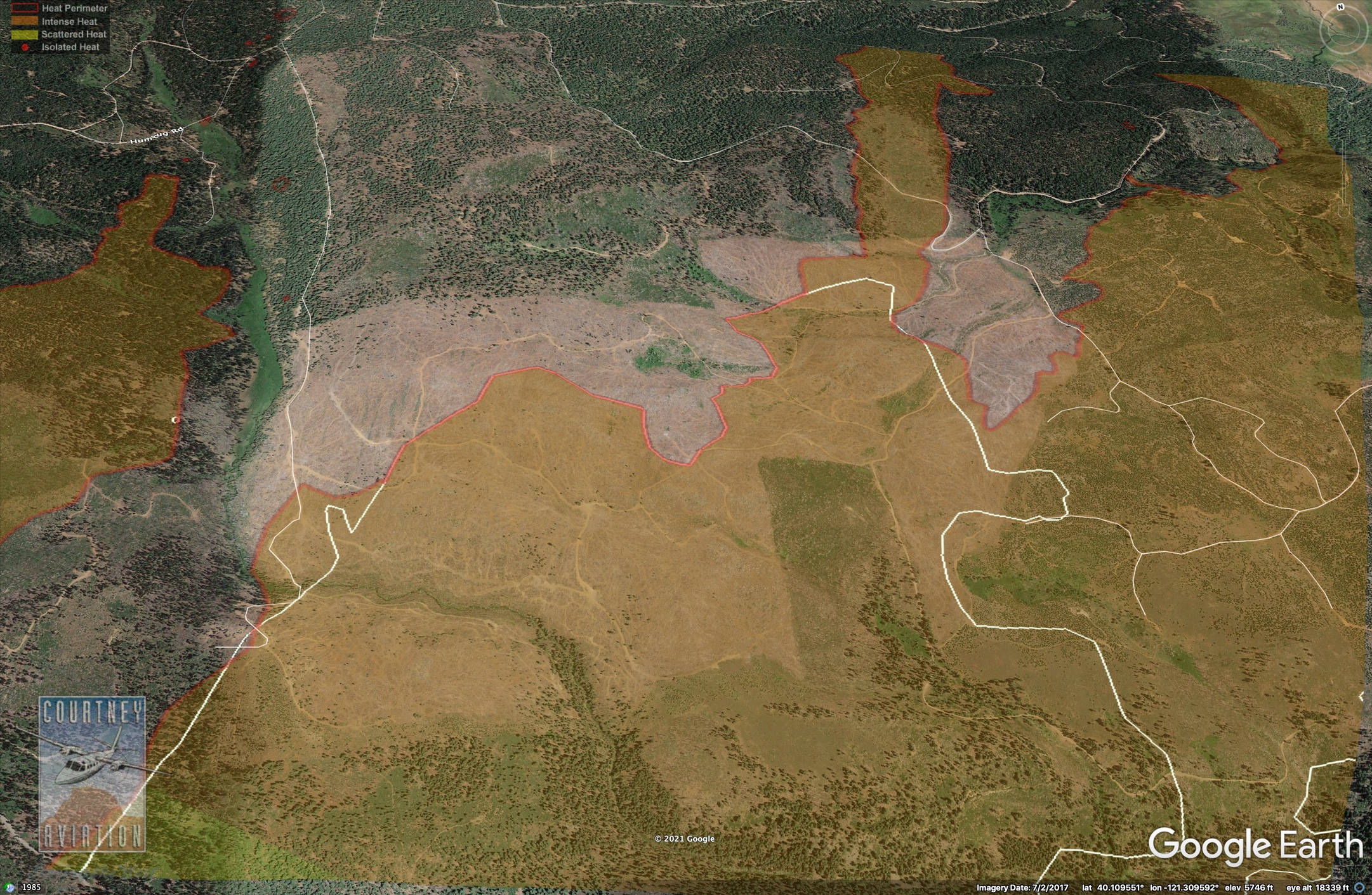
Doesn’t look like the lightning fires NE of Butt Lake have grown much.
After taking out Mosquito Creek 2 days ago, the fire below Caribou is kind of hung up on the ridge and also, in the gnarly barren serpentine downcanyon.
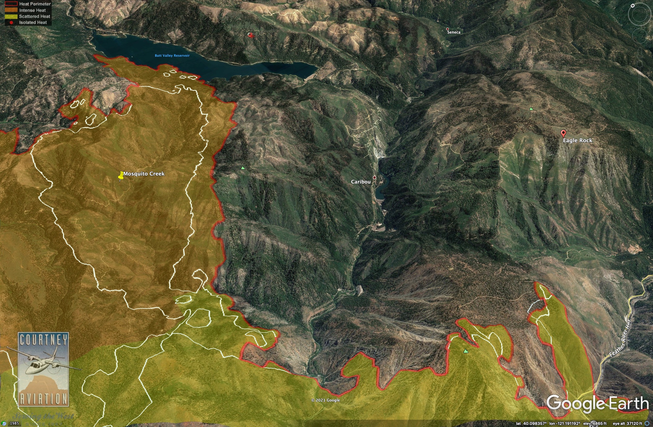
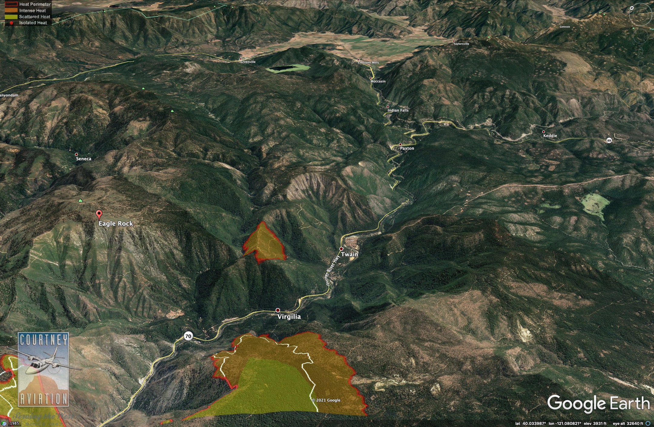
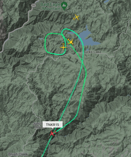
And the spot they thought was at Eagle Rock appears to be on both sides of the ridge about Twain.
Yesterday’s big run on SE took out the south side of Bucks Creek.
17 Likes
Take a look at the Alertwildfire Indian Ridge camera, the one hour loop is fascinating
4 Likes
This may be one of the first examples in the state of working forestlands having TWO post-fire plantations burned in subsequent fires. With the area seemingly being under a 10 year catastrophic fire cycle, and the neighboring Forest Service leaving there lands primarily brush and snag dominated, it’ll be interesting to see if the private forests continue to invest money in reforestation and cleanup.
5 Likes
@pyrogeography nice rundown on yesterdays activity from the IR, thanks
3 Likes
SPI had plantations wiped out by fires in the Concow area in 2008, replanted them in 2009, and lost them again in the 2018 Camp Fire. I hear they are not going to replant some of those areas, now.
2 Likes
They are not.
1 Like
Can anyone confirm or deny a order yesterday for additional dozer’s?
1 Like
2 posts were merged into an existing topic: R5 questions
I guess I’m also making the negative assumption that the plantations were cooked–which may not be the case, as fuels weren’t necessarily contiguous and the trees planted after the Storrie Fire were getting to a decent size.
I still can’t think of another example of working timberlands burning three times (i.e. post-fire plantation burns twice)–this seems like a real bad omen of things to come for this states forests.
1 Like
The post-Storrie plantations largely survived the 2012 Chips Fire. It will be interesting to see how they are holding up now. I don’t know when they were thinned or anything else about them. I’ll ask around.
Most of the Storrie Fire plantations survived unburned (literally an unburned island within the Chips perimeter). Where the Chips Fire did burn into the Storrie plantations (mostly along Grizzly and Cottonwood Creek), it was basically along property lines with the USFS–where it seemed that it came out of the brush/snag fields hot, and probably with some wind. Those plantations did not fair well–it seemed like it just took fire getting into the needle cast below the trees, and they would torch out. While the stuff that burned didn’t fair well, it was stopped within ~1,000’ or so of the property lines, suggesting resistance to control was low.
Both sets of plantations have been well thinned, with brush control, and small fuelbreaks installed along mainline roads.
3 Likes
Chips Fire Behavior: Case Study (fs.fed.us)
I highly recommend reading the attached case report particularly the conclusions about after action removal of vegetative matter.
2 Likes
2 Likes
That camera location does not seem ideal… too bad they couldn’t have put it at a better vantage point, like that high point about 2/3 mile SE.
I’ve been wishing they would be able to put a camera up on Butt Mtn (Carter Mtn to the locals). We are in a blind spot here on Hwy 36 by the St Bernard Lodge, going west toward the jct with Hwy 32.
2 Likes
ANother day in what will be a long list of day and numbers
The Dixie Fire is 103,910 acres and remains 17 percent contained. It continues to threaten a number of communities. Perhaps because the Dixie Fire is so widespread and it’s difficult to share specific information, fire officials are keeping their briefings just that: brief.
“Moderate fire behavior with short-range spotting, uphill runs and flanking observed overnight. Evacuation Orders and Warnings in effect for multiple communities. Firefighters continued construction on control lines and engaged in structure defense overnight. Fire is going to continue to move Northeast. Air and ground firefighting resources will work together to strengthen and improve control lines. The fire is burning in a remote area with limited access and steep terrain. High temperatures a little above seasonal normal will continue for Thursday.”
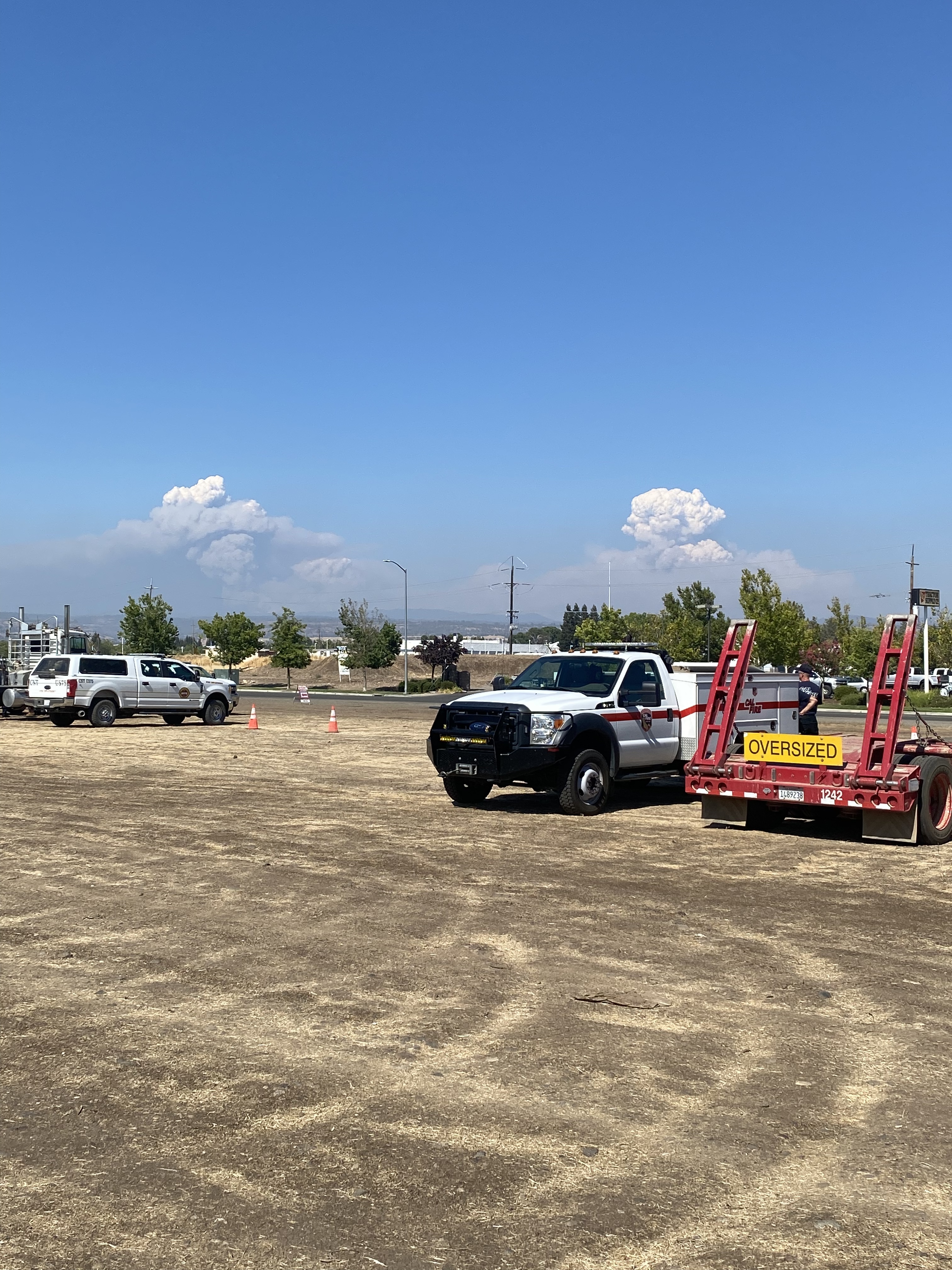
A Type 1 Interagency Team will be established at the Plumas Sierra County fairgrounds tomorrow
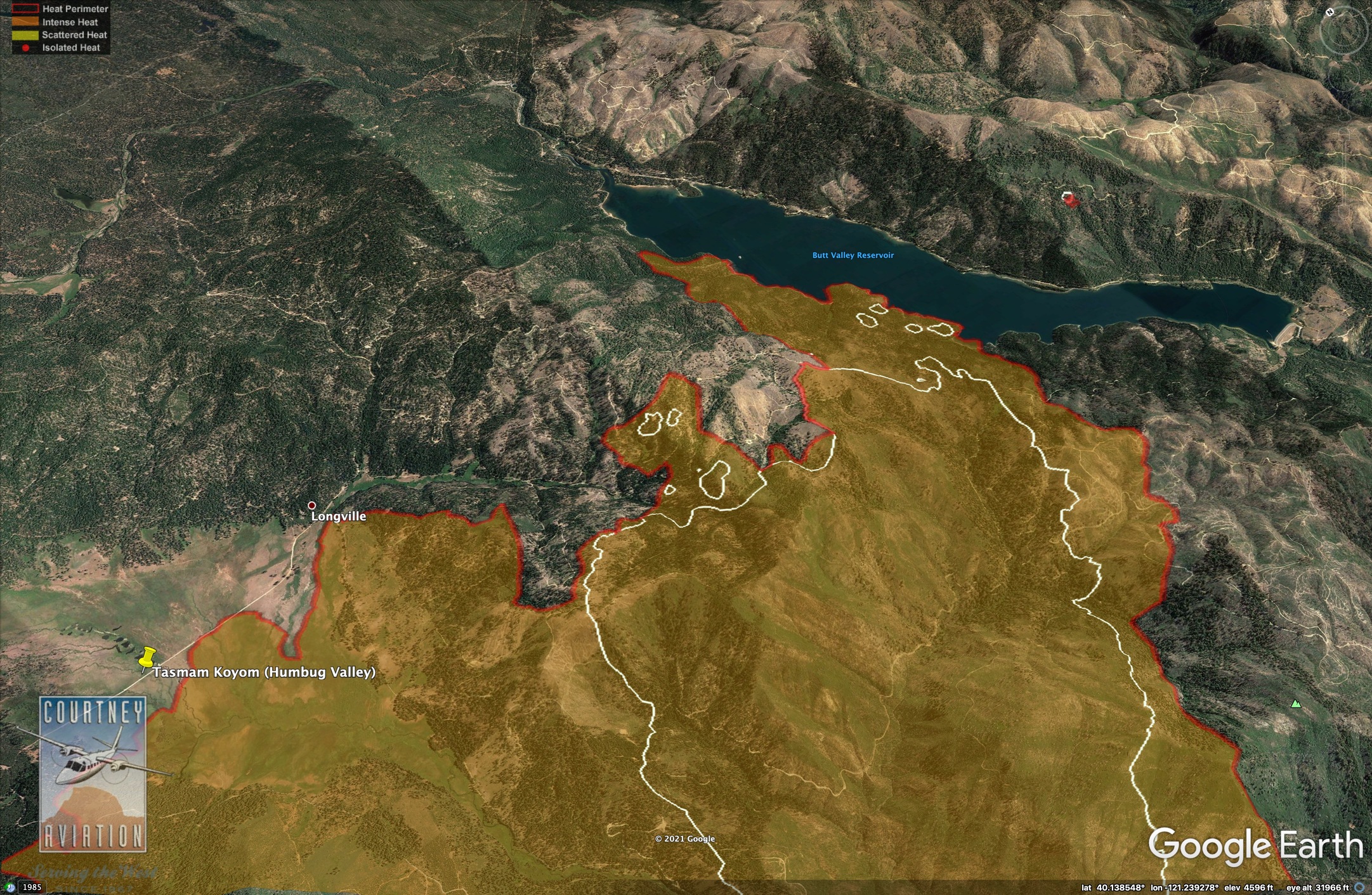
The fire on the north left shoulder has reached Humbug Meadow. Continuing east to Butt Lake, the fire has reached the lake’s edge. A fire that spotted over the lake has been put out.
Down toward Caribou Road, the fire is in the Caribou drainage, but crews are making progress…
The spot fire at Eagle Rock, which forced advisory evacuations last night, has grown to 300 acres in inaccessible territory, but firefighters are trying to box it in with an air attack and ground crews where possible. The fire is within one-quarter mile of high tension power lines, and the goal is to protect them. Though they are currently providing power, it could become an issue later today. The Air Quality this morning in Chester sits currently at 865… more than twice of anything else on the map I could find
Looks Likes the skies have cleared enough to get the tankers up as we just got buzzed for the first time today… it was soup here this morning
9 Likes
It would probably be more likely to put a camera up on Stover, which already has that repeater up there. That would fill a big hole in coverage south of Lassen.
3 Likes