
Sorry to be a newb. Where do I find this vehicle tracker?
2 Likes
ORC Alpha S/T launching at dawn.
5 Likes
Agency Software internal only
2 Likes
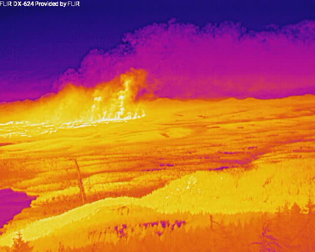
This is a time lapse of Greenville burning over. It’s hard to watch…

9 Likes
This is a scary one!
1 Like

Issued by NWS for: 5 Miles N Chester CA
Red Flag Warning
URGENT - FIRE WEATHER MESSAGE
National Weather Service Sacramento CA
330 AM PDT Thu Aug 5 2021
…Red Flag Warning For Gusty Wind And Low Humidity Through This Evening…
.Areas of gusty wind, mainly over higher terrain and through favorably oriented canyons, will continue today as low pressure moves through. Combined with lower humidity will maintain areas of elevated to critical fire weather conditions. Wind decreases this evening, with lighter northerly wind expected Friday as temperatures warm and humidities lower.
CAZ214-221-266-268-269-052300- /O.CON.KSTO.FW.W.0005.000000T0000Z-210806T0400Z/
Burney Basin and Northeast Plateau in Shasta County Including Northwest Lassen NF north of Lassen NP- Stanislaus NF West of the Sierra Crest- Northern Sierra Foothills from 1000 to 3000 Ft. Includes portions of Shasta-Trinity and Butte Units- Northern Sierra Including Lassen NP and Plumas and Lassen NF/S West of the Sierra Crest (West of Evans Peak-Grizzly Peak- Beckworth Peak)- Northern Sierra Including the Tahoe and El Dorado NF/S West of the Sierra Crest- 330 AM PDT Thu Aug 5 2021
…RED FLAG WARNING REMAINS IN EFFECT UNTIL 9 PM PDT THIS EVENING FOR GUSTY WIND FOR FIRE WEATHER ZONES 214, 221, 266, 268, AND 269…
-
AFFECTED AREA…Fire weather zone 214, 221, 266, 268, and 269.
-
WIND…Southwest 10 to 20 mph with local gusts up to 35 mph, locally higher. Strongest wind expected over higher terrain and through favorable oriented canyons. Wind shifts to the west northwest late today.
-
HUMIDITY…Minimum humidity in the single digits to teens.
-
IMPACTS…Any fires that develop will likely spread rapidly. Outdoor burning is not recommended.
PRECAUTIONARY/PREPAREDNESS ACTIONS…
A Red Flag Warning means that critical fire weather conditions are either occurring now, or will shortly. A combination of strong winds, low relative humidity, and warm temperatures can contribute to extreme fire behavior.
6 Likes
Well stated sir (Imt_Geek) and remember that the ATGS is well trained and has a huge responsibility over the resources.
5 Likes
Has today’s IAP been posted?
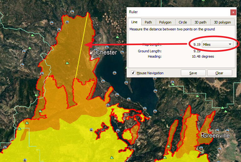
Has the fire moved this far since the posting of the posting of the latest kmz [20210804/1850PDT] (Courtney Air)? What would be the next road system or ridge for control measures?

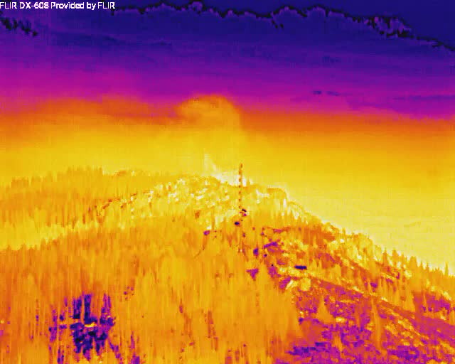
This is the latest VIRS I detection, it looks like the fire is already off the map.
2 Likes
Thank You, Have it saved now
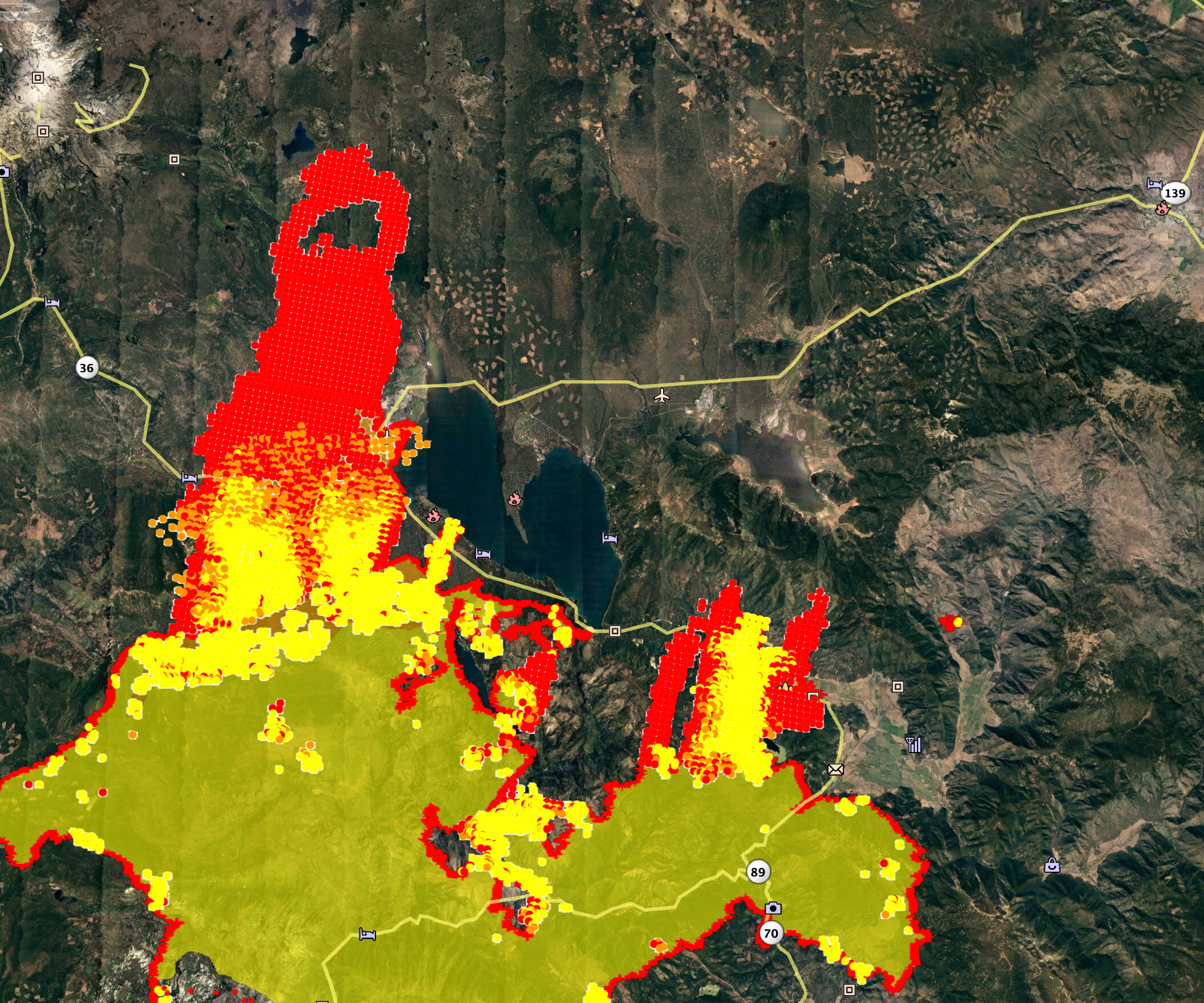
New spot to the east let’s hope it does not get established and suck in the main fire
3 Likes
I’d written off the willow creek homesites, but today was surprised to see that the fire skirted by them and that the few hot spots near them are pretty low energy. With the wind predictions for today, and a few month old controlled burn to the west of them, I am surprised to say that I am hopeful.
Anyone have any intel on the situation there, or if there are crews or structure defense measures in place?
The black dot is one of the central cabins in the tract.
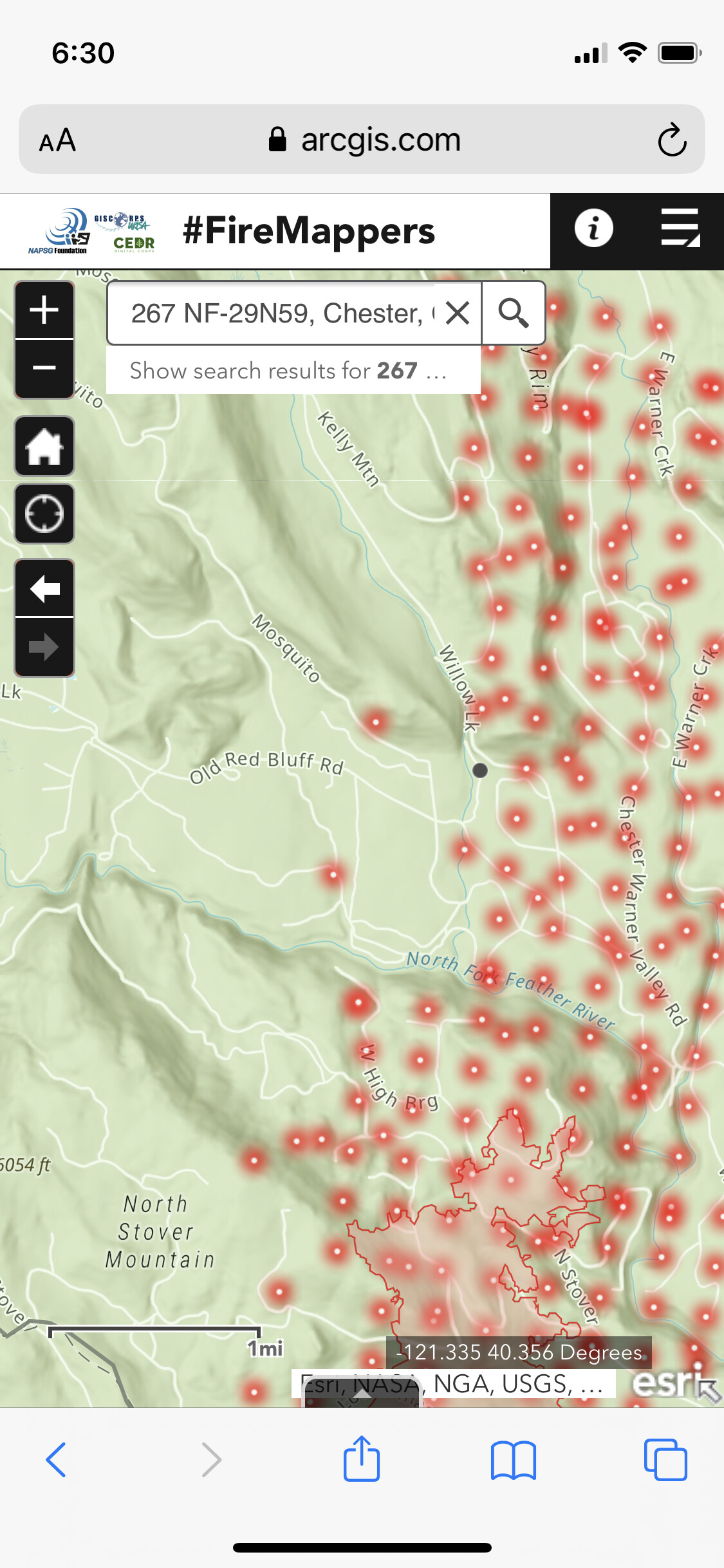
Courtney Air data was gathered by an IR Flight then “interpreted” before uploading to the FTP site @ 03:34 AM. Probably a few hours (?)
VIRS data is via satellite - if viewing on CalTopo with Fire Activity MODIS / VIRS selected, you can zoom in and see the date/time that the detection was taken.
Shows up like this:
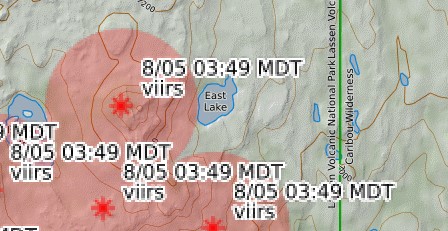
3 Likes
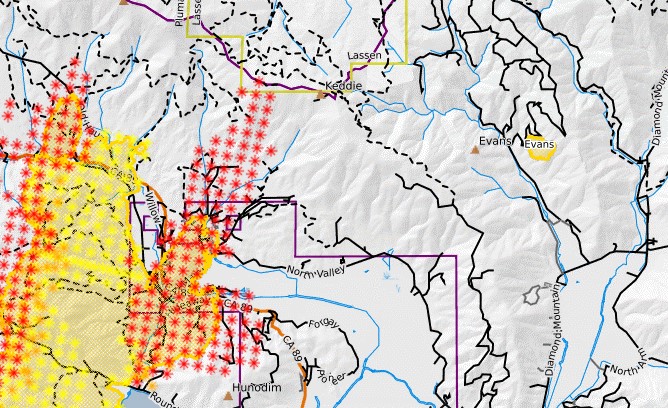
I think the entire planning branch is asking the same question as they pore over the maps. The new variables of National Park land and Caribou Wilderness would need to be considered as well. After that, Hwy 44 could become an 8 lane highway. 
3 Likes
@calfirebc that “spot” on the east side may be the Evans fire from early on. “red” on IR maps is just the perimeter.
8 Likes