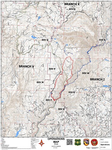
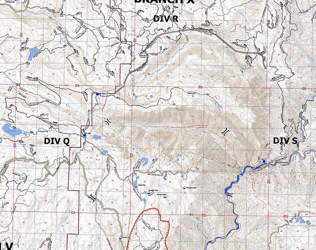
HelCo reporting the fire is now well established in the Rock Creek drainage with significant high tension powerlines overhead.
Mapped at just under 5K, 4,967 acres. The fire is spotting 1/4 to 1/2 mile ahead. AA is going to try and get Tankers engaged again.
Tankers on hold again due to smoke. IC is trying to figure out how to protect the train trestle above the Feather River. Critical infrastructure. It was stated earlier that it was not threatened, but now it seems to be a big concern.
Our water tender just got called see you guys in the AM
Their Dropbox is up now:
https://m.box.com/shared_item/https%3A%2F%2Fcalfire.box.com%2Fv%2FCALFIREIMT1
File folders are for the Dixie Fire, however have no files in them yet.
HelCo advising multiple spot fires into the Chip Creek drainage, Copters are working it but they don’t think they can hold it. Too smokey for Tankers in the drainage.
Spots are about 20 acres and pushing east.
One spot fire is about 20 acres. It’s said to be south of Morris Lake and not in the Chips Creek drainage.
Neither the Chips nor Storrie Fires held at the ridge where the dozer line is in Division R.
Hopefully the fact we’ve had 2 fires in this country in past 21 years will moderate the rates of spread a bit. A lot of the forest that survived during Storrie also survived the Chips.
BDU 9354L had been there for a day or two. I’m sure there are some others.
AA is ordering 4 LAT’s and 2 VLAT’s to start working this fire.
Caltopo current heat spots (still 3 hours old) power lines seen if you zoom in:
https://caltopo.com/map.html#ll=39.99465,-121.28168&z=13&b=t&o=f16a%2Cr&n=1,0.25&a=fire%2Cmodis_mp%2Cfeatures
Seems that it might be into Belden by now.
Quincy (East of Incident)
https://wrcc.dri.edu/cgi-bin/rawMAIN.pl?caCQUI
Click on daily summary and submit info for current day.
Jarbo gap RAWS: (way west of incident)
https://raws.dri.edu/cgi-bin/rawMAIN.pl?caCJAR
Winds gusts @ 1400 was 19mph
1800 now @ 10mph
15,000 acres, 15% contained this AM


