State ID: CA
3 letter designator: BTU
Fire name: Dixie
Location: Dixie Road x Camp Creek Road; Jarbo Gap, CA
Reported acres: 1,200
Rate of spread: rapid
Report on Conditions: burning in timber, on steep terrain with very little access. Spotting, torching, up canyon runs.
Structure threat: yes, evacuation warnings.
Resources: AA505, T89, T93, T95, T96, T102, T911, MAFFS-9
Hazards: multiple drone incursions has hampered air response. High tension powerlines.
Weather:
Radio channels:
Scanner link: Butte County Sheriff / Fire Tac, CalFire and Paradise Police Live Audio Feed
Webcam link: Flea Mountain
Bald Mountain Butte
Concow Mountain
Sawmill Lookout
Multi-camera tile page
Live video: FLIR- Live Video Stream
Agency Website: Dixie Fire (CA) Information - InciWeb the Incident Information System
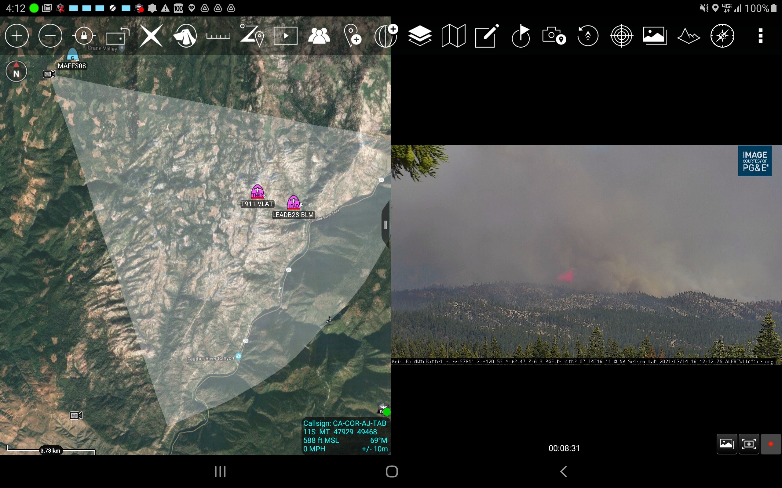
T-911 off MCC
Dixie AA requesting a helco
Head of the fire burning in lighter fuels, with spotting. Main concern right now is the shoulders.
IC requesting all transmission power lines be shut down. PGE says it will affects hundreds of thousands in the Sacramento area. Sounds like they will be having a meeting to discuss
Current aircraft is AA T-93, T-95, T-96, T-89,T-911, MAFFS-9.
AA just requested additional VLAT
And “hasn’t been filled yet” as there are “a lot of fires competing for resources” per AA traffic. 
T-912 eta about 20 minutes
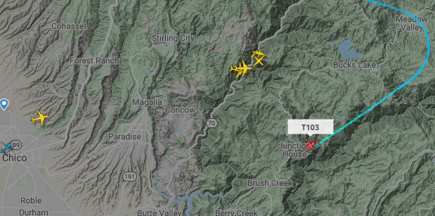
quite a traffic jam. there are 7 aircraft in this shot.
Dixie Operations is inquiring if the Union Pacific fire train is available in the area, they could insert some resources via the train.
T-914 joined the fray this afternoon as well.
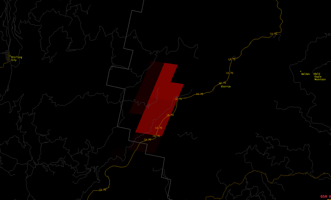
2200 acres 0% per BTU Twitter
For those just waking up and pulling up VIIRS and IR perimeters. Here is the GOES 17 Fire Temp algorithm as of around 5:20 am. Looks be burning pretty hot all night. 24 hour burn periods in place. Prevailing southwest wind flow should dominate and be strong enough to overcome the typical Jarbo Gap wind effects the next 18-24 hours.
Looking at the Bald & Flea Mtn Camera loops. You can see the fire burning hot. The winds didn’t change direction from up canyon to down canyon till about 0430 on the 3hr loops
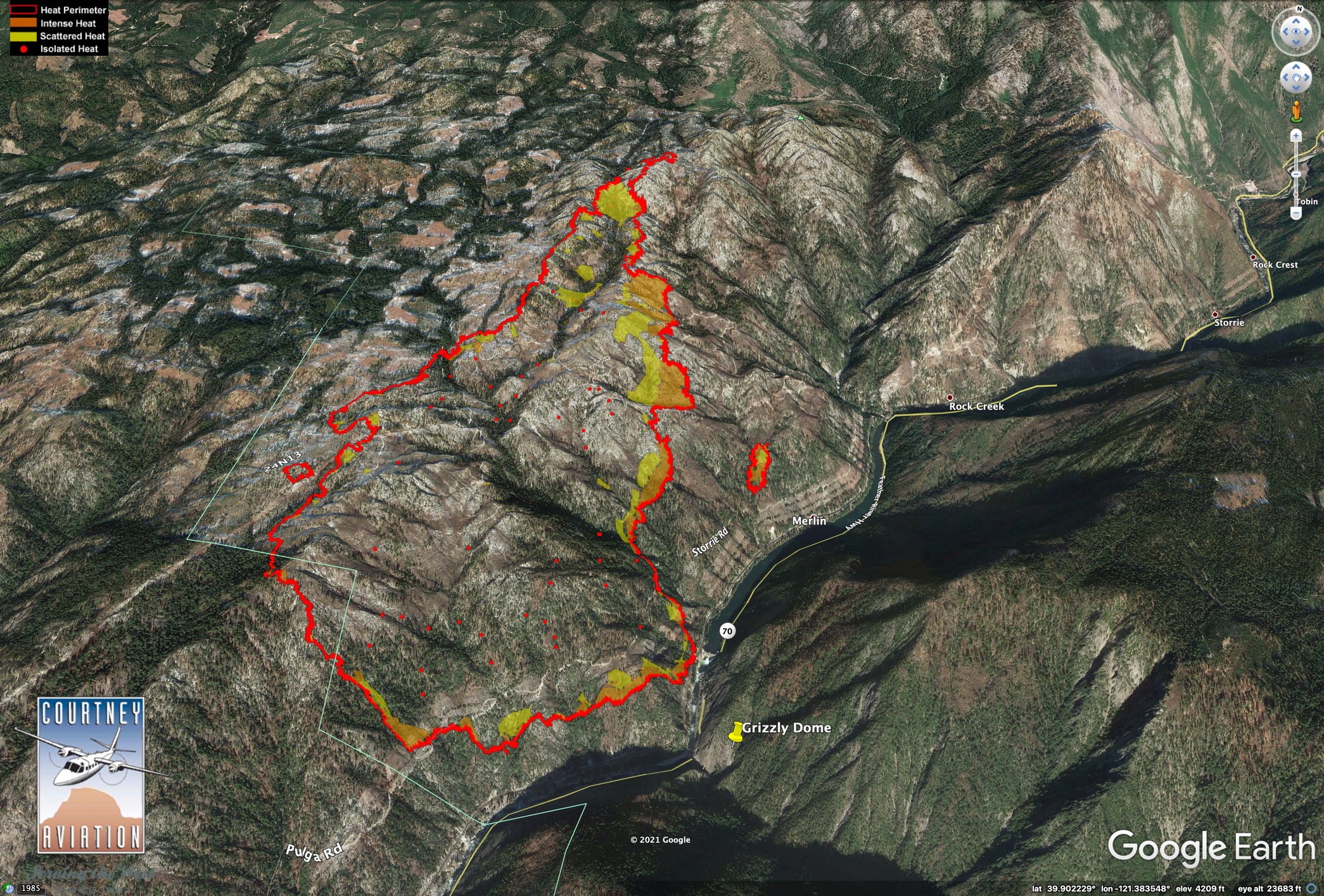
#DixieFire as mapped at 7pm, 7/14/2021. The fire burned yesterday within areas burned in 2008 (blue). Though the head of the fire was often smoked in, airtankers were able to drop dozens of loads of retardant on the left (west) flank. Data source: NIROPS/Courtney Aviation.

Nothing official here, but she seems to be getting her legs going just before noon. Nice column build right now.
It’s lighting up pretty good on the RAMMB SLIDER
A post was merged into an existing topic: CA-BTU-Dixie?