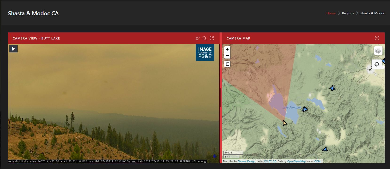
http://www.alertwildfire.org/shastamodoc/index.html?camera=Axis-BaldMtnButte1&v=fd40729
Appears to have a spot out iff the shoulder…

http://www.alertwildfire.org/shastamodoc/index.html?camera=Axis-BaldMtnButte1&v=fd40729
Appears to have a spot out iff the shoulder…
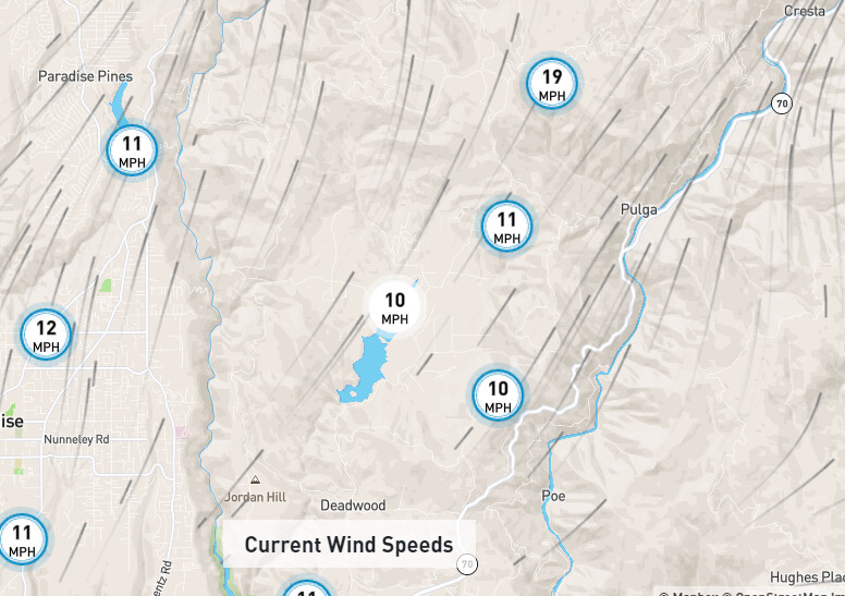
wind speed has picked up a bit . Paradise was socked in this morning with the down slope last night. Started clearing up and the Air Quality dropping back down about an hour ago
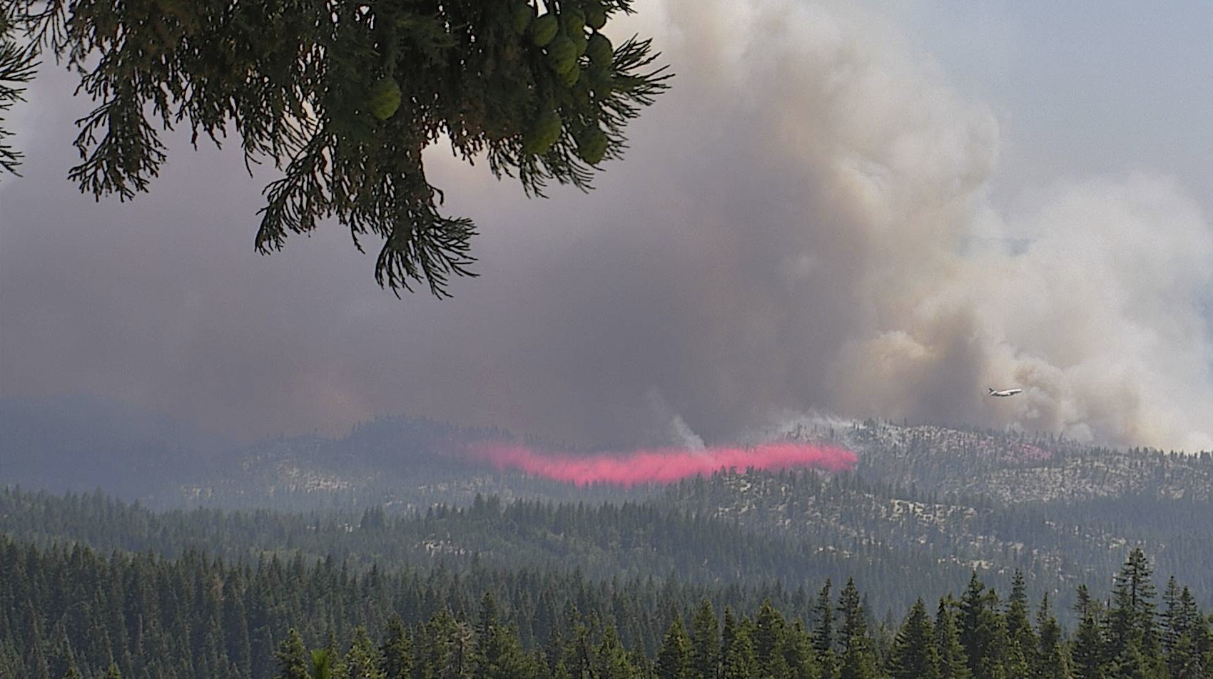
All tankers load and hold, per AA.
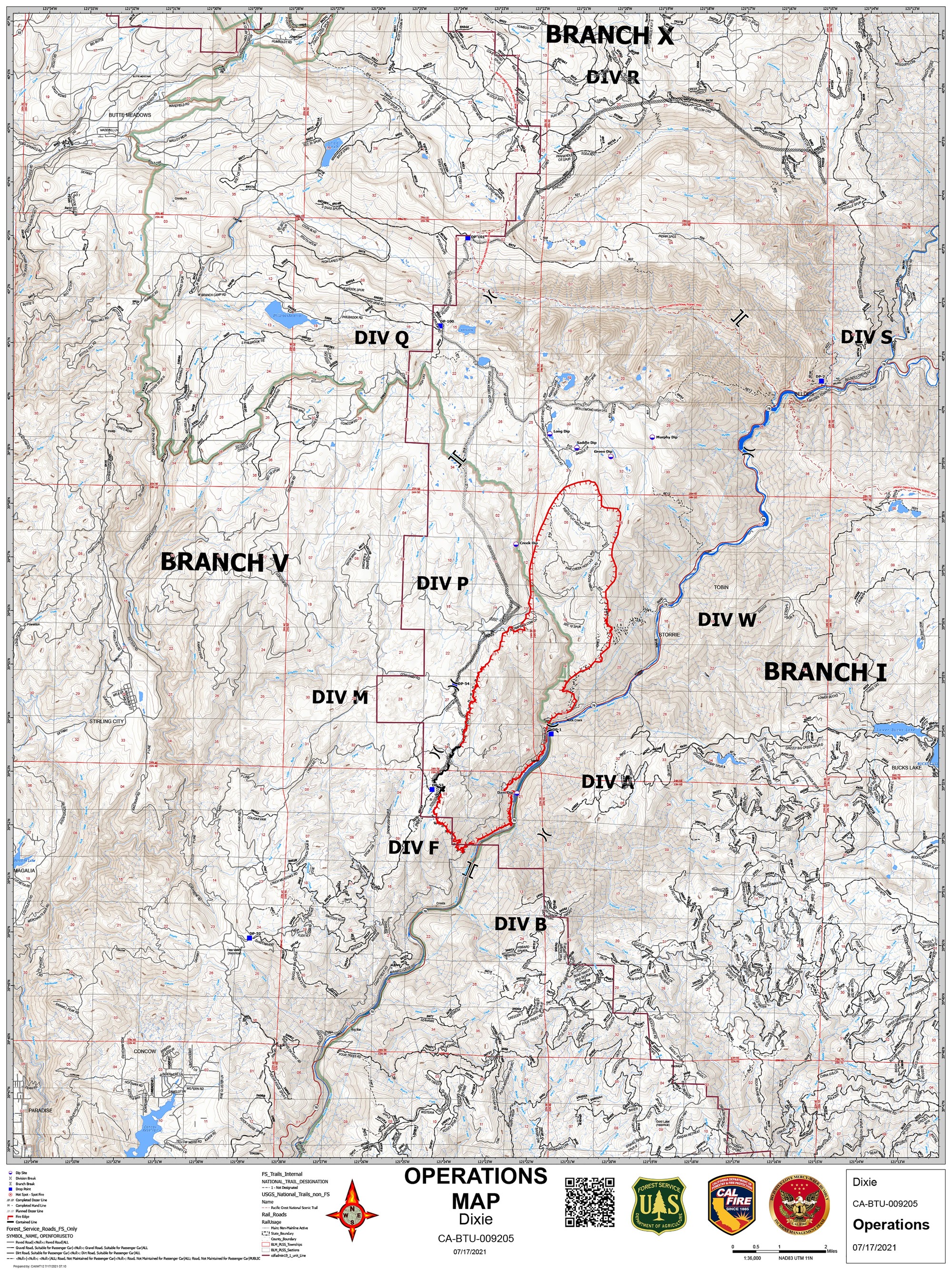
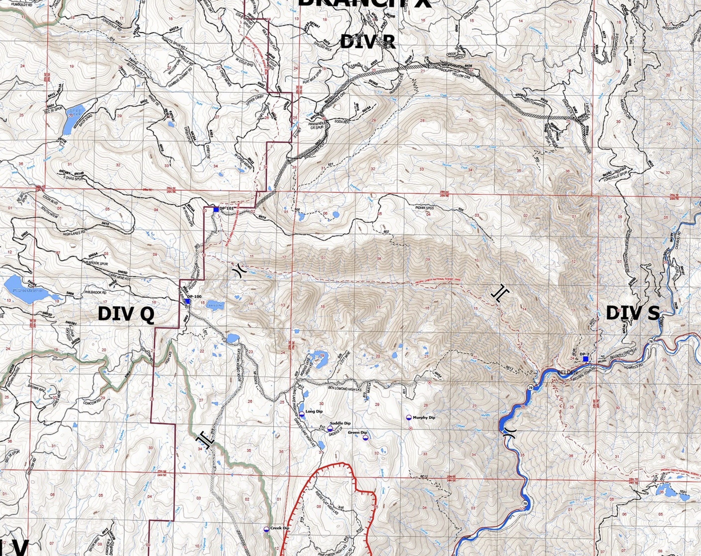
A Mandatory Evacuation Order has been issued for all of the High Lakes area due to the Dixie Fire. Additionally an Evacuation Warning has been issued for Rock Creek to Tobin (from the Plumas/Butte County line to the community of Tobin)
Yeah, all that smoke went somewhere else … we’re probably not going to see any flying out of Chester today (except for Air Attack 06, which left for Beckworth a little after 11 this morning, and is still up at the moment), unless the wind changes pretty dramatically. Reminds me a lot of last year, when we got socked in for two solid weeks without being able to fly.
HelCo reporting the fire is now well established in the Rock Creek drainage with significant high tension powerlines overhead.
Mapped at just under 5K, 4,967 acres. The fire is spotting 1/4 to 1/2 mile ahead. AA is going to try and get Tankers engaged again.
Tankers on hold again due to smoke. IC is trying to figure out how to protect the train trestle above the Feather River. Critical infrastructure. It was stated earlier that it was not threatened, but now it seems to be a big concern.
Our water tender just got called see you guys in the AM
Their Dropbox is up now:
https://m.box.com/shared_item/https%3A%2F%2Fcalfire.box.com%2Fv%2FCALFIREIMT1
File folders are for the Dixie Fire, however have no files in them yet.
HelCo advising multiple spot fires into the Chip Creek drainage, Copters are working it but they don’t think they can hold it. Too smokey for Tankers in the drainage.
Spots are about 20 acres and pushing east.
One spot fire is about 20 acres. It’s said to be south of Morris Lake and not in the Chips Creek drainage.