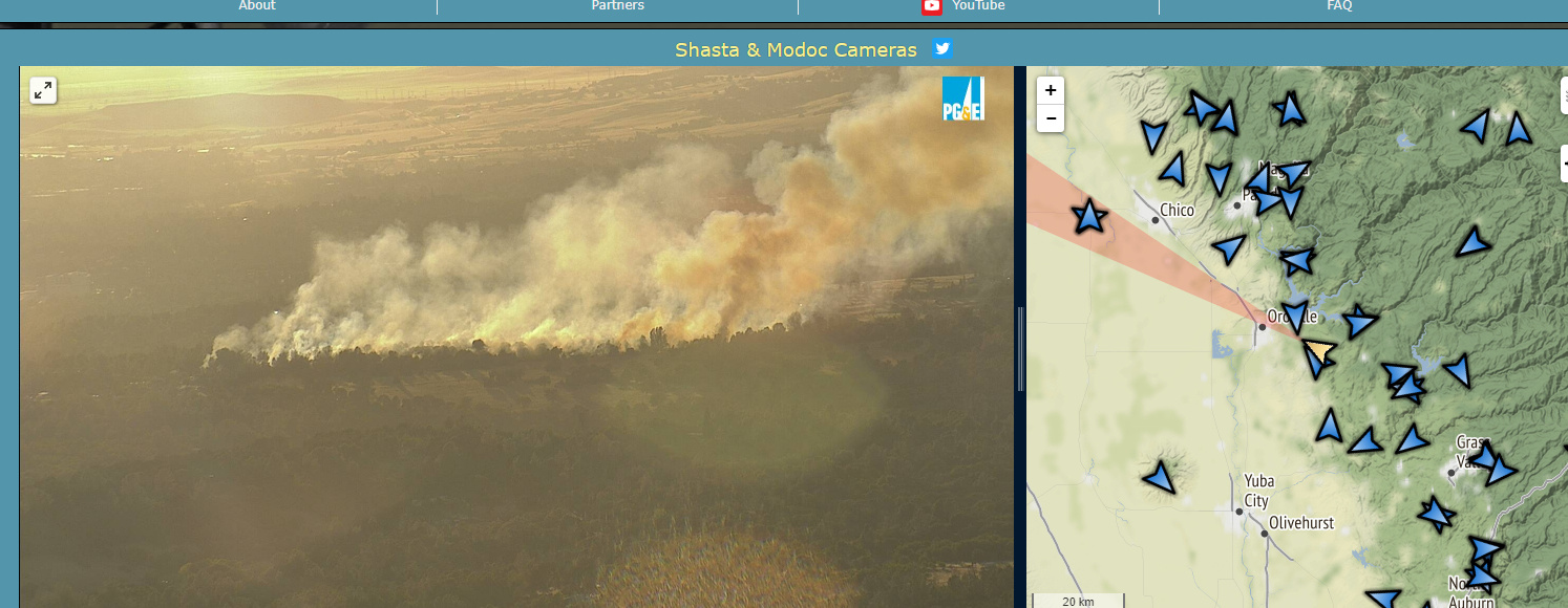
http://www.alertwildfire.org/shastamodoc/index.html?camera=Axis-ChineseWall&v=81e003f
1 Like
Is that the Robinson fire?
I do not think so.
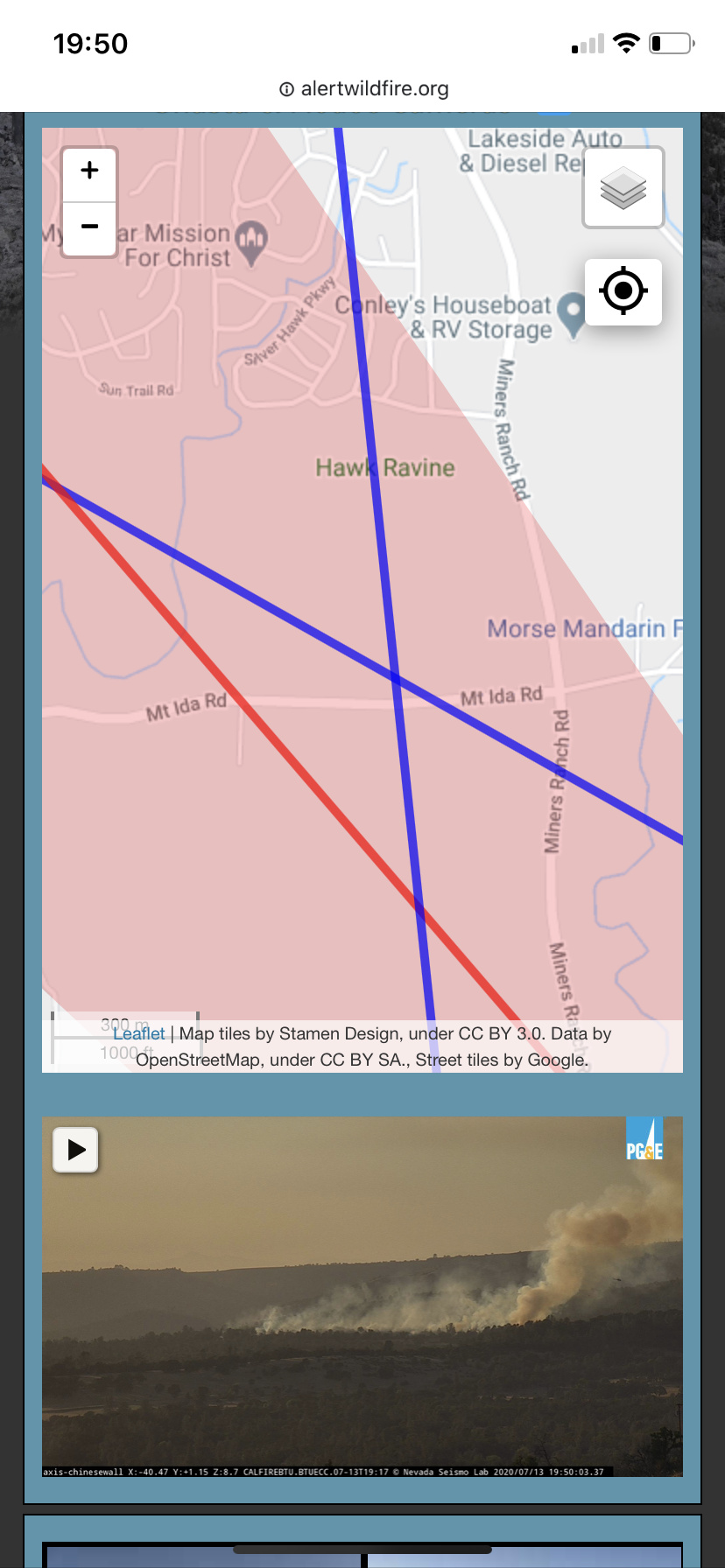
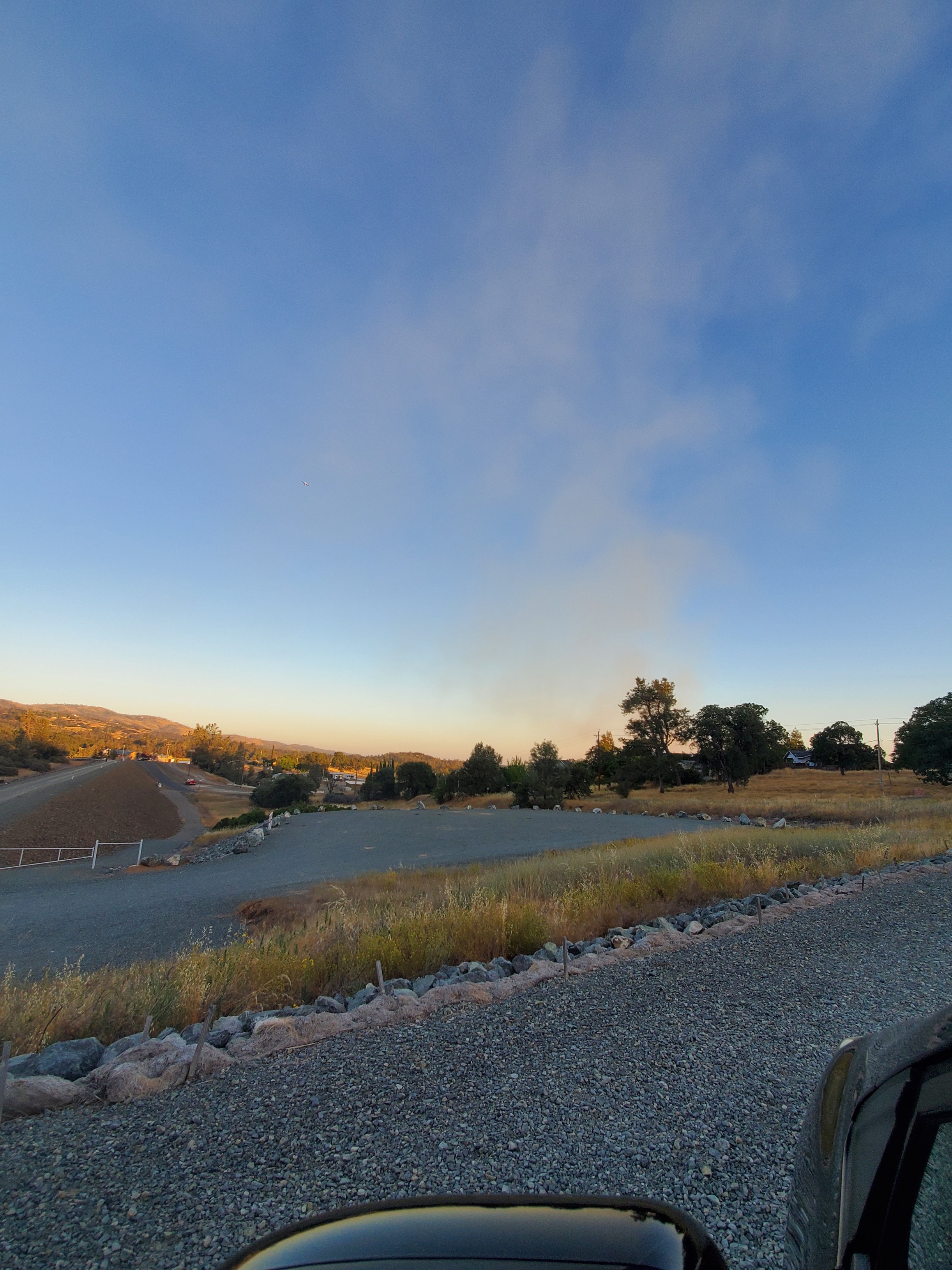
Ida Fire. Mt Ida Rd x Miners Ranch Rd. 5-7 acres w/ moderate ROS, subdivision out in front but has to jump a canal first to get there. 4 tankers ordered. Couple of spots @ the head.
1 Like
Most definitely not. The Robinson Fire can still be viewed in it’s smoldering state on the Sunset Hill camera http://www.alertwildfire.org/shastamodoc/index.html?camera=Axis-SunsetHill1&v=81e003f
This one is new and slightly to the North of the Robinson.
The camera angles place this new fire somewhere in the area West of Miners Ranch Rd and South of Hwy 162
1 Like
Where do you get the camera feed?
TV just had an Emergency Alert for evacuations
Mt Ida 1400 blk to soudan ct North to Olive Highway including Saddle Dr
1 Like
Under the stacking hot button in the upper right corner, you can choose the Show All Camera Targets option which will then show the exact camera views. Where the lines intersect for the camera where the fire is visible will pinpoint the location of the incident.
2 Likes
Forward progress stopped at 8 to 10 acres.
2 Likes
It was a warning.
1 Like
I do it from my phone can’t find anything for cameras
Sent you a PM to take it off line from the incident discussion.
Copy that thank you