State ID:
3 letter designator:
Fire name:
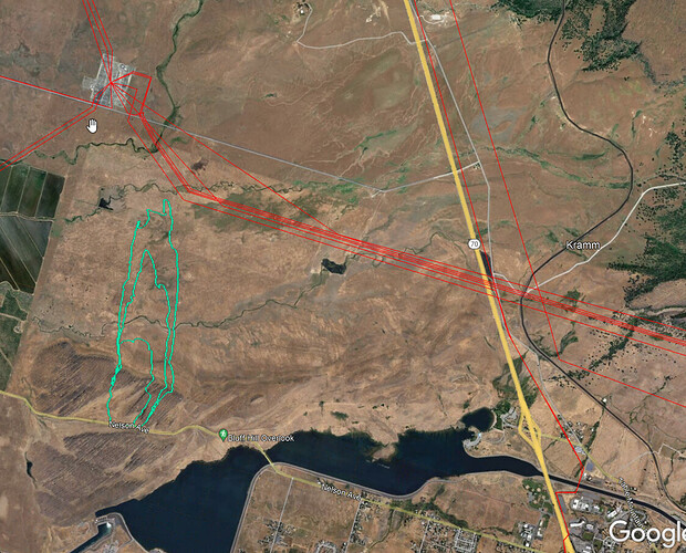
Location: Hwy 70 between Nelson and Cottonwood
Reported acres:75
Rate of spread:
Report on Conditions:
Structure threat:
Resources:2 S-2 Air Tankers, AA
Hazards:
Weather:
Radio channels:
Scanner link:
Webcam link:
Agency Website:
2 Likes
AA says 175acres, FIRIS has 185 acres, Dangerous Rate of Spread, direct impact to Table Mtn PGE substation. Sounds like they’re going indirect around the sub to get some quick friendly black around it.
Bloomer 1 has good line of sight to entire right flank and head of fire.
4 Likes
Latest FIRIS has 287 acres about 15 ago.
Oroville starts in lower right corner. Nothing more than rice and grass to the north, a few scattered ranch homes.
3 Likes
KCRA reports 40% contained
3 Likes

