
Just for clarification, that was yesterday’s IAP, just in case anyone is trying to locate a resource or frequency.
1 Like
Frequencies have not changed and that’s what I had available.
Easily able to navigate to today’s IAP from there.
3 Likes
The morning brief stated there are some changes, mostly with air tactics as I understand but it would be wise to double check and make sure you are up to date.
3 Likes
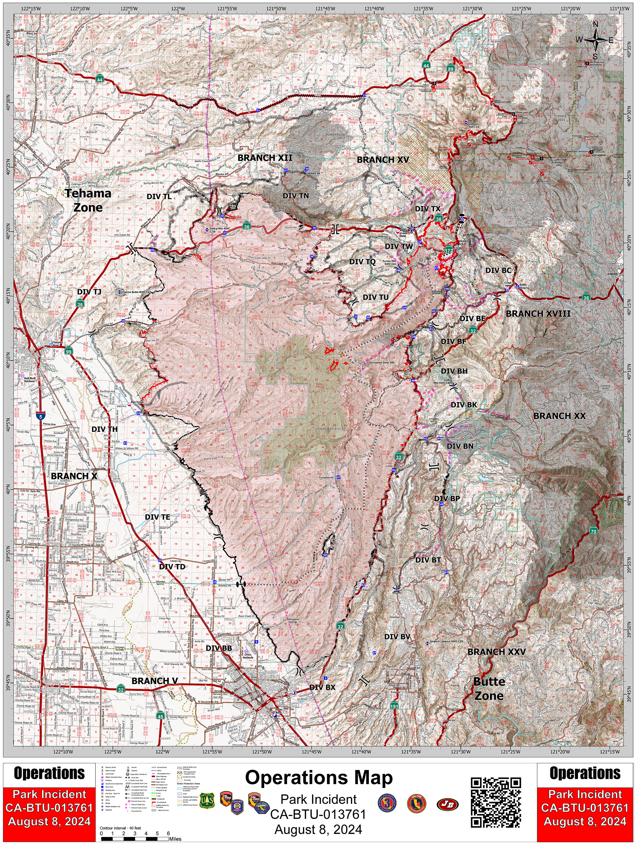
New clone today, V5.
2 Likes
3 Likes
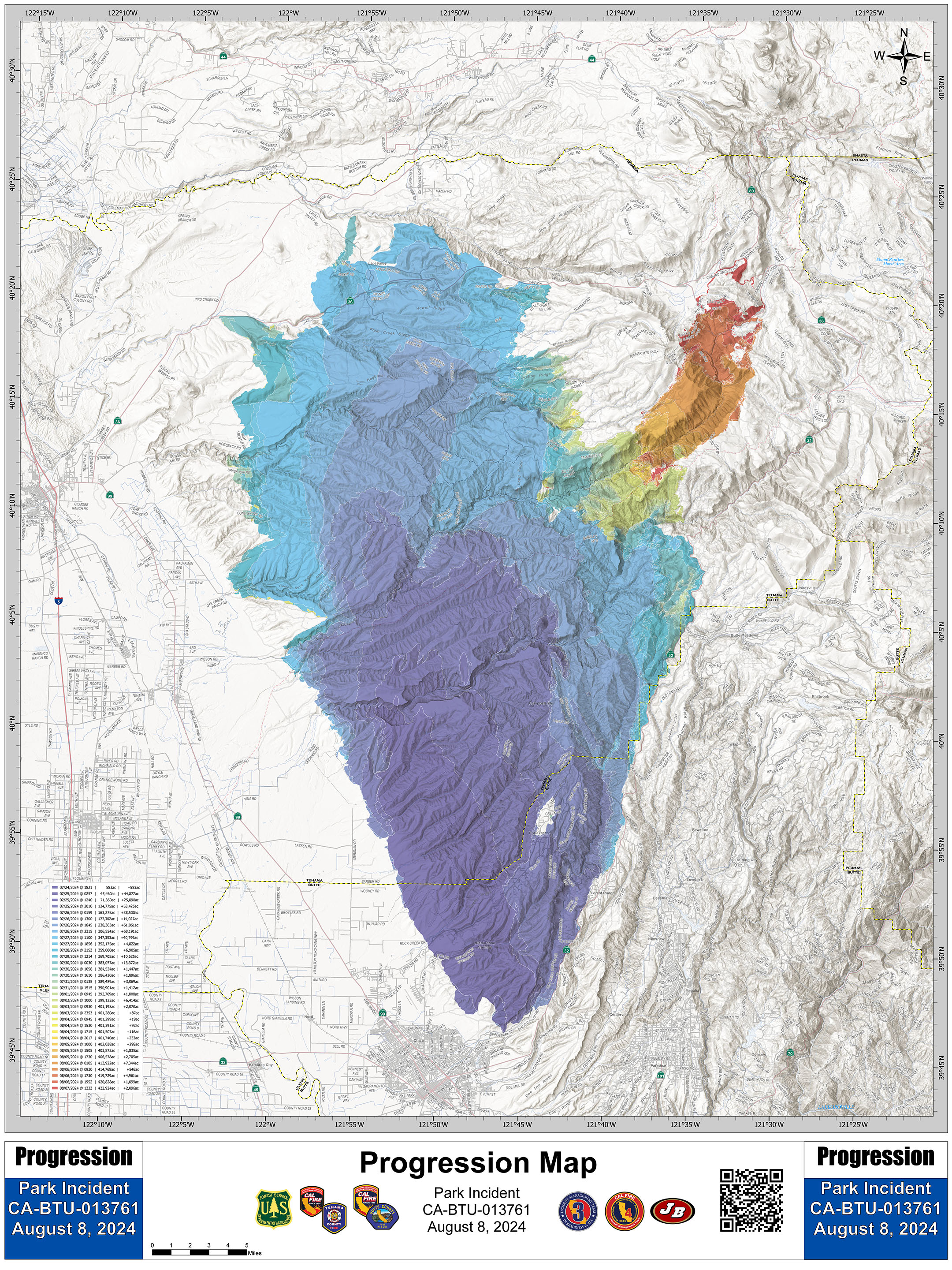
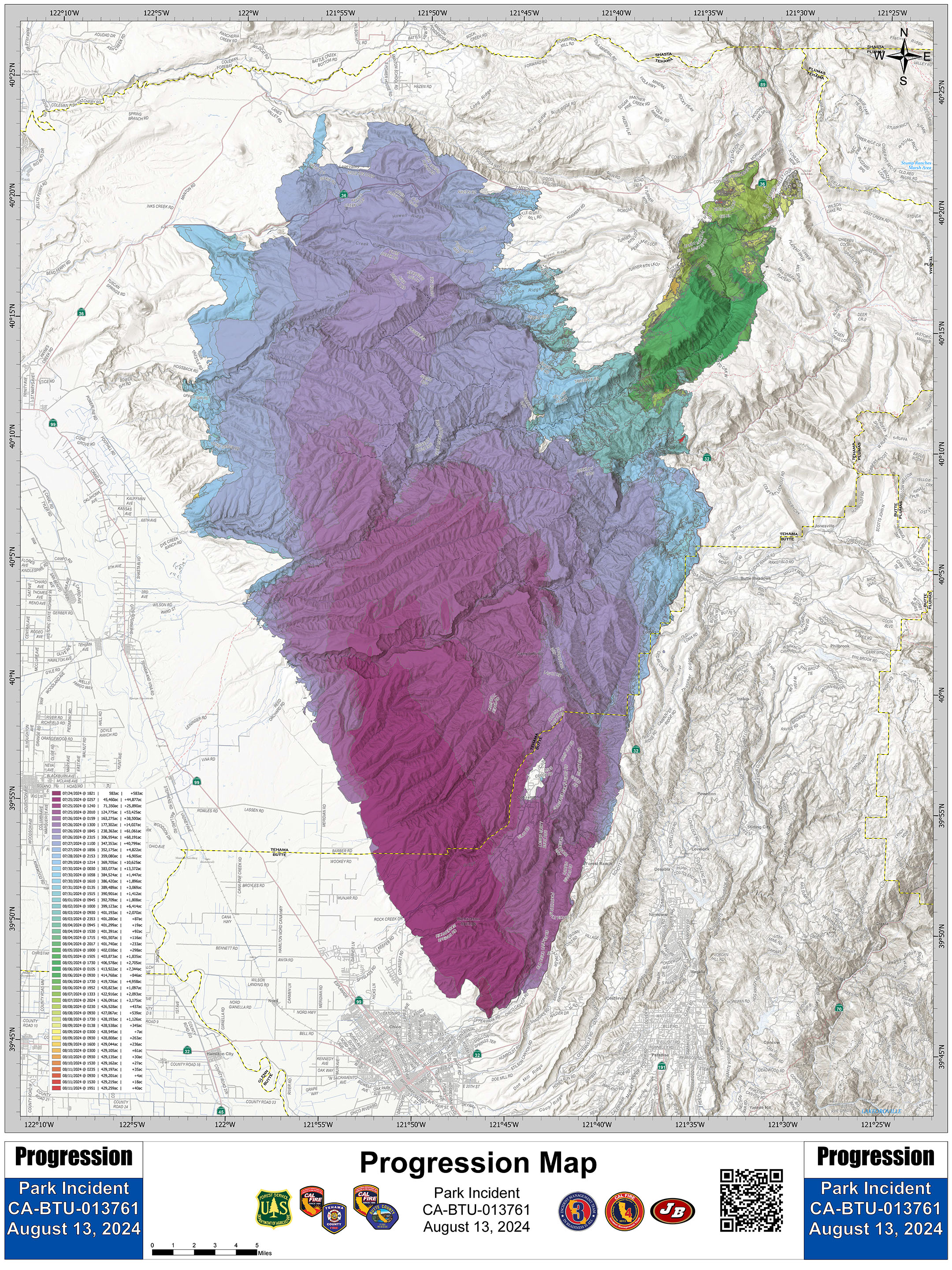
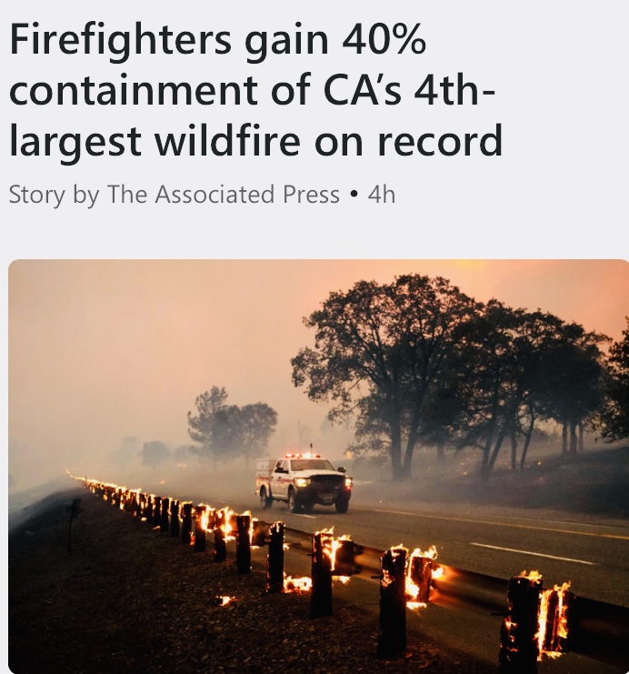
401,740 Acres @ 34% Containment
Anticipated Incident Containment: 08/31/2024
Damage Info:
Butte Co- inspections complete
Single Family Residences- 253 Destroyed, 19 Damaged,
Commercial- 5 Destroyed,
Other Minor- 168 Destroyed, 26 Damaged,
Infrastructure- 2 Destroyed, 2 Damaged.
Tehama Co- inspections complete
Single Family Residences- 128 Destroyed, 0 Damaged,
Commercial- 2 Destroyed, 0 Damaged,
Other Minor- 80 Destroyed, 4 Damaged
Infrastructure - 1 Destroyed, 1 Damaged.
9 Likes
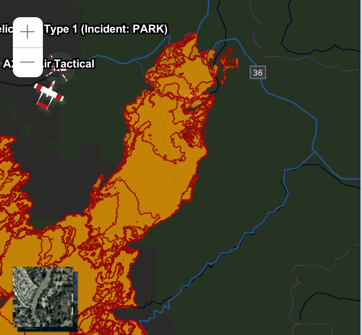
Setting up a fixed wing operation going direct on the line DIV TU below Turner Mtn, going south from the peak. Hoping to slow the flank and slops down, following up with an iron show going direct to hopefully put this piece to bed tonight.
Just ordered up 2 VLAT’s, 4 LAT’s, 2 S2T’s
6 Likes
Is this where the fire got a little excited the other day.
5 Likes
looks like the fire got really excited after seeing the weather report
7 Likes
Looks like T210 just dropped, T 105 and T912 are inbound with T93 right behind him.
T03 is following from Fresno
3 Likes
The winds are picking up, and doing some switching around. At least it’s not a really heavy (20-25) wind from the SW.
3 Likes
6 Likes
4 Likes
With fire comes flood…
https://www.facebook.com/photo/?fbid=914434630712870&set=a.246737254149281
6 Likes
4 Likes
Here are some photos of the Park Fire’s burn severity in Chico Creek Canyon, and in Mill Creek Canyon.
If you click on the external Gigapan links, you can open the panoramas in fullscreen mode (recommended). Use the fullscreen button on left of Gigapan page…
10 Likes