
In case anyone is wondering Platte mountain is on highway 32. It’s forest ranch area.
7 Likes
https://nifc.maps.arcgis.com/apps/webappviewer/index.html?id=f62c0156e48047f59791293aa794b0f3
Ah shoot, replied directly to this — sorry for the double post!
2 Likes
My good friend lost it all during camp fire currently lives in magalia. i was talking to him a bit ago he was telling me he was getting chills because the conditions, smoke, air attacks flying over are a lot like that day. i love this man so freaking much makes me wants boot stomp someone. im really sorry to hear about your friend man its a frustrating situation 100 percent even more so when it effects someone we love.
7 Likes
Sorry about your friend…and appreciate the kind words. Real sad thing is that some folks that had been burned out during the camp fire lost their home AGAIN right down the street from my friend. Lightning struck twice. Really feel for them. Stay safe!
5 Likes
This is pretty wild. I am 162 miles away from the Park Fire as a crow flies. You can see the Header looking due North from my the front of my house. You may have to enlarge the pic but it’s a faint little column middle of pic.
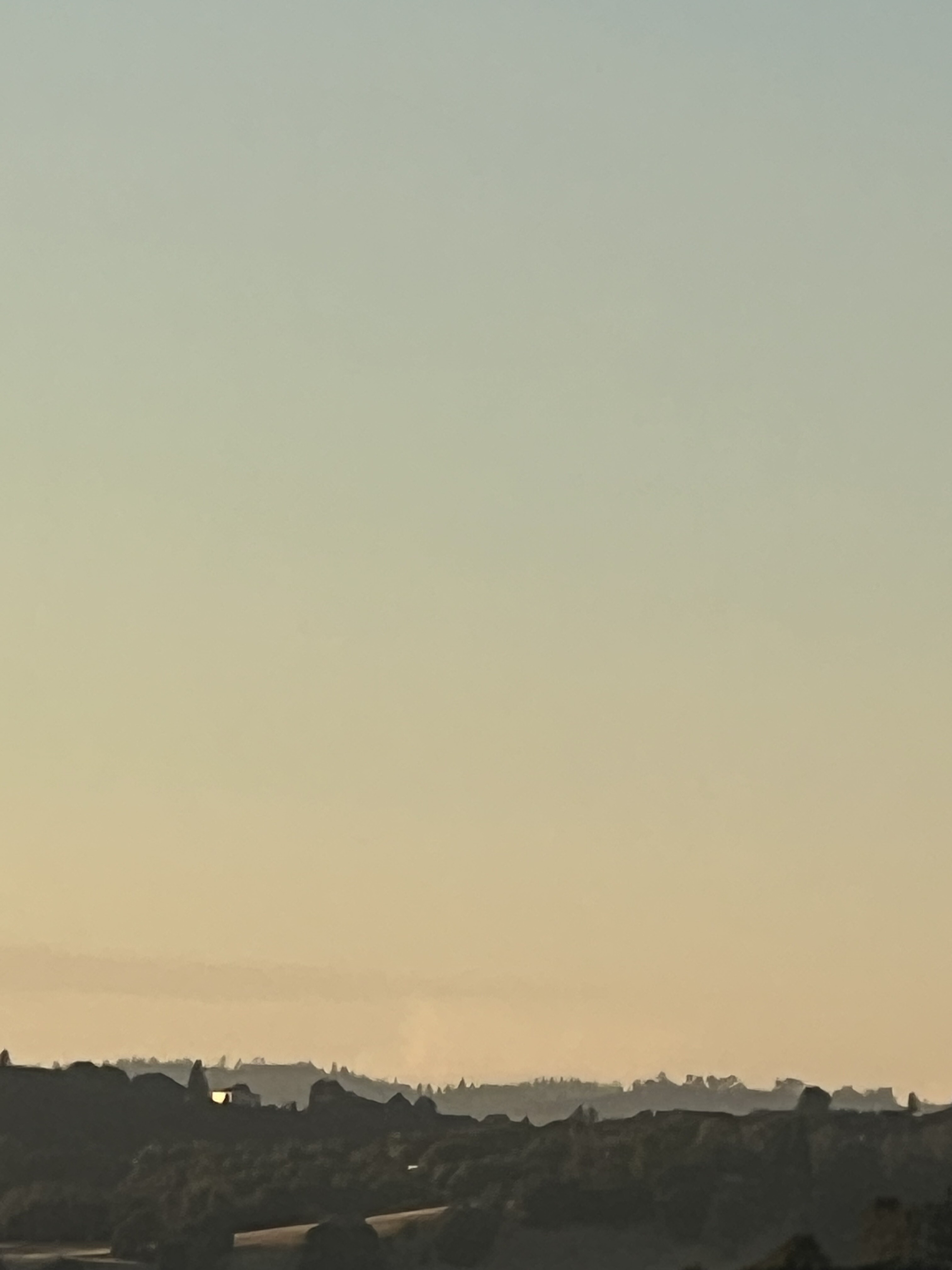
Sonora, CA
9 Likes
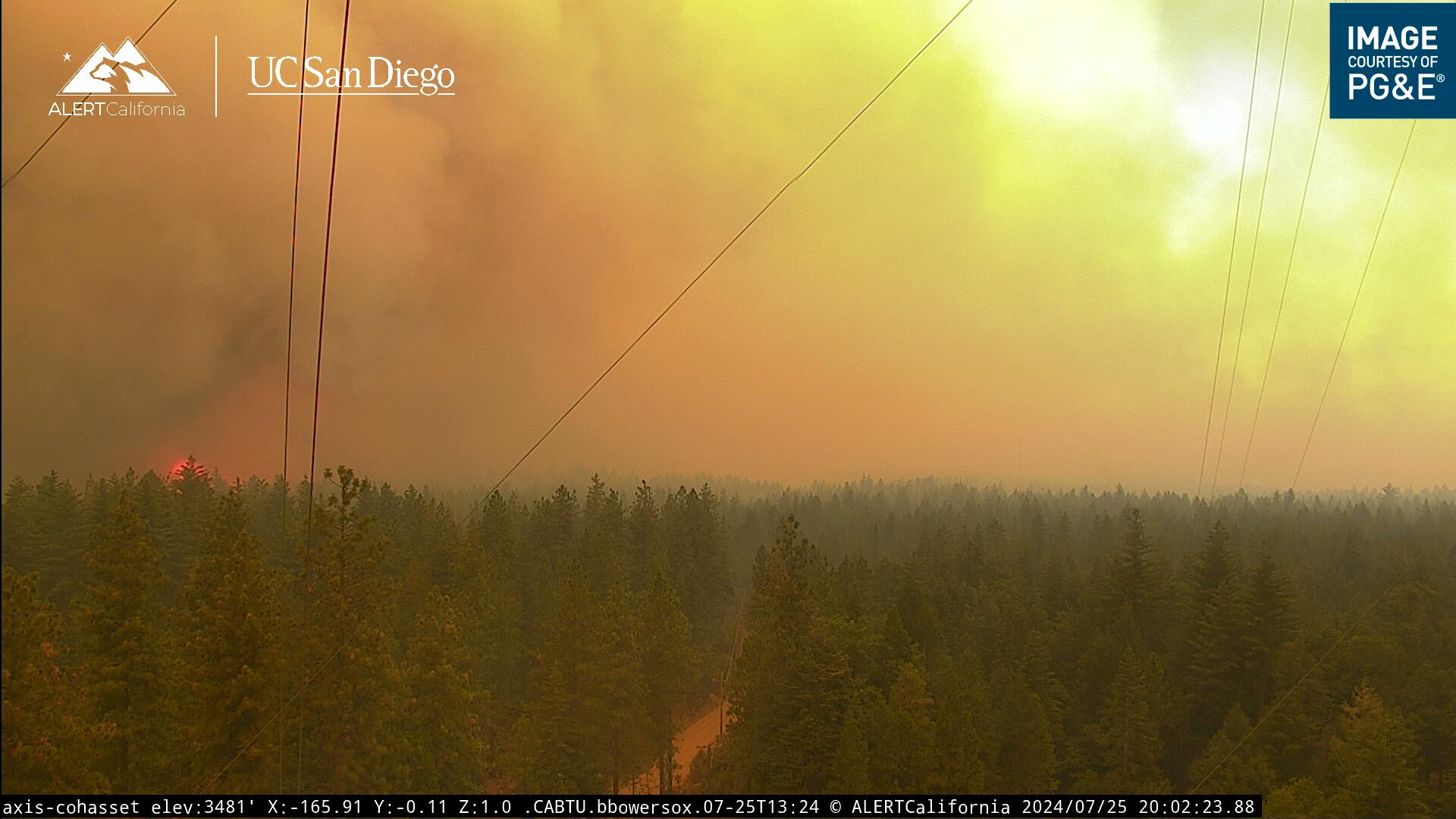
Cohasset hill cams about to take some fire
5 Likes
I can’t tell but those don’t look like fire resources.
6 Likes
fire also approaching from the opposite direction toward the cam
3 Likes
Nope, that’s a 1930’s Ford pickup.
11 Likes
Yes they do. I was on the Hwy 36 Pumper stand on the Campbell. Did NOT go well.
4 Likes
Not sure that Polaris is going to put in much work here…
As a telcom guy this stuff kills me to watch.
4 Likes
Looks like on Cohasset some crews did some tactical firing. The fire was far off then, I see a backing fire start at the base of the site.
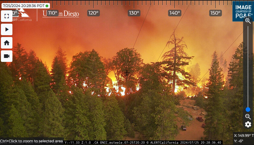
Platte Cam looks to be up next as the leading edge of a run is close:
https://ops.alertcalifornia.org/cam-console/1699
3 Likes
7 pm 7/25 from North Ops: 124,951 acres grass and brush, 0% contained. Extreme fire behavior reported with long-range spotting. Structures are threatened with Evacuation Orders and Warnings in place. Critical infrastructure, communication sites and power transmission lines are threatened. There is a Red Flag Warning in effect in the fire area for gusty winds and Low relative humidity. Highway 32 is closed in the fire area. Highways 36 and 99 are threatened with additional road and trail closures in effect. Fire is being managed under unified command with CAL FIRE Team 3 (See) and the Lassen National Forest.
4 Likes
Do we know when the next mapping is?
1 Like
Looks like a mapping flight is finishing up over the fire right now (N350SM)
7 Likes
Thank you wasn’t sure if that was a mapping plane or not
1 Like
Observing the column from south end of shasta cnty and it makes me want to continue following the thread to see what the overnight brings. I need to tap out tho and want to say thank you and shoutout to this “community” participating in this thread bcuz it has to be one of the most engaging and informative fire threads ever - to me anyway! Appreciate the learning & sharing taking place here and i bet our public & ngo’s that also visit this thread will find it to be most engaging & helpful just like i do… \m/
27 Likes