Nope, that’s a 1930’s Ford pickup.
11 Likes
Yes they do. I was on the Hwy 36 Pumper stand on the Campbell. Did NOT go well.
4 Likes
Not sure that Polaris is going to put in much work here…
As a telcom guy this stuff kills me to watch.
4 Likes
Looks like on Cohasset some crews did some tactical firing. The fire was far off then, I see a backing fire start at the base of the site.
Platte Cam looks to be up next as the leading edge of a run is close:
https://ops.alertcalifornia.org/cam-console/1699
3 Likes
7 pm 7/25 from North Ops: 124,951 acres grass and brush, 0% contained. Extreme fire behavior reported with long-range spotting. Structures are threatened with Evacuation Orders and Warnings in place. Critical infrastructure, communication sites and power transmission lines are threatened. There is a Red Flag Warning in effect in the fire area for gusty winds and Low relative humidity. Highway 32 is closed in the fire area. Highways 36 and 99 are threatened with additional road and trail closures in effect. Fire is being managed under unified command with CAL FIRE Team 3 (See) and the Lassen National Forest.
4 Likes
Do we know when the next mapping is?
1 Like
Looks like a mapping flight is finishing up over the fire right now (N350SM)
7 Likes
Thank you wasn’t sure if that was a mapping plane or not
1 Like
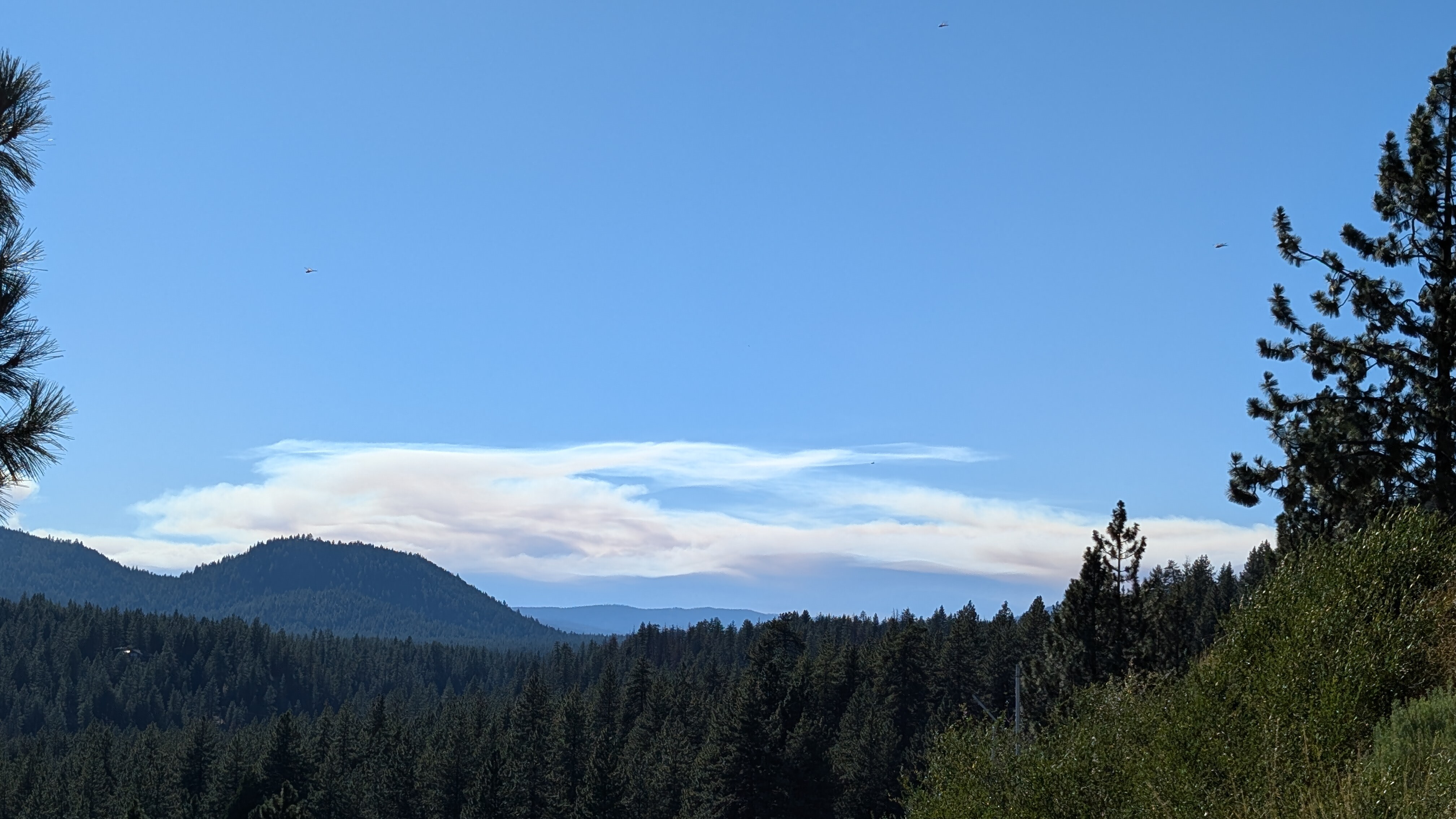
Observing the column from south end of shasta cnty and it makes me want to continue following the thread to see what the overnight brings. I need to tap out tho and want to say thank you and shoutout to this “community” participating in this thread bcuz it has to be one of the most engaging and informative fire threads ever - to me anyway! Appreciate the learning & sharing taking place here and i bet our public & ngo’s that also visit this thread will find it to be most engaging & helpful just like i do… \m/
27 Likes
I havent watched Zekes video or read any of Anvils or Swains recent posts so apologize for any redundancy. The weather pattern tomorrow is truly concerning with the given fire environment. At this point it seems clear the fire will start the day with a full head of steam as there has been no decrease in fire radiative power over the last 24 hours and it only is getting into heavier timber fuels (main line of fire looks about 25 miles long). The anomolus upper low moving onshore north of SF will only add to the instabilty with steep lapse rates just not normally seen on California fires. The low will produce large scale SSW wind flow up the east side of the valley with a turn to the SW by afternoon. Wind speeds aloft increasing with height will allow for extremely long range spotting distances with strong updrafts. Its not often you can fairly easily forecast rotating columns but this seems almost certain tomorrow. (the topography of the north end of the valley helps spin things up as well) Unfortunately the SW flow looks to have just enough west component to make holding hwy 32 unlikely. The alignment with Big Chico Creek, Mill creek and all those other SW to NE aligned drainages should produce some spectacular uphill runs. Also worth noting the models punch a solid dry layer through the low levels of the atmosphere so no initial RH relief of note on Friday. Perhaps the most dangerous time is about 24 hours from now with the winds switch to a more SE direction as the upper low pushes right overhead. Finally some more favorable conditions by Saturday. Truly sorry for all the loss and upheavel thats on the horizon, just a terrible line up of atmospheric conditions with fire like this on the ground. Pattern looks eerily similar (though distinct differences) to early August 2021 before some of the truly big Dixie runs. Did look at the fire history and the north end has that 2013 fire scar but lots of area with no history to the northeast until it hits the Cub Complex form 2008 and some Dixie country. Bottom line if it just did 125k acres with no significant weather, tomorrow could truly be historic. Things that have never happened before happen every day.
43 Likes
This is the best place to get real time info . The folks here are super well informed and have been in these trenches.
18 Likes
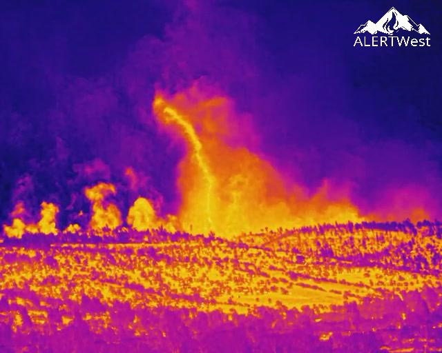
@ALERTCalifornia caught a firenado
11 Likes
Rotating column. Definitely not a firenado on the 6 year anniversary of the Carr fire.
10 Likes
Let’s not drag the old “firenado” conversation out of the barn. Definitely wild seeing column rotation on multiple days for extended periods
8 Likes
I posted a snip of the airport thermal camera with a pretty clear rotating updraft. Between that one, plus the wind sheer indicators of a tornado (also posted on this thread) in the same area as the alert instagram post, I’d be shocked if it wasn’t.
Here’s a different capture of the one from airport thermal camera from social media.
0000 update, INTEL12 remapping.
8 Likes
Spent yesterday in Forest Ranch on structure protection. Lots of good stops made by the crews up here and an overwhelming majority of houses still standing. Personally only saw 3-4 residences destroyed. Air show did an amazing job putting resources in place to assist us. 164,000 acres according to some radio traffic a couple hours ago.
25 Likes
Anyone seen a current map, curious how far into the Ishi Wilderness this has run
1 Like
2 Likes
Those vehicles all survived.
6 Likes