State ID: CA
3 letter designator: BTU
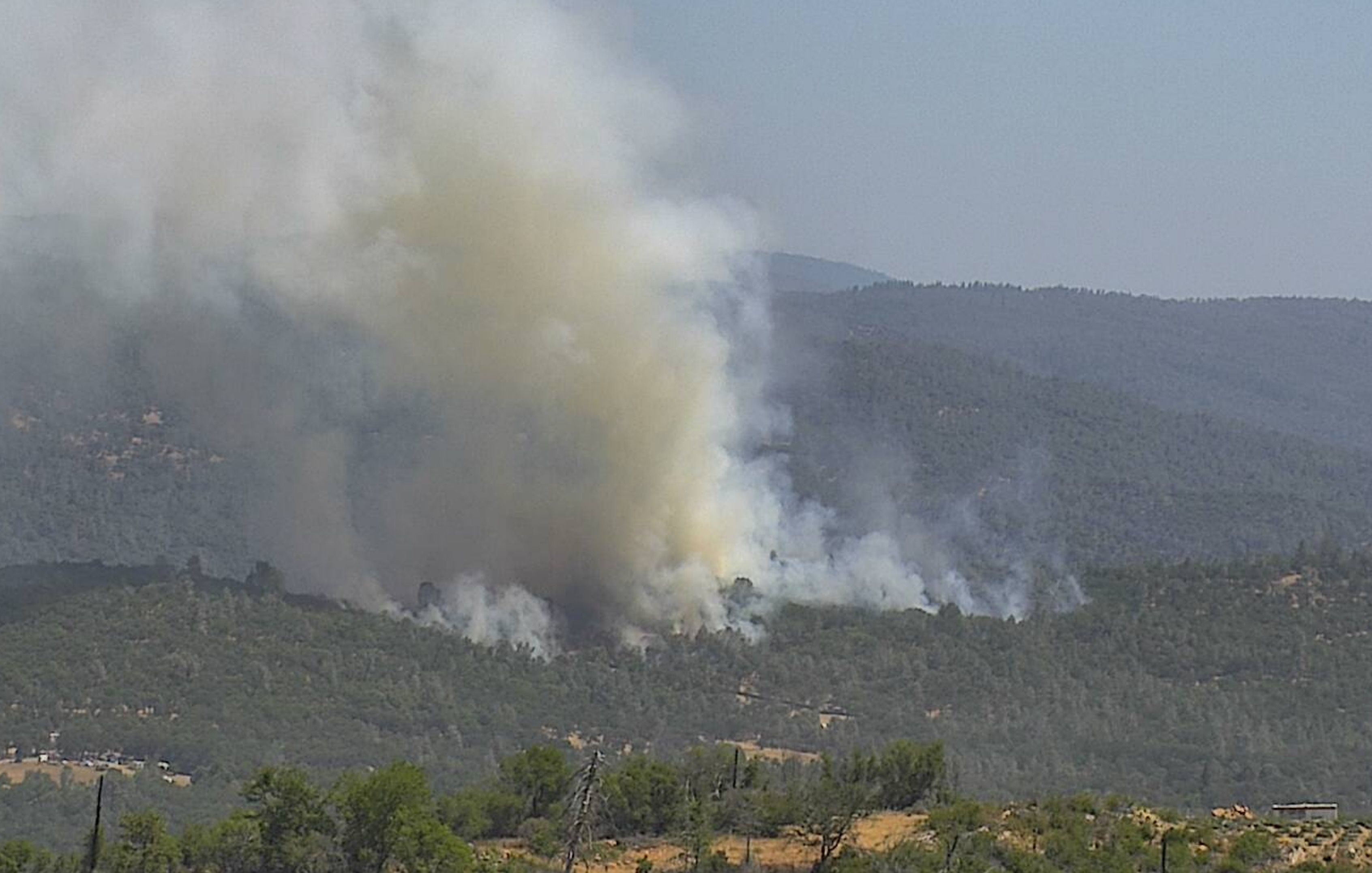
Fire name: Robinson
Location: Swedes Flats Road; E/O Bangor, CA
Reported acres: 10
Rate of spread: moderate
Report on Conditions: Potential for 10-15 acres. Being held in check by roads.
Structure threat: yes
Resources: AA503, T88, T89, T93, 94, HC512,
Hazards:
Weather:
Radio channels:
Scanner link: https://www.broadcastify.com/webPlayer/1929
Webcam link: http://www.alertwildfire.org/shastamodoc/?camera=Axis-RattlesnakePeak
http://www.alertwildfire.org/tahoe/index.html?camera=Axis-Paynes&v=81e003f
http://www.alertwildfire.org/shastamodoc/?camera=Axis-SunsetHill1
http://www.alertwildfire.org/tahoe/index.html?camera=Axis-SillerBrosTower&v=81e003f
Agency Website:
2 Likes
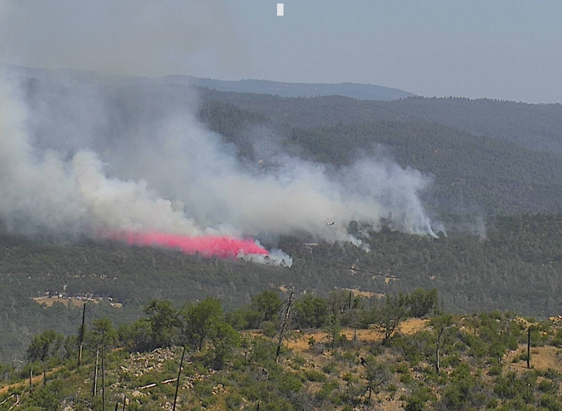
Request for 2 additional S-2’s and 1 type 2 or better Copter. Fire has thrown a few spots ahead of itself.
2 Likes
Potential of 10-15 acres seems optimistic. It’s moving pretty well, judging by the time lapse and size after less than an hour.
3 Likes
Primary Tac: CDF Tac 12
1 Like
Unless there is a spot… it is held up by roads, column has thinned out…
2 Likes
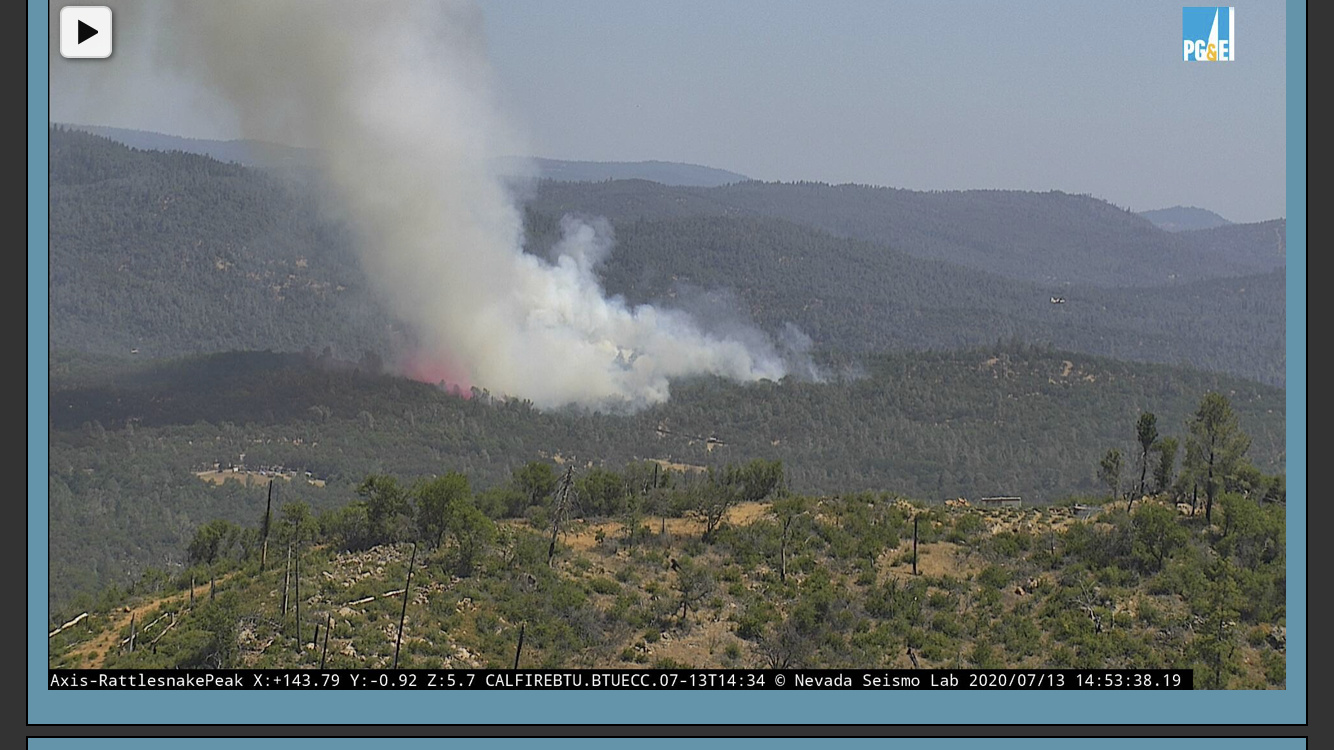
Looks like another spot outside the retardant on the camera
https://goo.gl/maps/D59o2gR1w82pUzgPA
Gold Mountain Road, near Stoney Oaks Loop.
1 Like
Robinson AA reports 20 acres, short range spotting, two spots on left shoulder 2 acres of size. Majority of fire has moderate but spots are a concern.
1 Like
5 additional engines just dispatched and a WT all call
Looks like they were spot on… trust the boots on the ground and in the air…
3 Likes