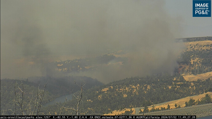
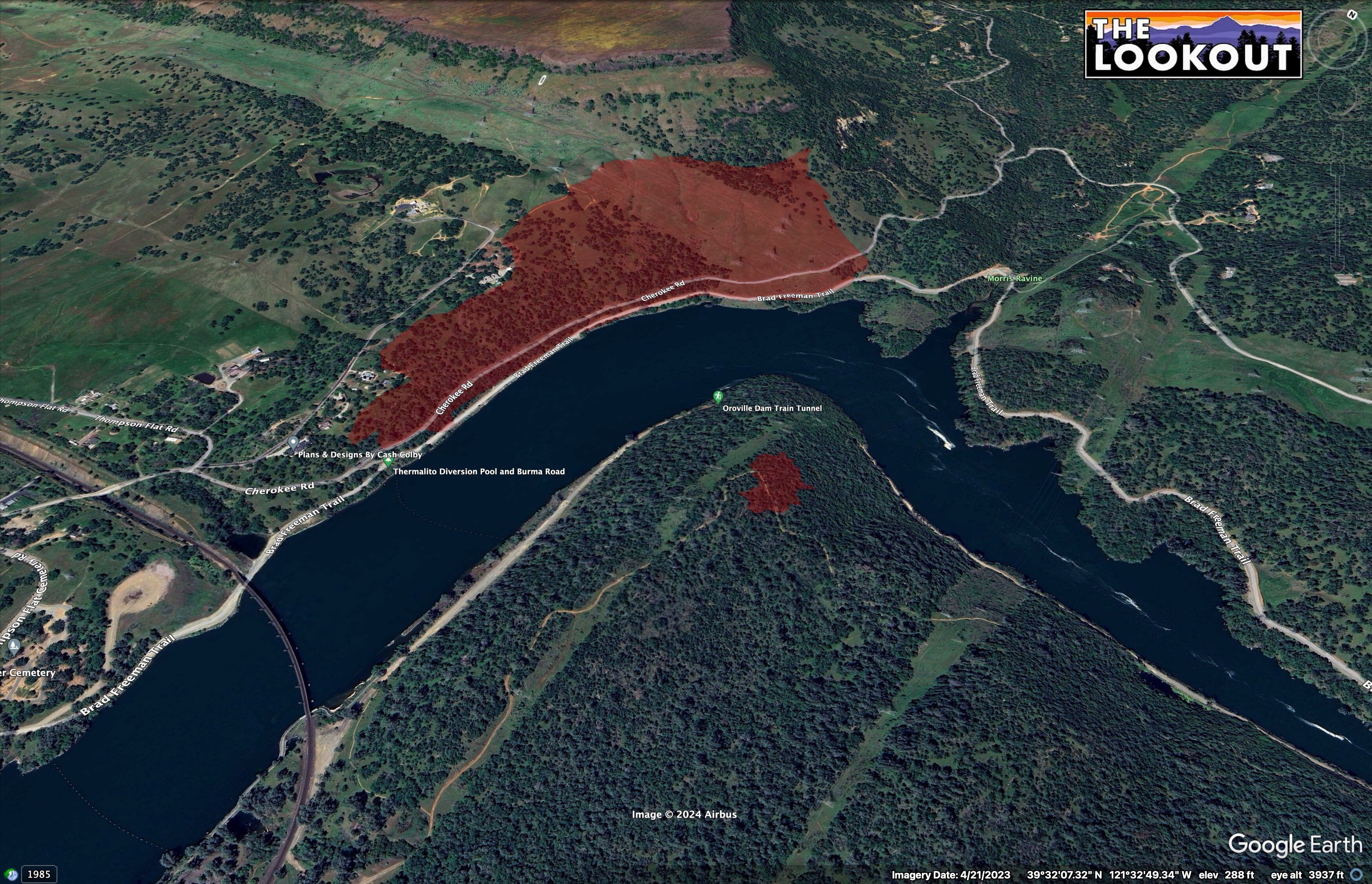
Fire in the area of Cherokee and Thompson Flat Rd. 10 acres per air attack. Additional air resources requested.
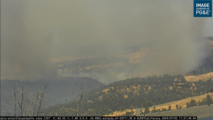
That’s the Thermalito Diversion Pool/Feather River, below Oroville Dam, not Lake Oroville, in the camera view.
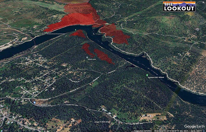
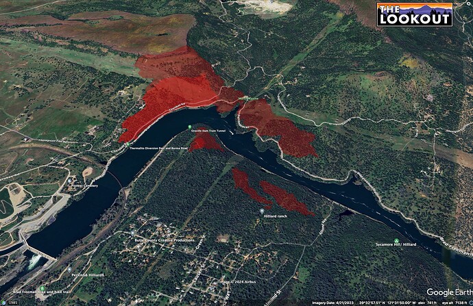
Yeah, sorry about that. Clarification: It jumped the much-smaller reservoir to the lake’s west. There also appears to be a windshift happening pushing the parallel firelines eastward toward the lake.
Per AA 50+ acres mod/critical ROS. Starting evacs on both sides of the river.
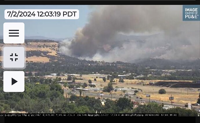
The other camera has a better View
South Oroville Cam: ALERTCalifornia
Oroville State Parks Cam:
https://cameras.alertcalifornia.org/?pos=39.4595_-121.4882_10&id=Axis-OrovilleCaStParks
Main fire is 75 Acres , 2 Acres spot across the river .
Per IC: request 4 Additional charlie ST for a total of 8
Cannot confirm request , but STC- should be “Strike team Crews”.
My bad… Charlie’s
FIRIS perimeter at 12:08PST.
Spread on north side of river up until now has mainly been in grass/blue oak woodland. Spot on other side of river is on the top of the hill in live oak/gray pine woodland. Both fires are somewhat sheltered from the northwest winds.
Has it burned around to the Oregon Gulch Rd area, or jumped the Diversion Pool again? Looks like its running pretty good there.
Running on both sides of the river. AA request no divert on 3? Tankers for numerous structures ahead of the fire
Edit: looks like the spot has taken off and spotted further down
Expanding evacuation warning to Canyon Drive
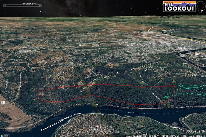
13:45 FIRIS perimeters.
For now, the fire on south of river is running parallel to the most developed areas, luckily.
10 Additional Strike Teams. Any type for structure defense.
Anyone find a scanner link that has air-ops as well as command ?
This is the beat I can find
Fire has spotted under the power lines of glen dr and is also running along Oroville dam rd east on both sides. Talking about evacs for all of kelly ridge.
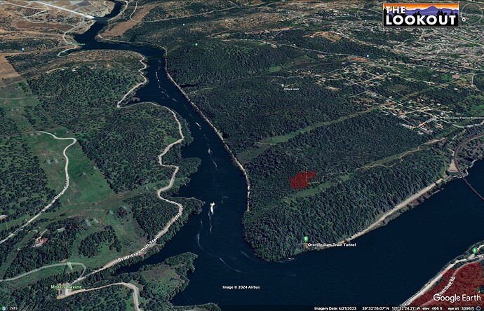
Fire looks like it is close to Oro Dam Blvd by now - WAG perimeter in red.
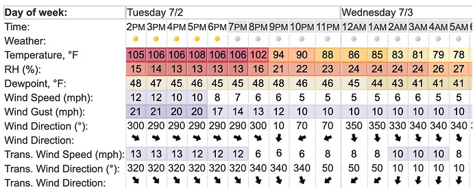
Kind of a bad setup for winds forecast for tonight, with the fire continuing to push east thru sunset with transition toward more of a northerly flow overnight that could push the fire more toward developed areas. Also, the overnight downslope winds from Feather River watershed, above, could contribute to problems on the southern flanks early tomorrow morning.
