State ID:CA
3 letter designator:BTU
Fire name:Thompson
Location:Cherokee and Thompson Flat Rd North of Oroville
Reported acres:10
Rate of spread: critical
Report on Conditions:
Structure threat: yes
Resources:
Hazards:
Weather:
Radio channels:Butte County Fire / CalFire, Chico Fire Live Audio Feed
Scanner link:
Webcam link: ALERTCalifornia - Oroville Ca St Parks
Agency Website:
250 acres per firis
IC states fire is 30 mins from Kelly Ridge area and is requesting 10 additional strike teams of engines for that area
1611 acres MROS
edited: fat thumbed it twice
Thats 1611 acres from AA
Sounds like the 3 LAT orders just got filled and T911 is inbound from MCC
operations requesting 15 strike teams any type, 10 dozers and 10 crews
Immediate need Type 1 STE leaving our county now for Kelly Ridge.
Please keep posts in this thread pertinent to the evolving incident. take q and a here
CAL FIRE IMT 6 activated for Thompson
XLC1205A enroute. STEN ARC BC105, STEN-T LVN BC, BUR E11, GLN E21, MPK E61, ALH E71, ARC E105
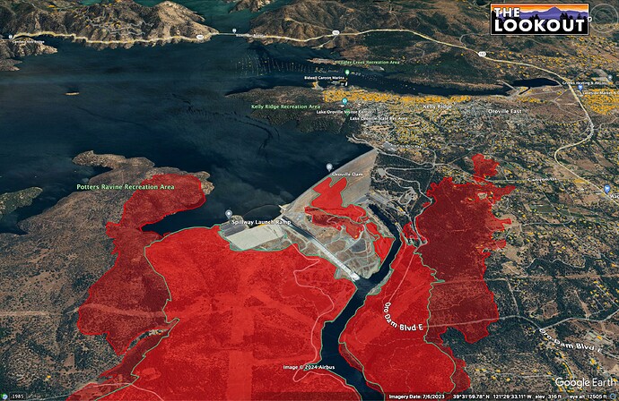
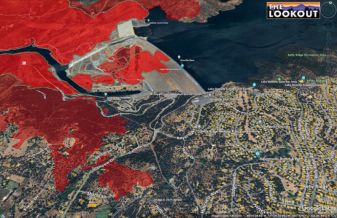
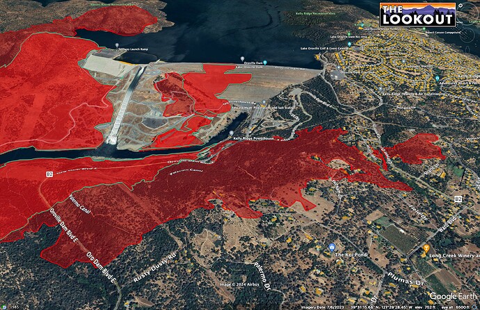
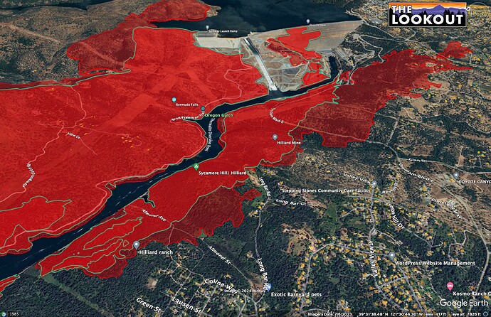
Good morning. Here is mapping for the Thompson Fire as of 11:30pm, last night. At that time, the fire had NOT gotten into Kelly Ridge or pushed south into Oroville. Green outline is fire growth since 5:30 pm (6 hours). Source: FIRIS
If you like your maps moving, here is a YouTube map tour.
Just did a quick livestream/map tour of #ThompsonFire mapping as of 11:30pm, 7/2/2024.
Extended Attack Frequencies
Command - CDF CMD7 is ordered and was being tested, (might stay on BTU CMD for another Op Period)
Air Tactics FM - 167.8125
Air/Ground - A/G8, 159.345 t192.8
AM Victors - 122.275, 118.075, 132.375
TAK data package is uploaded at http://maps.takserver.us
There is IR maps but not a kmz overlay.
The kmz on FTP is the Basin. They had the same IRIS so looks like a labeling issue.


