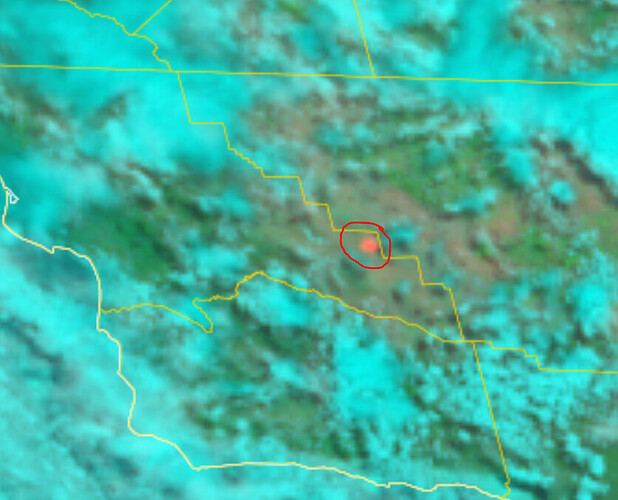
Likely new lightning start as seen on satellite:
Going to be CND hurricane
250+ acres near the Carrizo Plains.
McKittrick Summit South cam has it
859 acres, when last mapped about an hour or so ago.
Aircraft assigned: A340, A410, K5, T74, T76, T01, T12, C613, HT-0HT, HT-37S, HB-0FS, HB-9AB.
2 VLATS on order.
T-78 and T-180 diverted to KRN-white incident.
You’re right and so was T-03. They’re filling with MAFFS now.
Curious…think this is CalFire DPA. Does BLM even have any resources in the area?
The SRA map shows a very large chunk of BLM ground in that area. Might still be state DPA. FIRIS made the perimeter under a CND number.
BLM has a station in Taft somewhere or did in the past.
All BLM DPA until Kern County Line then State DPA protected by KRN. CND has a fire station in Taft.
First I’ve seen MAAFS activated this year, curious why they didn’t leave Mugu loaded. They finished their infrastructure upgrades last year if I remember right.
Probably because there is no staff to run the retardant plant including aircraft time recorder and/or air tanker base manager.
CND Hurricane extended frequencies assigned:
Air Tactics FM: 165.3625
Air/Ground: 171.0875
Rotor Vic: 125.125
Watch Duty says it’s 20,000 acres, hell of a grass fire.
Long way outside of Santa Margarita. A very long way.
50 some-odd miles, as the crow flies. There isn’t much on the Carrizo Plain that’s ‘outside’ of anything at all.
