
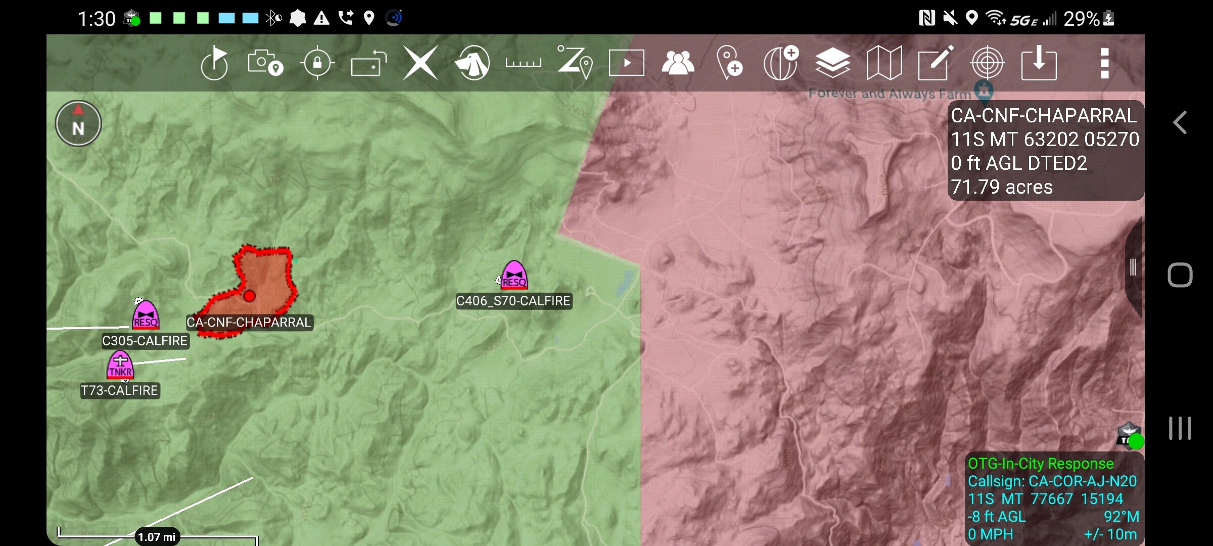
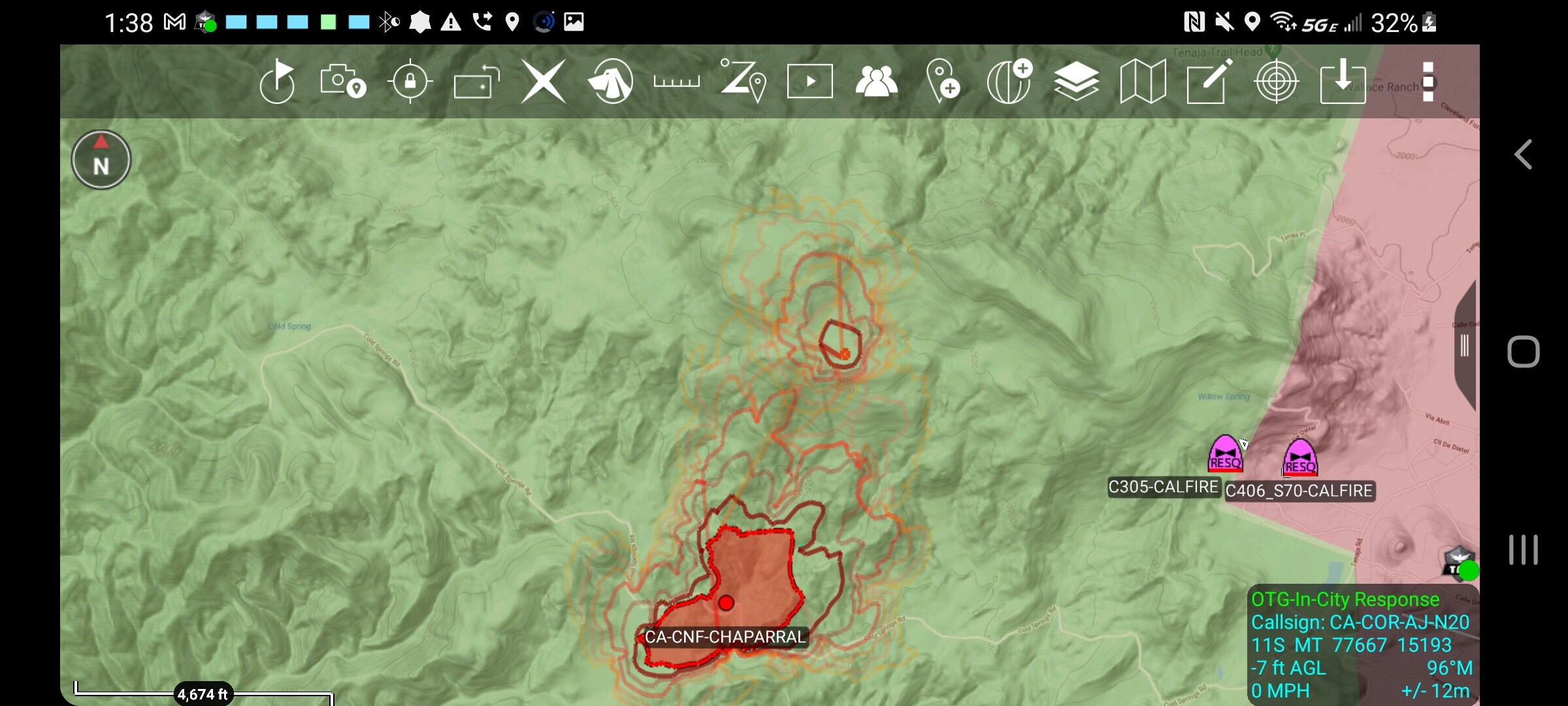
DPA MAP - Green CNF - RED is CDF FIRIS mapped at 80 acres with a spot.
8 Likes
Looks like a mixture of land ownership with CNF, RRU, and some BLM Wilderness???DOD (MCP) and MVU just South and East as well…
3 Likes
Fire area will be predominantly CNF…with the San Mateo Canyon Wilderness to the west of there. No BLM land that I know. Burning away from MCP (DOD) lands and a threat to SRA.
2 Likes

Last time it burned in that area was Walker Basin(1960’s ) or the 1993 Ortega.
Decadent Fuel bed with A LOT of houses in front in the LA Cresta Area
3 Likes
Is 406’s new firehawk flying as 301 or another ship?
Affirm, but being called 0DF. It’s at Hemet while 301 is at AMU…
3 Likes
The 1993 Ortega burned in a Santa Ana to the West. October 26, 1993.
The 1989 Ortega followed the Falls fire footprint or shall I say the Falls fire (2013) followed the June 30, 1989 footprint.
The 1989 Mateo Fire stayed within Mateo Canyon to the West and was topographically driven towards Rancho Carillo.
3 Likes
So yes, the Walker Basin Fire (I believe 1969) covered the whole La Cresta area to DeLuz…
1 Like
Wind will be dead by 7pm. Ocean breeze is what makes this area tolerable you can set your watch to it.
6 Likes

3 Likes
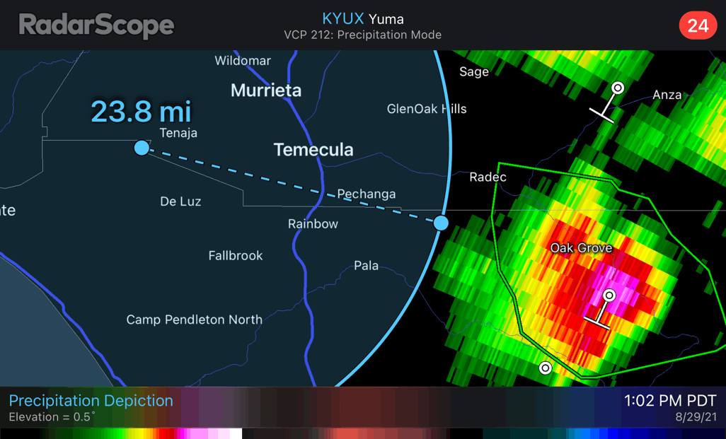
Lightning starting to show up…
7 Likes
Some very intense footage.

17 Likes
Everything is a firenado these days. The sheeting in the brush was impressive though.
4 Likes
Same location, different perspective. That hand crew wasn’t at a run quite yet, but I’d be willing to wager they had thought about it.

4 Likes
The footage starting about 5:35 is quite impressive. Look how fire 100ft downwind and downhill of that firewhirl is being drawn in.
1 Like