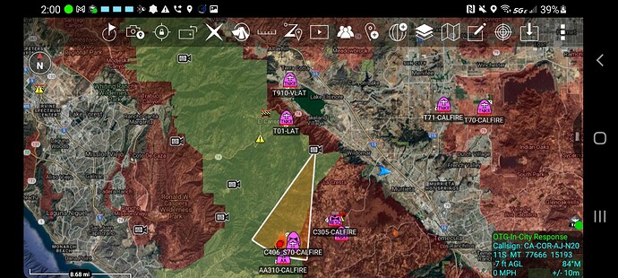
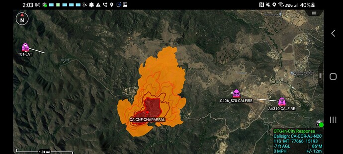
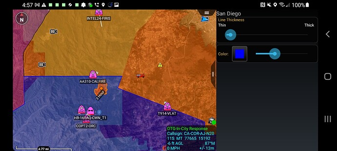
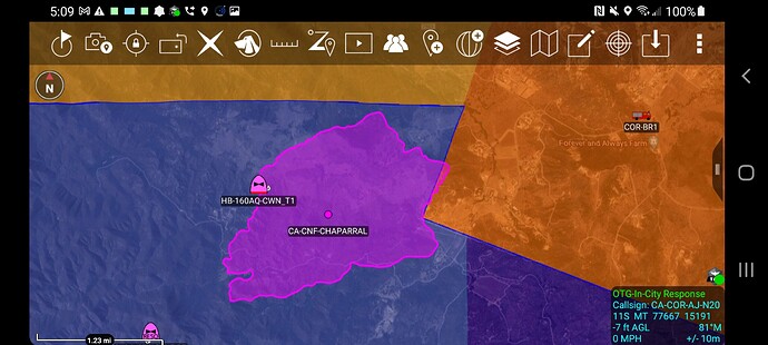
Just mapped at 72 acres.
250-300 areas, dangerous rate of spread
IC advising 250 acres with most of the fire on the CNF, MVU and 10% in RRU.
Ordering point is still going through Perris but pinging resources directly from MVU. We will keep the title as a CNF/RRU until further…Additionally, AA requested a third VLAT.
IC requested 2 DIV’s
AA requesting 3rd VLAT if available
6 crews 3 WTs FED order. Updated acreage 450-500 acres.
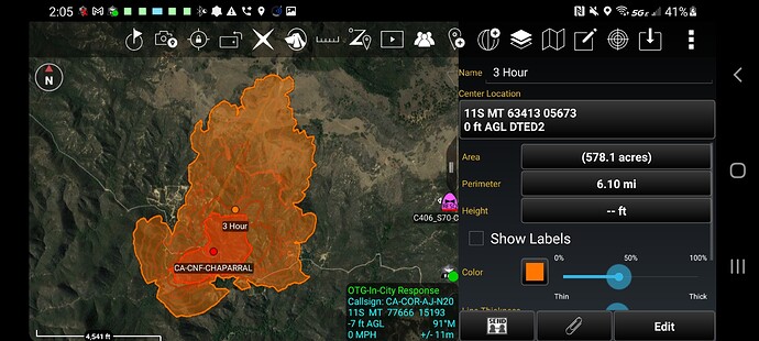
3 hour Wifire model at just under 600 acres pretty good. Would be interesting to see if we can get a new firis perimeter and compare
Updated pending
1 T1 Crew
11 Crew any type
2 DIVS
1 T3 Engine
5 T3, 4, 5, or 6 engines
3 Tactical WT any type
They must be listening they are up. New perimeter soon
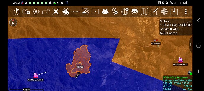
So this shot is SD County in Blue, Riverside in Orange. 3 hour model was just under 600 acres and it was entirely in San Diego county
Air attack for tomorrow is asking for 4 air tankers, 1 VLAT and 5 type 1 or type 2 copters.
County and DPA - Darker Color Orange Is SRA in Riverside and Lighter is CNF in Riverside. Light and dark in the blue applies to San Diego
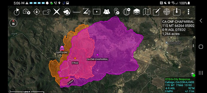
FIRIS Perimeter - 1200 acres
Orange underneath was 3 hour wifire model.
Pink is FIRIS IR Perimeter at 4 hours.
It would be great if WiFire would post their four hour prediction.
The fire is more than 100 percent larger than the 3 hour prediction in spite of a great deal of air and ground attack.
The way that these models get improved is if valid data is fed back into the simulation.
One important reason to have a model is to have a structured way to learn.
(Yes, I am indirectly involved in modelling. I confess.)
Wifire knows they are directly involved with the FIRIS program so they get this data.
Retardant all the way around the fire. Airtankers released due to nighttime. Firing operation underway near Cold Springs. Lots of open line, thick vegetation, and light down canyon winds already occurring. Air attack doubled up the retardant in some areas but would not be shocked if it chews through.

