State ID: CA
3 letter designator: CNF
Fire name: Chaparral
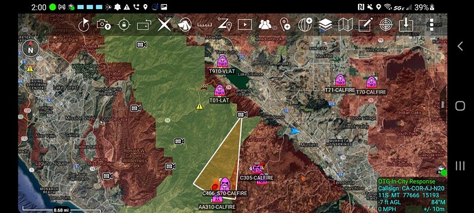
Location: Cold Springs Road x Tenaja Road; La Cresta, CA
Reported acres: 25
Rate of spread: rapid
Report on Conditions: two structures immediately threatened
Structure threat: yes
Resources: CNF, RRU, MVU
Hazards:
Weather:
Radio channels:
Scanner link: Rural San Diego County CAL FIRE and USFS Live Audio Feed
Webcam link: Mt. Elsinore 2
Rancho Carillo 1
Rancho Carillo 2
Upper Talega South
Red Mountain North
Boucher West
Minnesota Hill 1
Idyllwild 1
Santiago Peak 1
Live Video: 2021-08-28 Chaparral Fire - Evening - YouTube
Agency Website:
Scanner link: Rural San Diego County CAL FIRE and USFS
AA asking for two LATs and two VLATs
Total of 8 tankers:
(4) S2’s
(2) LATs
(2) VLATs
Just mapped at 72 acres.
250-300 areas, dangerous rate of spread
A post was merged into an existing topic: CA-CNF/RRU-Chaparral ???
IC advising 250 acres with most of the fire on the CNF, MVU and 10% in RRU.
Ordering point is still going through Perris but pinging resources directly from MVU. We will keep the title as a CNF/RRU until further…Additionally, AA requested a third VLAT.
IC requested 2 DIV’s
AA requesting 3rd VLAT if available
6 crews 3 WTs FED order. Updated acreage 450-500 acres.
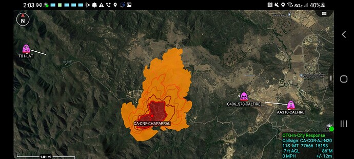
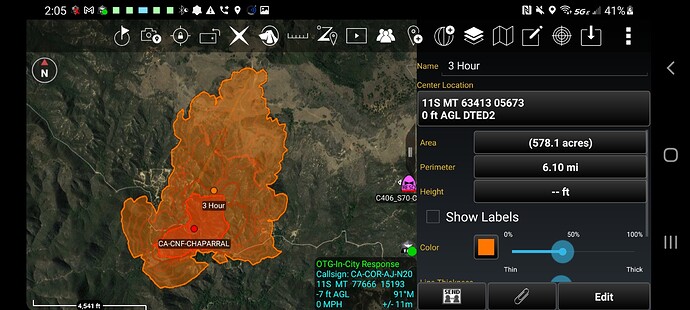
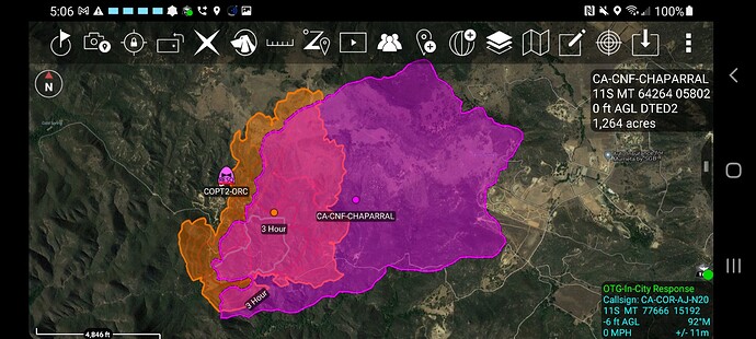
3 hour Wifire model at just under 600 acres pretty good. Would be interesting to see if we can get a new firis perimeter and compare
Updated pending
1 T1 Crew
11 Crew any type
2 DIVS
1 T3 Engine
5 T3, 4, 5, or 6 engines
3 Tactical WT any type
They must be listening they are up. New perimeter soon
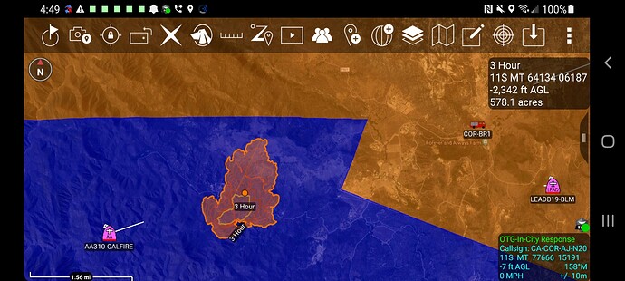
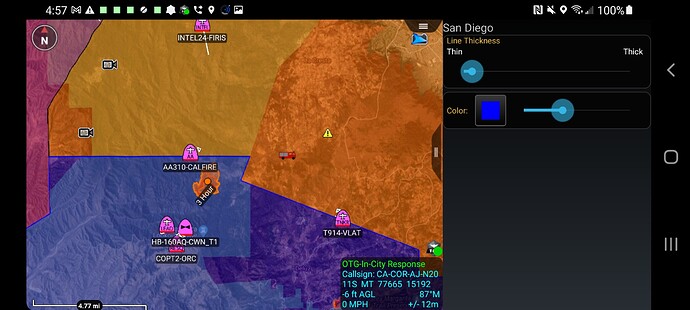
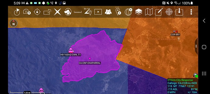
So this shot is SD County in Blue, Riverside in Orange. 3 hour model was just under 600 acres and it was entirely in San Diego county
Air attack for tomorrow is asking for 4 air tankers, 1 VLAT and 5 type 1 or type 2 copters.
County and DPA - Darker Color Orange Is SRA in Riverside and Lighter is CNF in Riverside. Light and dark in the blue applies to San Diego
FIRIS Perimeter - 1200 acres
Orange underneath was 3 hour wifire model.
Pink is FIRIS IR Perimeter at 4 hours.
