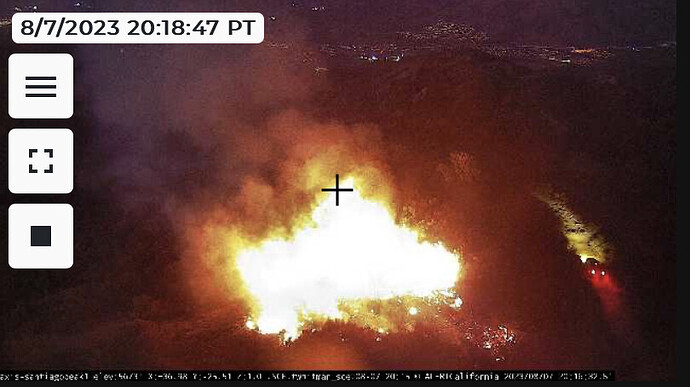
New start on Santiago Peak
I wonder if they have a good location of where the fire is?
Think that truck knows how it started?
Is someone on there way up or down in your last pic?
Exactly. It’s a long drive up there so that is not CNF or RRU.
1/2 acre, slow to moderate ROS. Potential for 10 acres. Immediate threat to the radio towers.
Maybe it’s just me but I think those five propane tanks may need a little more clearance. Need to look at them when there’s a little more light.
Fire mapped at 1.6 acres.
Commitment time approx. 3-4 hrs according to IC
Just curious if word on the cause of this fire. Also about the vehicle anvilhead screen shot in the back ground of the fire starting up on the road. Now looking at this in the daytime I would do some Weed Abatement around those propane tanks.
Looks like more than one up there prior to event… I would hope there is better cameras keeping an eye on all the important Communication infrastructure.( better resolution ). I know some power stations and large distribution power spots have great cameras due to high target hazards.
Santiago is a really really busy site with a mix of commerical and public safety. If they wanted to set some or part of it on fire they did a pretty poor job. Possible those are engineers visiting one of the commerical shelters.
And sure, the AWF stuff isn’t the highest res out there but consider a lot of these are on cell modems or microwave backhaul (and do not have traffic or bandwidth priority). And, they’re free… Can’t beat that.
The brush spontaneously combusted?
You guys seem to know the roads up there. Is there no lock gate to prevent entry?
https://www.instagram.com/reel/CvsoZ1zLdOE/?igshid=MzRlODBiNWFlZA==
Coulson has some cool IR video of them doing night drops from the chinook.
Pretty impressive and scary with the proximity to those towers.
There is some public access.from the south Side ie Main Division Road off Ortega Hwy, but the Corona (East side) access is locked.
