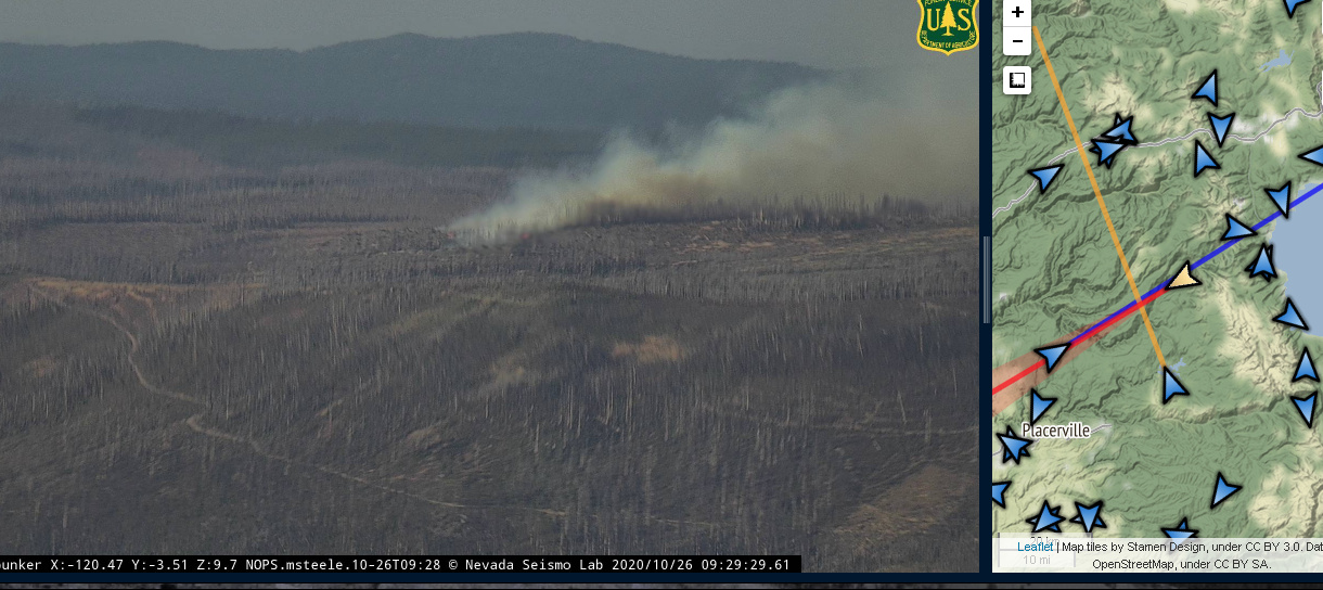
Fire showing roughly between Placerville and north shore of Lake Tahoe
http://www.alertwildfire.org/tahoe/index.html?camera=Axis-BaldCA&v=7a7f1a7
http://www.alertwildfire.org/tahoe/index.html?camera=Axis-BigHill&v=7a7f1a7
Fire showing roughly between Placerville and north shore of Lake Tahoe
http://www.alertwildfire.org/tahoe/index.html?camera=Axis-BaldCA&v=7a7f1a7
http://www.alertwildfire.org/tahoe/index.html?camera=Axis-BigHill&v=7a7f1a7
Using the cameras, this is southwest of Hellhole Res., west of the Rubicon River, north of Eleven Pines Rd. above Pollock Pines quite a ways. This should be on the ENF. I believe this was the north end of the King fire, but its been a few years…
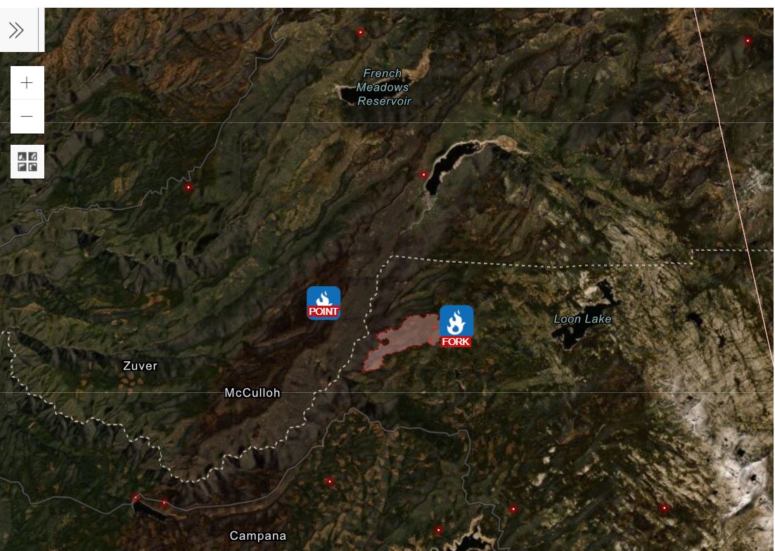
Nevada Point Ridge Road…20 acres with spots.
Reading on FB, this is some slash piles from a clearing project
Incident name “Point”, off of Nevada Point Ridge Rd and 11 Pines Rd. Units just arriving on scene
BALD MTN LOC (BDMC1) Severity:50
| TIME | RH | WIND | TEMP | FUEL |
|---|---|---|---|---|
| 06:36AM | 9% | ENE7G29mph | 42 | 7 |
| 05:36AM | 8% | ENE8G30mph | 42 | 7 |
| 04:36AM | 9% | ENE10G28mph | 41 | 7 |
| 03:36AM | 11% | ENE6G33mph | 40 |
Scoopers and Type 1 copter from Truckee ordered by Point Air Attack
Air assets may not be feasible due to deteriorating wind conditions
Couple WX stations in the area, both are ridgetop and fire seems to be midslope?:
PGE Wallace Peak (just NE and above incident on Nevada Point Ridge Road) 37F 23RH NE15G26
RAWS Hell Hole (just NE of PGE Wallace WX, above Hell Hole Reservoir) ENE 38G59
Looks like it is in a footprint of a previous fire?
triangulating . Big Hill , Bald Mountain with the camera from Bunker Hill
The winds look to be surfacing, unlike an hour ago.
Oldcdfguy. Looks like it’s possibly in the 2014 King fire burn scar
Believe this should be at the northern end of the King Fire scar
I agree this is in the burn scare of the King Fire.
However, the King Fire ran a lot further north than the location of this fire. North Tahoe Ski Areas activated their snow making guns as it continued to run north altho it (fortunately) didn’t get to them.
http://www.alertwildfire.org/tahoe/index.html?camera=Axis-Bunker&v=7a7f1a7
Looks to be picking up in the Bunker Hill cam