State ID: CA
3 letter designator: ENF
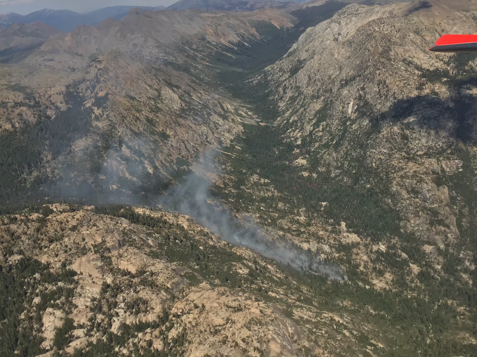
Fire name: Summit
Location: Area of Silver Lake off Highway 88 adjacent to Kirkwood Ski Resort
Reported acres: UNK
Rate of spread: UNK
Report on Conditions:
Structure threat: None
Resources:
Hazards:
Weather:
Radio channels:
Scanner link:
Webcam link:
Agency Website:
New start on the El Dorado National Forest. Limited information available. Heard that crews were to be helicopter shuttled in to the fire. IC requested an Air Attack and additional Type 1 helicopter for a total of 2 Type 1 rotary wing ships. Ground resources also bringing a UTV to the incident for transportation.
Quick A/C update: 3rd and 4th T-1 helicopters on order. IC also ordered a load of jumpers. Crew shuttle mentioned earlier was moved from Lumberyard to the Pacific Helibase and is in progress.
That’s technically one crew, both are ten man fuels crews. Nothing against them they are normally very strong capable crews. Sounds like they’ll need a few more boots on the ground tho, especially with the fire behavior we’re already seeing
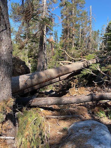
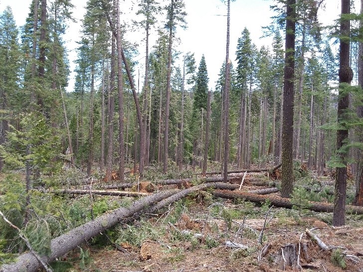
Driving up Hwy 88 above the turn of to Bear River Reservoir. The was one heck of a lot of blow down from there to Cason Pass. And what was not blown down was snap in half. Just a phenomenal amount of blow down. I know they get big wind there but that must of been something else.
Jumpers on the fire in addition to crews flown in earlier. Sounds like this fire is giving them some difficulty. Air Attack requested a TFR for tomorrow and all aircraft are held on assignment. Interesting is that this TFR bumps up against the Tamarack TFR so the fires are in close proximity.
A few months ago, iirc, they had 100+ Mph wind event. Riding dirt bike on Pardoes trail must have seen over 100 trees in less than 5 miles all uprooted or snapped off. 24-40” trees.
True, approximately 20 miles along 88 on both sides of the road there are trees down or damaged now. Some areas look to be nearly a 3rd of the standing trees were damaged or up-rooted. A large section of the damage was through an area where the forest was thinned the last few years to establish a defensible area.
These photo’s are off the El Dorado USFS site, credits to them
The big wind storm was in January 2021 on the Monday night of MLK day. Huge trees down, not sure that completely applies to the drainage where the Summit Fire is burning.
very dangerous terrain, gotta keep them in our prayers. Live about 60 miles south and can see it from my house had no idea it was another start until now. Thought it was Tamarack. This is really not good.
EldoradoNF - Summit Fire is 20% contained. Extensive air support is helping hand crews make progress building fireline in steep terrain. The fire is in the Mokelumne Wilderness, 3 miles south of Kirkwood, CA.
Looks like a good old fashioned ground and pound fire with an adequate resource spread air and ground, the fact that they could find a IHC is amazing, someone is looking out…I hope they pick up and no injuries…Peace…