State ID:CA
3 letter designator: FKU
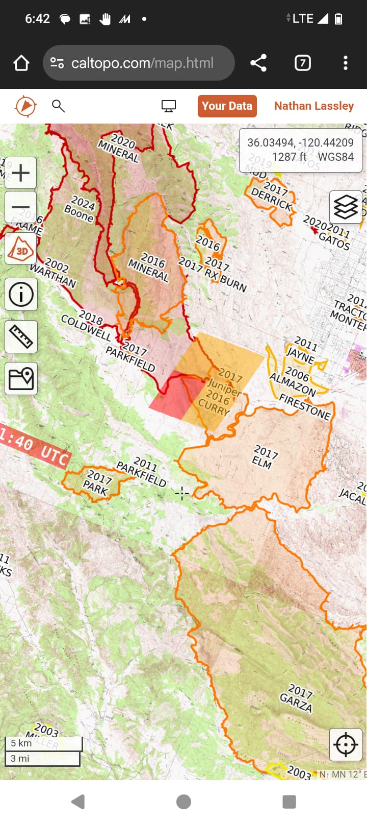
Fire name:mFIRESTONE
Location: Highway 198 East of Curry Mt. Trailhead
Reported acres: 15 Acres
Rate of spread: Critical
Report on Conditions: 15 acres with a critical rate of spread and a potential for 5,000 acres. On the south side of Hwy 198 . Shut down Hwy198 between Hwy 25 and Firestone
Structure threat:SO for Evacuations along Hwy 198 up to Mineral Springs Rd
Resources: High dispatch
Hazards:
Weather:
Radio channels:
Scanner link:
Webcam link:
Agency Website:
3 Likes
Showing on Joaquin Ridge and Parkfield cams
1 Like
2 Likes
Aircraft enroute.
High Tension Power lines along hwy198.
Request SO for evacuations.
FKU Local 1-151.385 and AirTactics 4- 151.28
3 Likes
1 Like
3 Likes
AA - 50 acres rapid rate of spread potential for 300 in light fuels. Terrain driven.
2 Likes
This area is big fire country and will probably go up and over Curry Mt. The last large fire in the area was the Elm Fire and it burned from the river south of highway 198 all the way South to Jacalitos Creek.
6 Likes
I’ll pm you.
3 Likes
Ugly nasty country
Bring in lots of dozers
7 Likes
Fires established on Curry mountain will likely run to the top of the mountain.
3 Likes
10 type 3s 5 type 1s, 10 dozers, 6 water tenders 4 heavy equipment bosses immediate need.
3 Likes
AA- 2 Additional type 1 tankers 3 type 3 tankers for a total of 8 tankers
1 night helco and 2 night helicopters.
Edit maxed out: 350 acres load and hold aircraft until a replacement AA is up over the incident
4 Likes
AA505 is over the fire now.
3 Likes
The Scanner is pretty quiet and not much heat is being picked up on satellite.
3 Likes
It’s been backing off a ridge for a little bit but sounds like they’re expecting it to rollout. Fires trying to chew through the retardant
7 Likes
482 acres 25% contained
2 Likes
copter 34VG blackhawk only aircraft working the fire this morning.
Lines holding and not much smoke showing. Good work !
7 Likes
AA340 spent a little time with 34vg to knock out a flareup this afternoon.
5 Likes