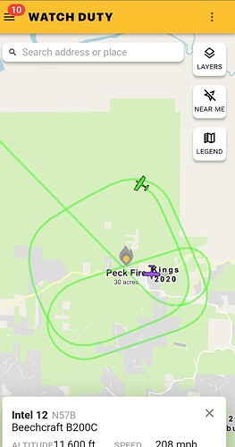
State ID: CA
3 letter designator: FKU
Fire name: PECK
Location: PECK LANE X HWY 180, SQUAW VALLEY
Reported acres: 20
Rate of spread: DROS
Report on Conditions: 20 acres, North side of 180, structure threat. Potential for 100 acres
Structure threat: yes
Resources:
Hazards:
Weather:
Radio channels: FKU LOC 1
Scanner link:
Webcam link:ALERTCalifornia - McKenzie Ridge
ALERTCalifornia - Bear Clover 1
Agency Website:
Per air attack heal is looking good still at 20 acres and they should be able to hold the head of the fire at a road I wasn’t able to catch the name of it.
Hopewell road.
Thank you for clarifying that.
Resources have the right flank tied in, aircraft making good progress on the head
30 acres, forward progress stopped, dozer line almost all the way around.
any one know how close to hopewell rd it is?
they were staging at Hopewell and 180 and had crews taking a stand one Hopewell. SO notified residents of voluntary evacs.
thanks, my grandma lives over there, last i got was my cousin was there to evac but cell service got spotty
12.61 acres per Intel12
hose lay all the way around the fire, releases some crews, remainder will be working through the night

