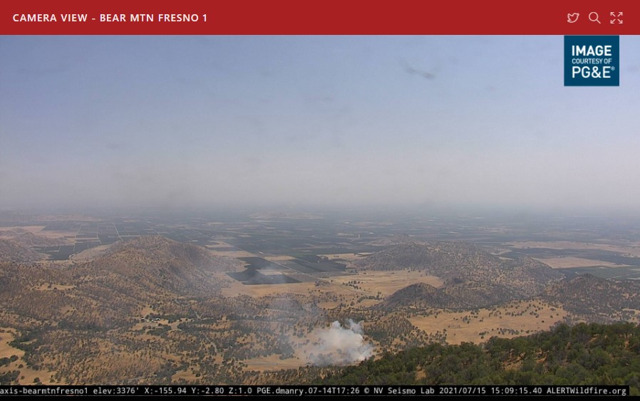
New smoke just popped up (2 roadside smokes actually) @ 15:06 on the Bear Mountain Cam
Axis-BearMtnFresno1 | Sierra & Foothills | Regions | ALERT Wildfire
Any intel on this?
Looks to be on 180 just west of 63
New smoke just popped up (2 roadside smokes actually) @ 15:06 on the Bear Mountain Cam
Axis-BearMtnFresno1 | Sierra & Foothills | Regions | ALERT Wildfire
Any intel on this?
Looks to be on 180 just west of 63
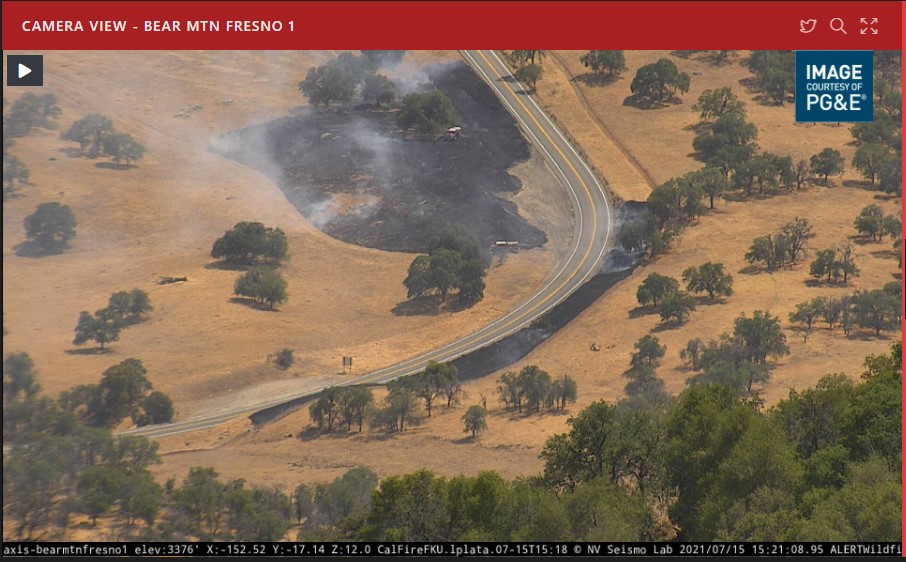
CHP has it as 180 and 63. Their RP stating both sides of the road.
Zoom in on the cam shows two state engines on scene. Looks like they picked it up.
Copy that, the handline on the fence line held it in check.
The 180 “rat trail” that Miramonte works on every year has stopped more fires than not…runs from cove road almost all the way to hopewell.
Heck yes, it’s a great tool and good training for the crews. We used to do that in Owens Valley and here in TCU when I ran crew. Kudos to those crews from Miramonte.
Most likely cow trails
The fire on the north side of the highway (right side of road in pic) is the Miramonte Rat trail. The trail is about 10 feet of weedeating and a 4-6 ft scrape. It goes fro Cove Rd at the bottom of the hill at the valley floor to Bear Mtn Rd in Squaw Valley about 7 miles away. On good years they also complete or get a portion done from Elwood to Hopewell Rd near Dunlap an additional 4 miles. Great tool to keep roadside fires from instantly climbing the steep northside of Hwy 180, the main traffic route to Sequoia and Kings Canyon NP.
Goes almost to Hopewell this year
You are correct on the north side of 180
Those would be some well organized cows
" Your Killing me Smalls"