State ID:CA
3 letter designator:HIA
Fire name:Mill Creek 1
Location:Mill Creek area of the Hoopa Reservation
Reported acres:1000
Rate of spread:Unknown
Report on Conditions:
Structure threat: Currently, Low. The fire is moving toward the community of Hoopa.
Resources:Hoopa Fire Department and Office of Emergency Services, CalFire, CHP, Humboldt Co SO, BIA
Hazards: Steep terrain, road closures
Weather:Current: 82 degrees, Winds East at 7, RH 35%
Radio channels:
Scanner link:
Webcam link:
Agency Website:Hoopa-nsn.gov Current info is on Facebook
From Hoopa Fire Department and Office of Emergency Services:
Mill Creek 1 Fire Update, 1600, 08/19/18
Due to Hwy 96 Bull Creek to Hwy 96 Mill Creek fully closing today, north of Hoopa, we would like to announce that Dowd Road is an alternate route for traffic and currently has no restrictions on it. We anticipate the Mill Creek 1 Fire expanding towards Highway 96 later this evening. Therefore, we advise people to take alternative routes, if possible.
No evacuation orders are currently in effect nor are there any structural damage caused by the Mill Creek 1 Fire at this time. Road closures continue on Big Hill, Mill Creek, and Deer Horn.
For more information, please call the Hoopa Fire Department and Office of Emergency Services main line at 530-625-4366. In addition, information is relayed to the Two Rivers Tribune, the KIDE radio station, local sandwich boards, the Hoopa Fire Department and Office of Emergency Services Facebook page, and various crucial news outlets.
08/20/18
Team 6 in place.
1500 ac
5% contained
From local news:
The Mill Creek Fire continues to push towards Hwy 96. Evacuation advisories are in place for the Norton and Mill Creek areas, according to the Northern California Geographic Coordination Center. They also say the fire is now 1,500 acres and only 5% contained.
From Hoopa FD
FIRE UPDATE – Great Basin Team 6 assumed command of the Mill Creek 1 Fire today, August 20, 2018 at 6:00 a.m., led by Incident Commander Brook Chadwick. The Incident Management Team is comprised of individuals from several agencies working within the Great Basin (Idaho, Nevada, Utah & Wyoming). This is a full-suppression fire and the objective is 100% containment. The top priority for the Incident Management Team is the safety of fire personnel and the public. The Incident Command Post (ICP) is located at the Hoopa Fire Department, Hoopa, California.
Our objective is to keep the fire East of Highway 96, west of the Reservation boundary, north of Mill Creek and south of Deerhorn Creek. Resources are being ordered to assist with the suppression of the fire. Currently we are in a National Preparedness Level 5, mobilization of fire resources is heavily committed to numerous large fires throughout the country.
California State Highway 96 is closed from Bull Creek to Mill Creek due to fire behavior. Traffic is being redirected through Dowd Road. This is for the safety of the public as well as for crews and aerial resources working on the fire.
Here’s the latest from Hoopa Valley Fire.
The Mill Creek 1 Fire started on August 16, 2018 on Tribal lands near the town of Hoopa, California. The cause of the fire is ARSON. There is a $10,000 reward offered for information regarding the fire. Calls will be taken on an anonymous hotline by calling 1-800-468-4402.
It came up on Inciweb this morning:
Date of Detection: August 16, 2018
Current Size: 1,500 acres
Location: Mill Creek North of Hoopa California, Hoopa Indian Reservation
Legal Description: Latitude: 41ᵒ 8’ 24” Longitude: 123ᵒ 39’ 36”
Cause: Arson
Containment: 5%
Resources on Fire: There are currently 272 personnel on this incident
Great Basin Team 6 assumed command of the Mill Creek 1 Fire today August 20, 2018.
There will be a Community Meeting on August 21, 2018 at 6:00 p.m. (location to be determined). The location, once chosen, will be posted on the Hoopa Valley Facebook Page
FIRE UPDATE – Great Basin Team 6 assumed command of the Mill Creek 1 Fire today, August 20, 2018 at 6:00 a.m., led by Incident Commander Brook Chadwick. The Incident Management Team is comprised of individuals from several agencies working within the Great Basin (Idaho, Nevada, Utah & Wyoming). This is a full-suppression fire and the objective is 100% containment. The top priority for the Incident Management Team is the safety of fire personnel and the public. The Incident Command Post (ICP) is located at the Hoopa Fire Department, Hoopa, California.
Our objective is to keep the fire East of Highway 96, west of the Reservation boundary, north of Mill Creek and south of Deerhorn Creek. Resources are being ordered to assist with the suppression of the fire. Currently we are in a National Preparedness Level 5, mobilization of fire resources is heavily committed to numerous large fires throughout the country.
California State Highway 96 is closed from Bull Creek to Mill Creek due to fire behavior. Traffic is being redirected through Dowd Road. This is for the safety of the public as well as for crews and aerial resources working on the fire. As soon as it is safe for public travel the highway will be reopened.
BACKGROUND - The Mill Creek 1 Fire started on August 16, 2018 on Tribal lands near the town of Hoopa, California. The cause of the fire is ARSON. There is a $10,000 reward offered for information regarding the fire. Calls will be taken on an anonymous hotline by calling 1-800-468-4402.
FOR MORE INFORMATION: For additional fire information, please get the latest fire updates on the Hoopa Valley Tribe Facebook Page at: https://www.facebook.com/HoopaTribe/
lostcoastoutpost.com and kymkemp.com have local news info
Tough company fire is responding to a request for mutual aid. See you in the AM
Not a lot of updated info coming out, but this was posted on Redheaded Blackbelt (kymkemp.com). This information is from the Hoopa Valley Tribe. Acreage indicated is an estimate.
The Mill Creek Fire is burning around 1500 acres and is now 26% contained. According to the Incident Management Team,
The fire was active last night, especially at the higher elevations. Crews working on the fire continued to improve lines and work on hot-spots within the fire perimeter. Today resources will continue direct attack on the northeast flank of the fire. A structure protection group is being developed to assist the community, if needed. Holding the fire in-place continues along the southwest corner, along Mill Creek Road and down to Highway 96. Due to a National Preparedness Level 5 we continue to request additional crews and other resources to assist with fire suppression…
There is a Temporary Flight Restriction (TFR) in place for the fire area and the Hoopa Airport is closed to traffic except aerial resources working on the fire.
Roads:
Hwy 96 continues to be closed from Bull Creek to Mill Creek while traffic is being detoured onto Dowd Road.
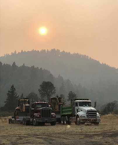
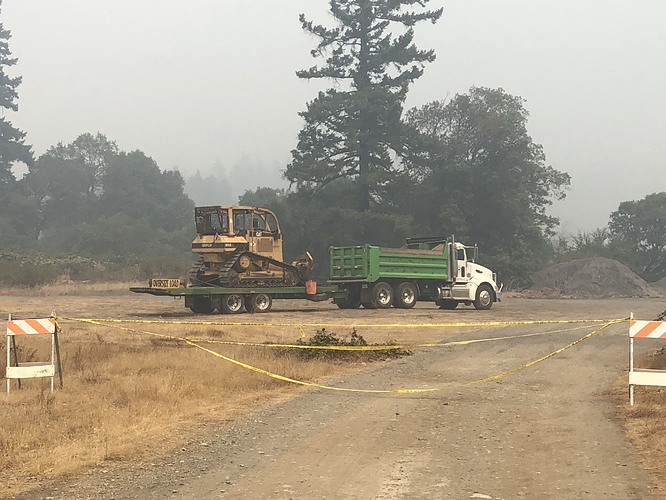
Were on incident now. Camp is coming together. Tent city is almost built. There are 3 of us dozers still staged on transports.
Strike team 2252A from SFR arrived today.
I haven’t seen an update this morning. This is from Inciweb, yesterday evening.
Total Personnel 248
Size 2,162 Acres
Percent of Perimeter Contained 26%
Estimated Containment Date Wednesday September 05th, 2018 approx. 12:00 AM
Fuels Involved
Chaparral (6 feet),
Timber (grass and understory),
Tall Grass (2.5 feet)
Scott & Reinhardt 40 Fuel Models SH1, TU5, TL9 and GR4 correspond better with the fuels available with the various stages of tree regeneration on the landscape.
Significant Events
Moderate, Flanking, Backing and Uphill Runs.
Growth was mostly backing, flanking, and isolated line reinforcing burnouts. Conditions in the afternoon prompted short runs and isolated torching. Perimeter fire and interior burnout exhibited generally low to moderate spread rates and flame lengths.
Structural Protection resources are being put in place.
Hwy 96 is still closed. CalTrans:
IS CLOSED FROM 2.8 MI EAST OF HOOPA TO 0.3 MI WEST OF THE SOUTH JCT OF SR 169 (HUMBOLDT CO) - DUE TO A WILDFIRE - MOTORISTS ARE ADVISED TO USE AN ALTERNATE ROUTE
No IR mapping is available, reported mechanical issues.
Getting some good ground today. Fav RH good over night recovery’s
. We even had a local stray adopt usHoopa dogs love when ICP is in town!
That’s Hoopa!
Here is this morning’s update:
August 24, 2018
Date of Detection: August 16, 2018
Current Size: 2,921 acres
Location: Mill Creek North of Hoopa California, Hoopa Indian Reservation
Legal Description: Latitude: 41ᵒ 8’ 24” Longitude: 123ᵒ 39’ 36”
Cause: Arson
Containment: 42%
Resources on Fire: There are currently 370 personnel on this incident
Crews: 7, Helicopters: 3, Engines: 17, Dozers: 6
FIRE UPDATE: Air quality in Hoopa Valley continues to be poor. Air quality measurements measured Unhealthy (Red) to very Unhealthy (purple). These levels affect not only smoke sensitive people but also the rest of the population. Unhealthy or worse air quality is expected to continue until the Mill Creek 1 Fire stops actively growing. Peak impacts occur around midday when the air has been as high as Hazardous for a number of hours. You can find a detailed description of the Air Quality Index at this site: wildlandfiresmoke.net/outlooks/HoopaValley-EurekaArea .
HIGHWAY 96: California State Highway 96 is closed from Bull Creek to Mill Creek due to fire behavior. Traffic is being redirected through Dowd Road. This is for the safety of the public as well as for crews and aerial resources working on the fire. However, if fire conditions permit, and it is safe to do so, an opportunity for the public to drive Highway 96, through the Mill Creek 1 Fire Road Closure has been established. Interagency co-operators are going to provide three openings daily, one in each direction at the designated time. Timeframes: 7:00 a.m. 12:00 (noon) and 6:00 p.m. A pilot car will escort travelers through the fire area. Please, be on time or you will miss the opportunity. Public safety is our priority. If there is an increase in fire activity or a possibility of falling / rolling debris dangers, travel through may be delayed or cancelled. As soon as it is safe for public travel the highway will be reopened.
OPERATIONS: Today on the fire, firefighters will continue to patrol and secure the southern flank and the Highway 96 corridor. Crews will construct direct fireline and conduct firing operations on the northeast corner of the fire to prevent further spread east of Mill Creek Road. Resources will continue to mop-up and secure completed line as conditions allow. Crews will prepare for future firing operations that will allow containment of the fire south of Deerhorn Road. A priority on the northeast flank is to prevent further impacts to the timber management areas.
Attention - The Mill Creek 1 Fire was caused by arson on Tribal lands near Hoopa, California. There is a $10,000 reward offered for information regarding the fire. Calls will be taken on an anonymous hotline by calling 1-800-468-4402.
FOR MORE INFORMATION: Get the latest fire updates on the Hoopa Fire Department and Office of Emergency Services Facebook Page at: https://www.facebook.com/HoopaOES/ or check fire updates for Mill Creek 1, and throughout the country on Inciweb at: https://inciweb.nwcg.gov/incident/6161/
Inciweb:
Current Situation
Total Personnel 364
Size 3,211 Acres
Percent of Perimeter Contained 43%
Estimated Containment Date Wednesday September 05th, 2018 approx. 12:00 AM
Fuels Involved
Chaparral (6 feet),
Timber (grass and understory),
Tall Grass (2.5 feet)
Scott & Reinhardt 40 Fuel Models SH1, TU5, TL9 and GR4 correspond better with the fuels available with the various stages of tree regeneration on the landscape.
Significant Events
Moderate, Flanking, Backing and Short-range Spotting.
A spot fire yesterday afternoon produced about 100 acres of growth. Overnight growth was mostly backing, flanking, and isolated line reinforcing burnouts. Perimeter fire and interior burnout exhibited generally low spread rates and flame lengths. Conditions through the night prompted occasional short runs, accompanied by short-range spotting.
The coastal morning weather has a light W/NW breeze and clear sky. Hopefully, this’ll mean better air in Hoopa and better flight conditions. Having flown in that valley, it can get kinda hairy.
Local news is putting out air quality advisories for Hoopa and areas northwest of the valley. See the bottom of this update.
Inciweb:
Mill Creek 1 Fire Update
Contact Fire Information: 530-618-2844 Hours: 7 a.m. - 8 p.m.
August 26, 2018
Current Size: 3,599 acres
Cause: Arson
Containment: 54%
Resources on Fire: There are currently 507 personnel on this incident
Crews: 12, Helicopters: 3, Engines: 20, Dozers: 6
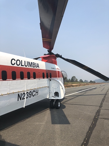
FIRE UPDATE - OPERATIONS: Yesterday, the smoke finally lifted away from the fire. Aerial resources, including multiple helicopters and air tankers took advantage of clear skies and flew to suppress the fire. We now have a Type 1, Type 2 and Type 3 (Heavy, Medium and Light) helicopters assisting firefighters with water bucket and retardant drops. Numerous crews will continue to monitor the south and southwest areas of the fire ensuring that any hot spots are put out that could possibly threaten the line. Throughout the north and northeast sections crews and engines will continue to mop-up and increase the width of containment lines. Firefighters plan to complete firing operations along the 603 Road on the northeast corner of the fire. All fireline construction is being utilized to prevent any further impacts to timber management areas.
HIGHWAY 96: California State Highway 96 is closed from Bull Creek to Mill Creek due to fire behavior. Traffic is being redirected through Dowd Road. Firefighter andpublic safetyis our number one concern. Highway 96 is a main thoroughfare connecting the rural communities of northern California. When it is safe to do so, the highway accepts limited travel provided by a pilot car at 7:00 a.m. 12:00 (noon) and 6:00 p.m. Late yesterday, a large tree fell across the road and hit the power line on Highway 96. The electrical line was not damaged but a large amount of debris fell into the road. It was deemed too hazardous for the 6 p.m. opening. However, the road was cleared by 7 p.m. of the hazard. Vehicles already lined up were able to travel through the highway again with the pilot car escort.
WEATHER: Afternoon temperatures in the 80s and relative humidity dropping to around 30%. Typical up canyon winds will develop at the lower elevations with west to northwest winds at the higher elevations.
Air Quality: Hoopa Valley continues to be poor. Air quality measurements measured Unhealthy (Red) to very Unhealthy (purple). Unhealthy or worse air quality is expected to continue until the Mill Creek 1 Fire stops actively growing. You can find a descriptions of the Air Quality Index at this site: wildlandfiresmoke.net/outlooks/HoopaValley-EurekaArea .


