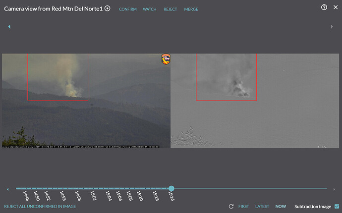
Tanker 94, AA120 enroute to fire on
Red MTN CAM
Pecwan Fire.
T96 and T95 also look like they are up there.
Not much info but toning out additional resources
- Helitanker 93HT and kmax 5RA
T91 out of Ukiah also
We caught the fire when smoke peeked over the hill at 13:57.
Below the fire picture is the situation now at 1516.
Looks like T210 from MCC enroute
Think this is probably SRF, not HUU.
Will be State DPA, HUU. The entire Klamath river canyon in that part of Humbolt county is SRA.
Remote, narrow roads, heavily forested, and not a lot of previous fire activity in the area. There has been a bit of prescribed fire in this area.
Watching the Timelapse and judging by the smoke column it doesn’t appear to have grown very much over the last hour
Looking at the RAWS, they have been getting good recovery at night (90s). Should be able to wrap it up. But I’ve learned to expect anything up in the Klamath.
#PecwanFire As per BLM California Wildfire Dashboard (Public) the fire is at 7 acres. ArcGIS Dashboards
You mention RH recovery. Not familiar with that area…do they get a marine fog layer at night?
Definitely get a coastal influence. Not sure how far the marine layer gets in that exact area. My info was from some of RAWS data the past few days
Someone on this site mentioned that the marine layer follows the Klamath up as far as Happy Camp. I don’t have personal experience, just what I read here.


