CA-INF-Pizona??

https://www.wildwebe.net/incidents?dc_Name=CAOVCC

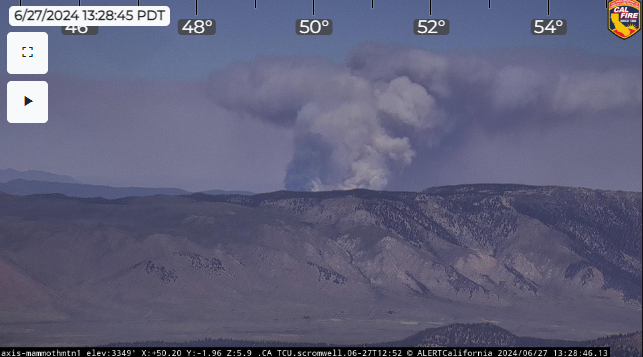
Unit ID is CA-INF regardless of which side of the border it is on, the INF crosses into Nevada there. That is a remote area, between Montgomery Pass and 120. I think there used to be a casino and hotel just over the state line, long abandoned, on highway 6. Other than that, not much out there.

4 Likes

Fire appears to be in NV, but administered by the INF and in South Ops.

6 Likes

It might be a weird technical quibble, but that land is part of the INF (within the co gressional boundary), not just administered by it. Administered by would be if it was part of another forest, but the Inyo managed it. An example would the the Ukonom district of the KNF that is administered by the SRF. The GACC boundary crosses into Nevada there, just like GBCC crosses into Bridgeport and Markleeville.

Anyway, about the incident, I don’t ever remember seeing large fire in that area.

5 Likes

100-150 acres potential for a few thousand

5 Likes

Benton RAWS: Benton California
TV Hill Camera: ALERT Wildfire
Mohawk Esmeralda Camera: ALERT Wildfire

2 Likes

It’s an INF fire just like much of 395 from Alpine County south to the Mono County line is NV HTF and the NW corner of Nevada is CA MDF it’s fed ground and state borders don’t matter

8 Likes

Why is it not showing up on Cal Fire or Federal Inciweb?

I can only find it on Google Maps and they are reporting acres from NCIF…however, I can’t find that info on NIFC or Incidweb. Google Maps is reporting 300 acres.

2 Likes

It started this afternoon, is still in the initial attack phase, and is very remote, so it is likely that no one has had time to post on inciweb yet.

It is listed on the OSCC News and Notes page: Team Rotations

3 Likes

I may have to correct myself here. I think there is a piece of the HTF administered by the INF up there, and the fire might be on that. There is also some INF that does extend into Nevada. I don’t have the right map in front of me to confirm either way. Regardless, it is a CA-INF incident.

2 Likes

Thank you! We live in Benton; about 11 miles from fire. We can see smoke movement just above the fire zone.

2 Likes

It looks like the wind is pushing it away from your area right now.

2 Likes

I agree - smoke has been going East.

2 Likes

There is a post about the fire on the Inyo National Forest’s Facebook: https://m.facebook.com/story.php?story_fbid=pfbid0k1jtvsKKU8zXBD9shRn9oFQMbsGn2uEcXgoLG41Npu5cVDHB5afhS3o9mowr7LpBl&id=100064648453714&mibextid=Nif5oz

Watch Duty also has it:
Pizona Fire @ 1.75 Miles North of McBride Springs, Inyo National Forest - #PizonaFire https://share.watchduty.org/i/23351

3 Likes
4 Likes

Looking for updates!? Fire is 42 miles from us now. Had lots of smoke earlier…wind shifted…getting clearer

2 Likes

Last update fire was 325 acres as of this morning.

3 Likes

As I’m approaching the Sherwin Grade, looking like it might be an active day for the folks assigned.

6 Likes

TV Hill cam has good view of the fire. Winds getting on it, definitely picked up activity in last hour
https://ops.alertcalifornia.org/cam-console/12233

4 Likes

Looks like T-82 & 83 from Columbia are headed to this fire.

3 Likes

Looking from Mammoth Mt cam it’s looking pretty active right now.
https://ops.alertcalifornia.org/cam-console/2723
ScreenHunter 988

5 Likes