Estimated/ mapped at about 70 acres
Willl be back with links and better location
Edit: looks to be off South Russian Road X John Meadows road
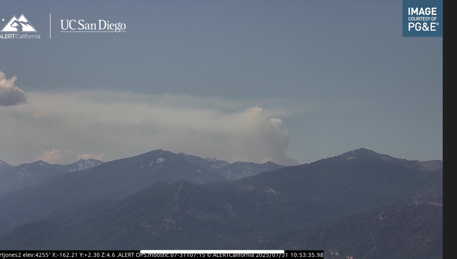
Cam links: ALERTWest - Hayfork Bally Lookout 1 ALERTWest - Fort Jones 2
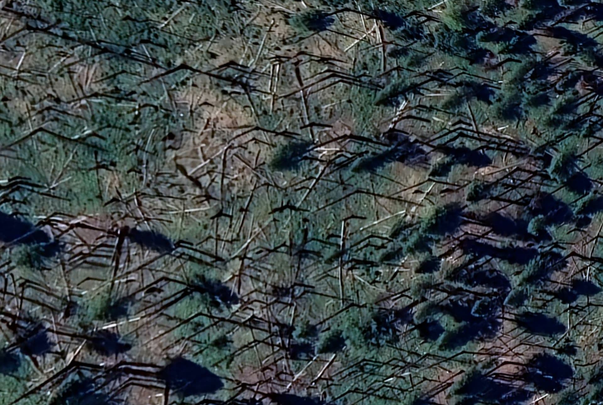
In the 2014 Whites Fire scar.
Estimated/ mapped at about 70 acres
Willl be back with links and better location
Edit: looks to be off South Russian Road X John Meadows road
Cam links: ALERTWest - Hayfork Bally Lookout 1 ALERTWest - Fort Jones 2
In the 2014 Whites Fire scar.
Now 90 acres
AA was asking for retardant.
RFW in effect until 20:00 tonight for thunderstorms. Current RH’s for the area are around 30 - 40%, and dropping.
Tanker 136 is made some drops and looks to be headed back to Redding for reload.
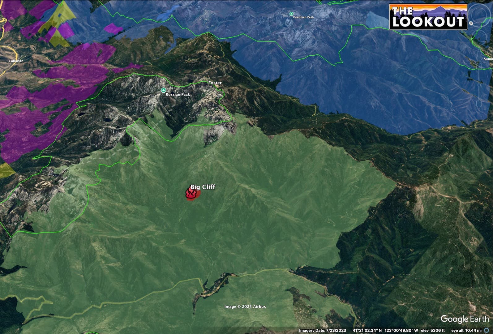
The fire is burning in 2014 Whites Fire scar (green), with 2021 River Complex to the south (blue). Areas to the east, outside of 2014 burn include private timberlands managed by New Forests and EFM (yellow and purple). Map view is to the SE.
It’s cooking up pretty good, already, and there are still about 8 hours of good burning weather ahead of us, plus forecasts for afternoon thunderstorms which could bring major instability and potential for strong outflow winds. Cumulus clouds starting to build, nearby. It could be a long day. ALERTWest - Fort Jones 2
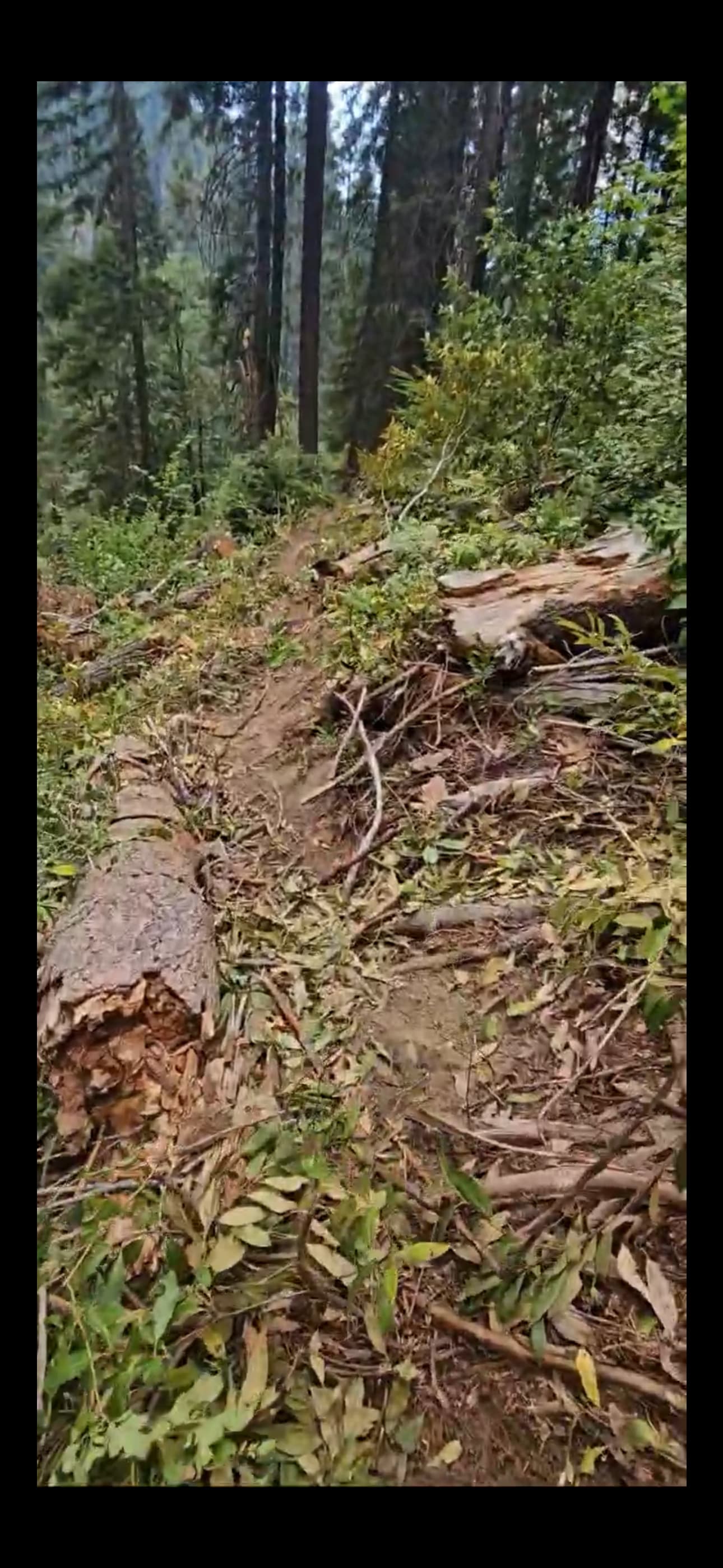
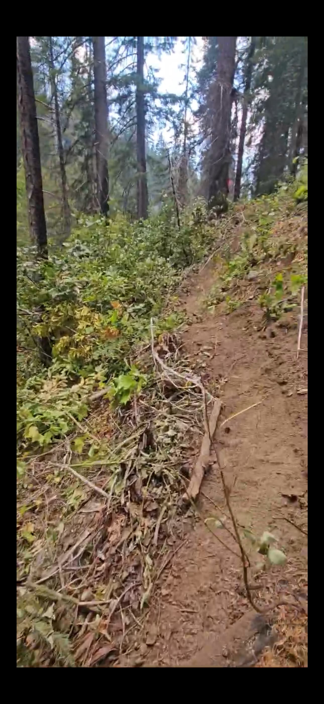
Lots of dead and down from 2014 Whites Fire.
And a tileset for those who can view the cameras:
Updated acreage is 27.4 acres.
Anyone have an online scanner with air tactics for this fire?
I’ve heard a few aircraft on this feed.
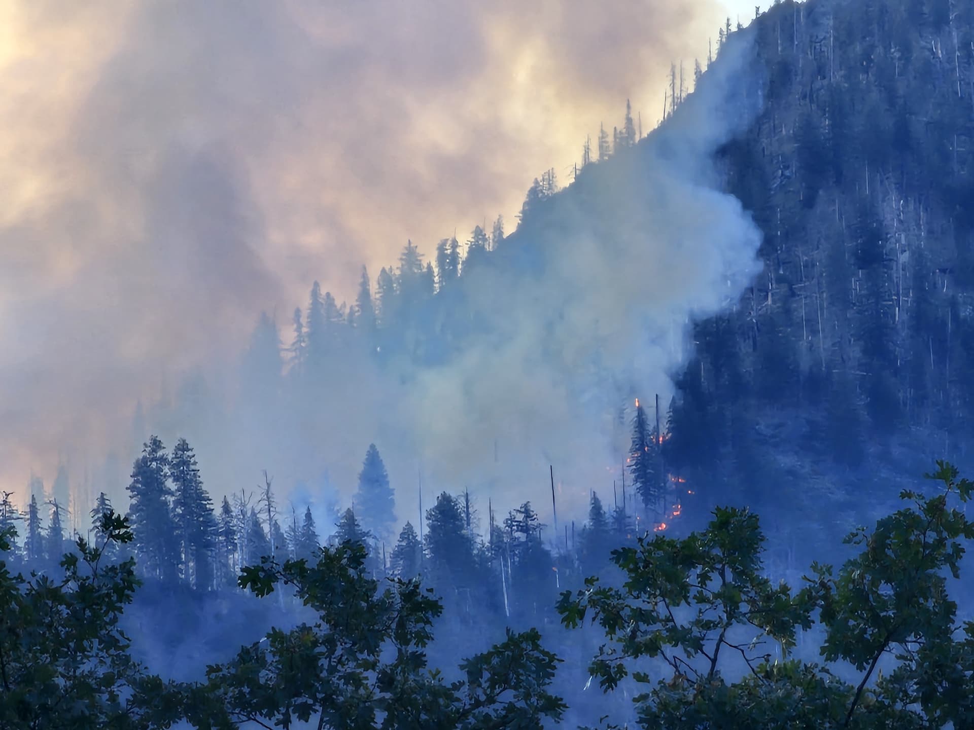
Big Cliff looks a little more impressive from the south.
Now mapped at 263 acres. Visible glow on the Fort Jones 2 cam.
Seems like there is high potential for the Big Cliff Fire to turn out to be a lot like the Butler Fire - both burning in 11-12 year old burn scars on super-steep Salmon River terrain.
Ecologically, the Butler Fire looks like it may have done a lot of good, burning up dead and down in country that is not ever going to get treated in any other way. We’ve got some writeup on this on today’s Lookout post.
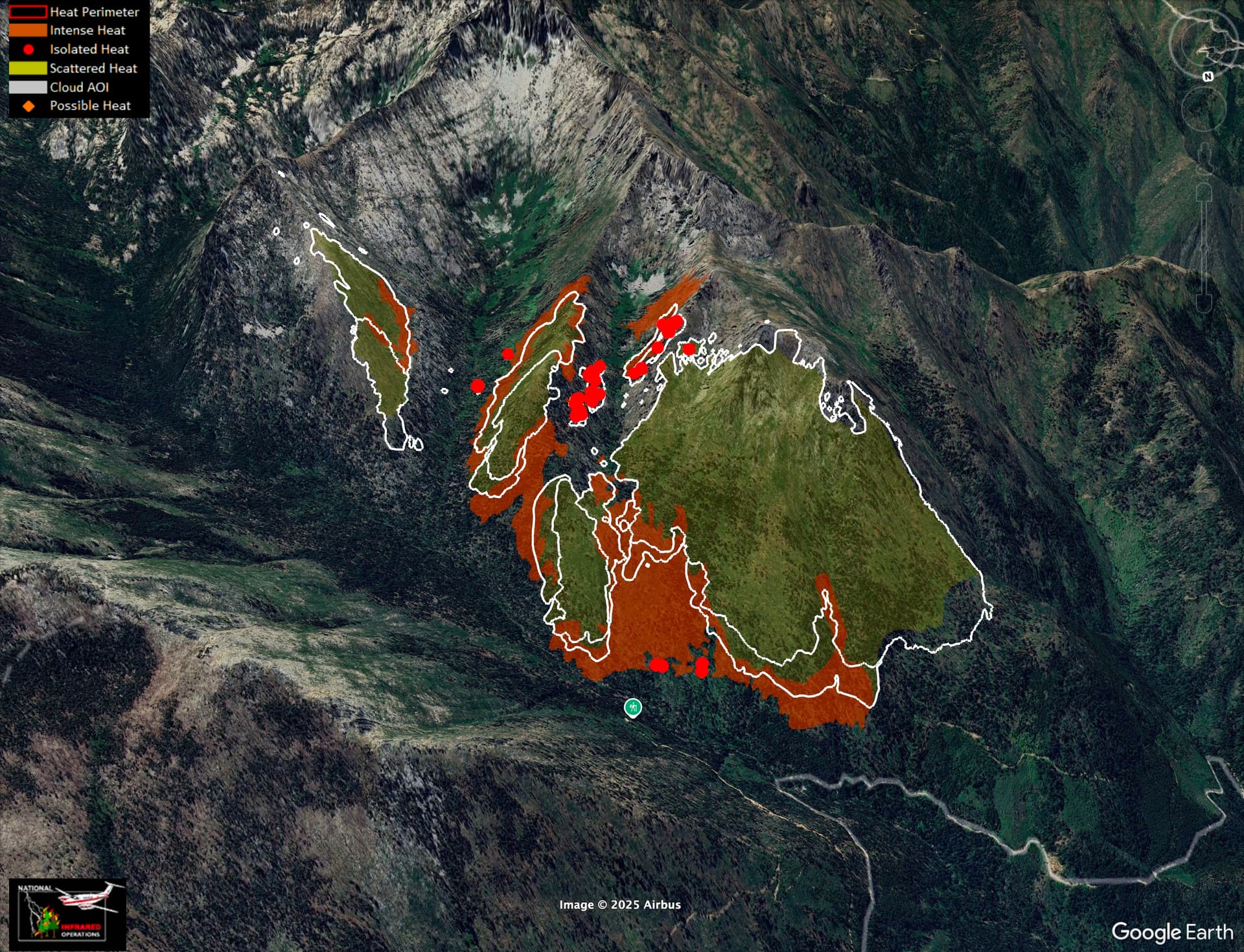
The fire is spreading really slowly. Up to about 650 acres, now. Here is last night’s IR. White lines show previous 24 and 48 hr perimeters.
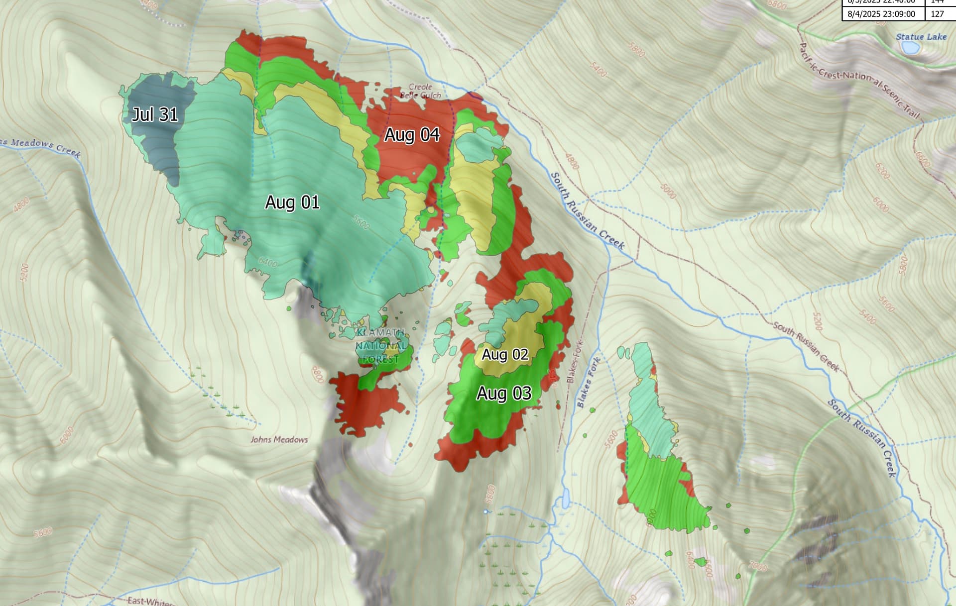
Progression map from the IMT.
I got some photos from the line and it is really green up there in the understory on that deep north-slope (also shared on NorthOps Wx thread a couple days ago…
Heat still showing up on the satellite sensors today.
NIFC has it at 970 acres on 8/13 13:47 with 33% containment.