CA-KNF-FOX

North Ops News and Notes

09/15/2020 1915
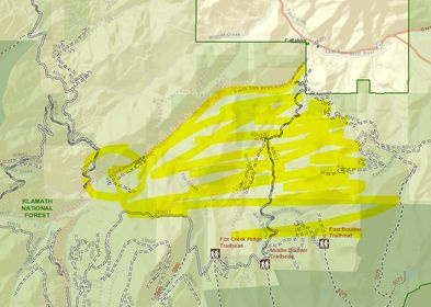
CA-KNF Fox Fire: 500 acres brush, timber, 0% contained. Active fire behavior with group torching, wind driven runs and short-range spotting. Structures are threatened with Evacuation Orders and Warnings in effect. Commercial timberlands are threatened and road and trail closures are in effect.

4 Likes

There are mandatory evacuations now for Callahan-Cecillville Rd and warnings for Callahan proper up to Wildcat Creek.

If anyone could help decipher this CodeRED and help with a map, it would be so appreciated. Strike Team is responding to 40N17.

CodeRED:

This is the Siskiyou County Sheriffs Office with an evacuation order west of carter meadows to boulder creek drainage east of boulder creek drainage to forest service road 40n21 north to callahan cecilville rd south to the county line.

This is my attempt:

image

9 Likes

9/16/20. 6:30 a.m.

Fire did not progress much last night. Did not make it to the 17 Road. Night resources spent the shift prepping the road.

Fire has spotted over the top of Blue Jay Ridge.

Briefing at 7.

9/16/20 6:40 a.m.

900 - 1,000 acres

2 Likes

Fox Fire IR Map. 2315 hrs 091520.
761 ac.

20200916_Fox_IR_Map_11x17_Topo.pdf (3.0 MB)

5 Likes

9/16/20 2:45 p.m.

1,700 - 1,800 acres
Fire has reached 40n17 in Slide Creek
Gusts of 15
Group torching and isolated crown runs

4 Likes

1512 acres per last night’s IR flight.

2 Likes

4 posts were merged into an existing topic: KNF/SKU-Fox???

Last report was 143 personnel assigned including three crews and 17 dozers.
17 dozers sounds about right.

2 Likes

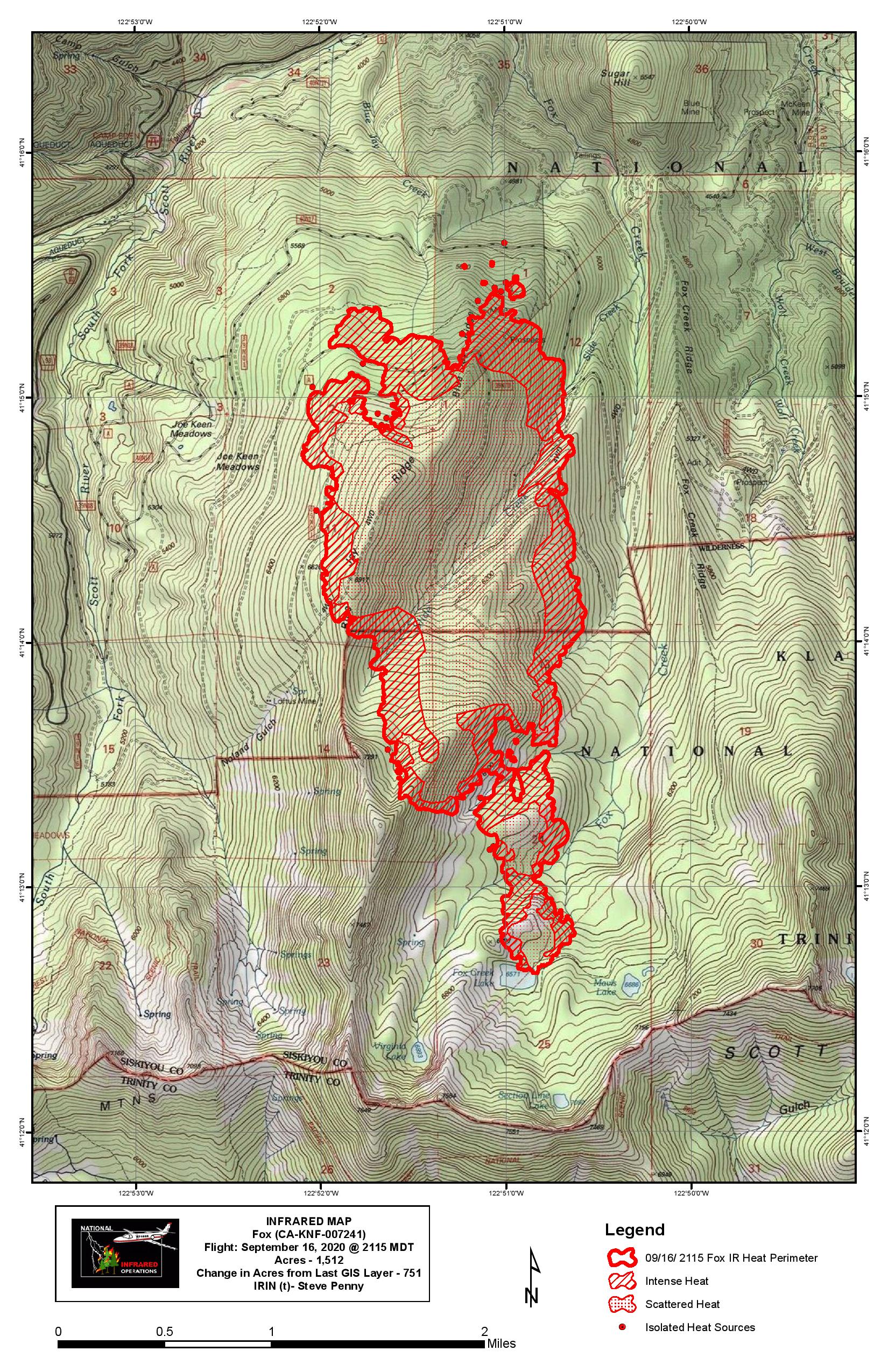
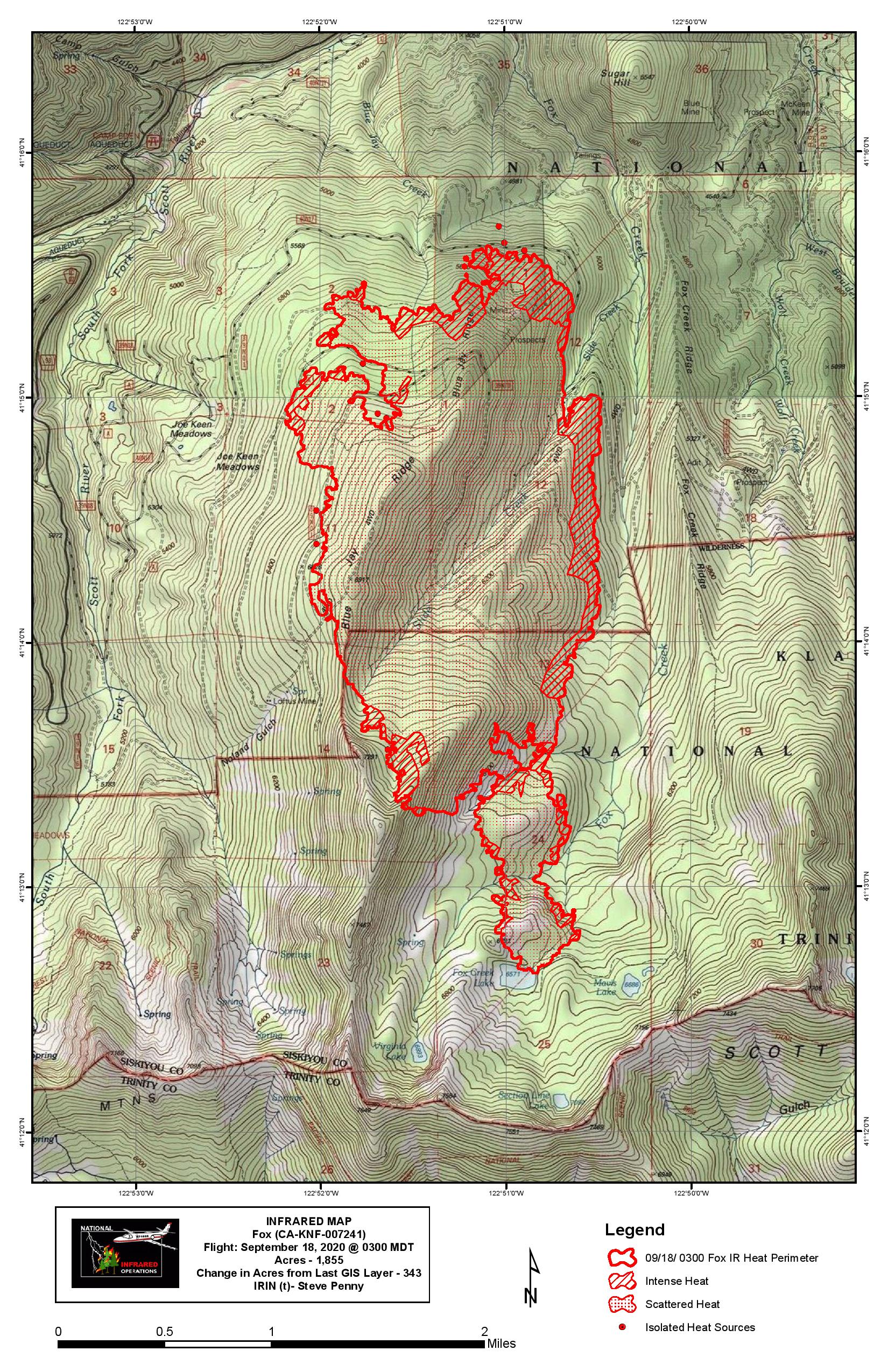
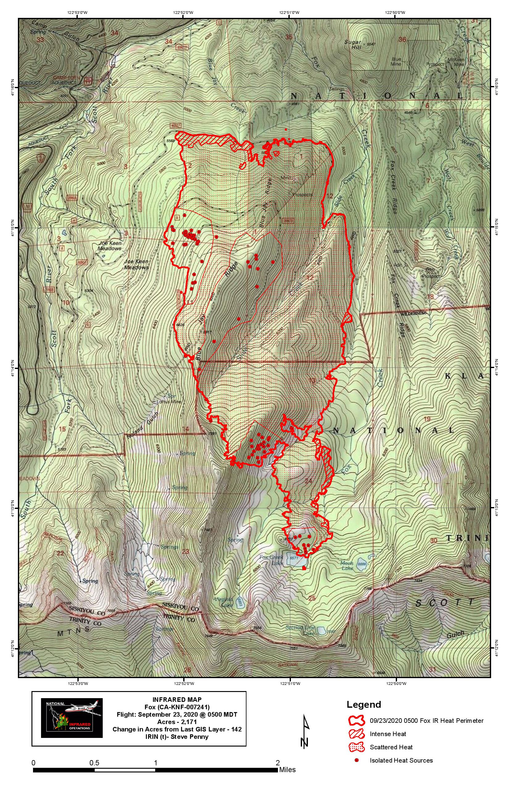
1855 acres (+355), 0% contained. Lots of good work by those firefighters yesterday with a south wind on the fire. They are trying to hold it at the 40N17 road. There was a large air show on Blue Jay Ridge, with MAAFS and at least one DC-10 painting and doubling up that flank. Heard AA mention that some of it was burning through. Had helos cycling through the entire day as well to support the ground troops.

1 Like

A post was merged into an existing topic: CA-KNF/SKU-Fox???

1937 acres (+82), 17% contained. The weather has been favorable. Still some work to do, but this one’s looking pretty good.

Link to Ops Map:

https://ftp.nifc.gov/public/incident_specific_data/calif_n/!2020_FEDERAL_Incidents/CA-KNF-007241_Fox/GIS/Products/20200920/Ops_ArchE_Land_Fox_20200920_0504_CAKNF007241.pdf

6 Likes

2188 acres, 43% contained. Looks like the burnout along the 17 road is progressing.