State ID: CA
3 letter designator: KNF
Fire name: FOX
Location: Fox Creek Lake off Cecilville Rd.
Reported acres: 10+
Rate of spread: Moderate with high potential
Report on Conditions: Timber and brush, isolated torching, heavy south wind on it
Structure threat: No
Resources: Patrol 54
Hazards:
Weather:
Radio channels:
Scanner link: https://www.broadcastify.com/listen/feed/28507
Webcam link:
Agency Website:
First unit hiked in at about 6:30 p.m.
7:45 p.m update from Fox IC
10 acres plus. Moderate rate of spread.
High potential. Burning in timber and brush. Extended Initial Attack.
Requesting three type 2 IA crews or better for tomorrow and one type 1 helicopter.
Type 4 incident per complexity analysis
Will be looking for an LZ and sling site for tomorrow. Fire is in the wilderness - confirmed ok to pump out of the lake.
Significant increase in size and behavior per IC @ around 9:30 p.m.
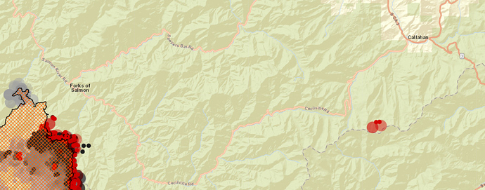
Red Salmon on the left, Fox on the right.
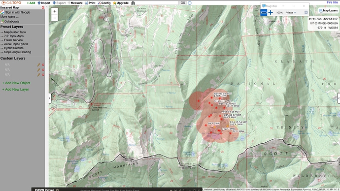
Caltopo link with MODIS/VIIRS hits
AA overhead on A/G 43, and at 10800 msl, is making it into Red Bluff nicely. Fire appears to have stayed north of the ridge, on the Siskiyou County side. Some short range spotting ahead of itself. Jumper 42 enroute with 4 (I think) jumpers on board. Sounds like aircraft will be on IA freqs today. Popping up on the normal IA freqs for A/G, Victor etc.
Initial size-up is 100 acres - AA will try to do a more accurate mapping. “Long, skinny fire about 1/2 mile long and 200 feet wide.” 3 helicopters available at Scott Valley helibase. Jump 42 getting oriented over the fire.
Scanner traffic posted as available here: https://www.facebook.com/groups/SiskiyouAlerts/permalink/1224074474644610/
Air Attack just ordered a lead and 3 tankers at 9:20 a.m.
5 tankers on the fire now, 3 MAFFS and 2 S-2’s, I believe. 3 copters also assigned. Spot ahead of the main fire has retardant around it. Fire beginning to burn through retardant on the main fire. Going direct on the right flank with the tankers. Wind is not cooperating.
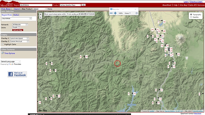
Callahan RAWS - 5 miles north at the base of the Fox Creek drainage, 4000ft 84F 12RH SSE12G23
Nothing really indicative of the 7000ft ridgetop behind this thing. There’s Scorpion RAWS but it’s 3300ft midslope down in the Trinity River north of Trinity Lake. Might show some lower influence coming up the canyons (shrug). The fire is north of the ridge in north-south alignment, but everything on the south side is more E-W aligned.
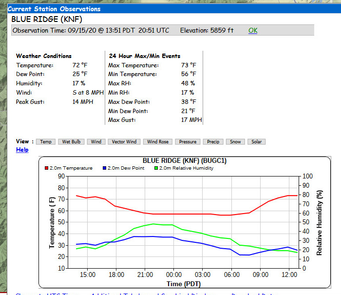
I would consider Blue Ridge probably the best representative station for that area.
Requesting a VLAT (wonder if there are any availlable?).
Edit: 911 en route, will shut down the tanker show after 911 drops due to visibility.
Lost the battle with the spot, lots of active ground fire.
Last size-up was 170 acres at about 2:45.
On the west, fire had reached 39N70 road, Bluejay Ridge, B spur. IC requested a strike team.
AA cancelled relief for himself, but kept order for relief Bravo in case air improves. Inquiring about availability of a Helco
Smoke rolling in thick in Etna.
Edit: Looking to release Bravo and utilize Helco from Scott Valley helibase at 16:50.
4:55 Helco estimates 300 acres. Has moved quite a bit into Slide Creek. Spotting and some group torching out ahead of the fire. Just ordered a type 2 (H502) to come work on spots to the north.
5:25 p.m.
Helco: Will maybe get 2 more buckets in for each helicopter and then will have to pull the pin. There are multiple spot fires all across Slide Creek well to the north and west of the main fire.
Expects fire to move “a long ways to the west tonight.”
Will make one more pass to get a lat/lon and hover over the spots west of Slide Creek for crew on the road to see where he is, and then head back to base.
Making a substantial run up Slide Creek toward Blue Jay. Pulling resources out of that area. Large column that is leaning over.
Is there a cam on that area?
Nope, no cameras in Scott Valley. It would be really nice if Alert put some up, but power and internet are difficult there.
Just a matter of time before Antelope and Herd Peak can see column. That is if they
weren’t smoked out.


