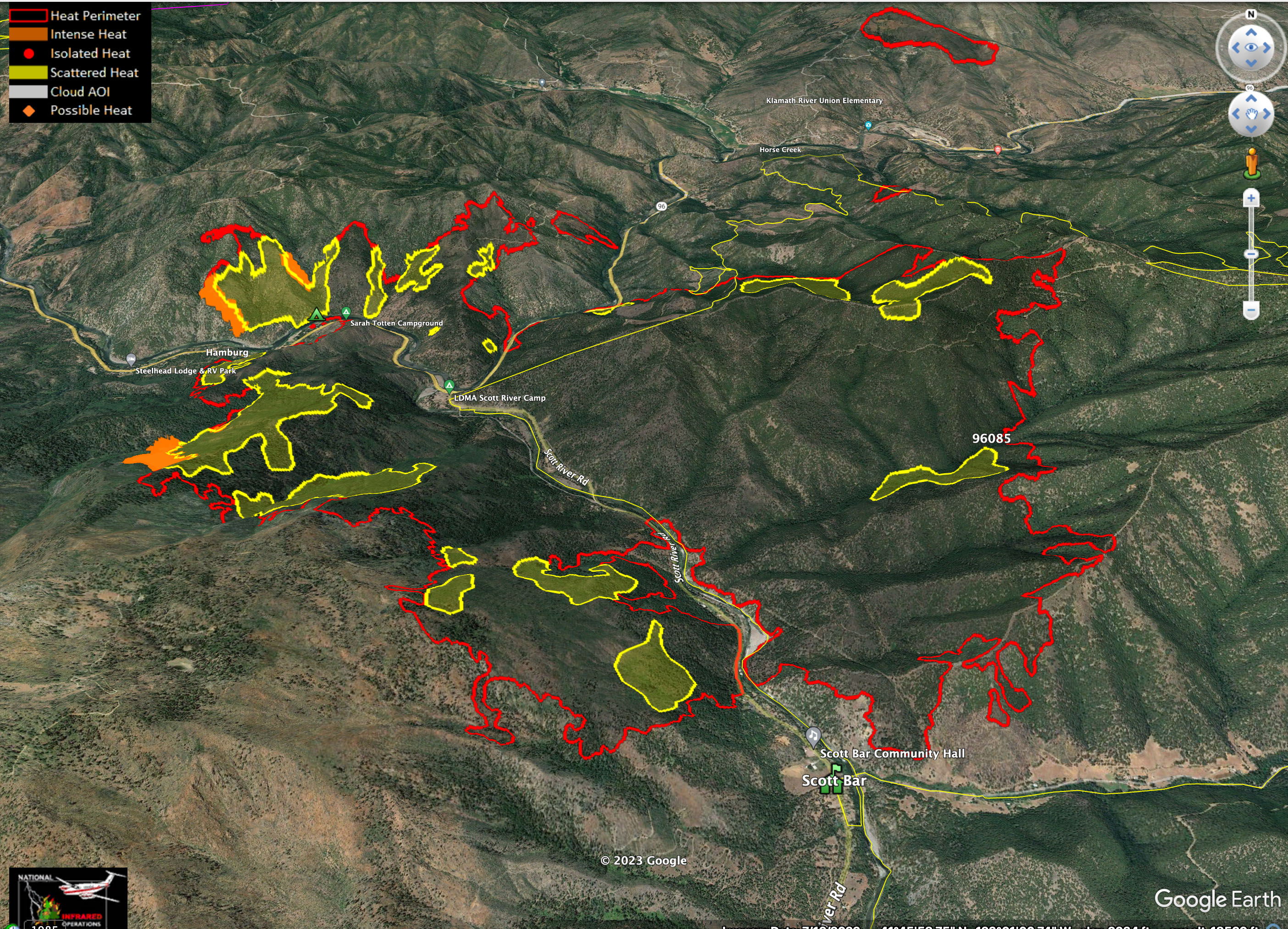
Fire has been hung up in the drainage of Franklin Gulch for a couple days. Was wondering when it would finally push to the top of the hill.
Mill Creek Road is on far right of image.

Fire has been hung up in the drainage of Franklin Gulch for a couple days. Was wondering when it would finally push to the top of the hill.
No IR flight last night UTF Mechanical.
Got several texts last night for “single resources”. Ordering has made it down to San Mateo County.
NIRPOS has been out of the game for this entire event.
Request have made it to San Diego County
This morning’s Lookout video covers new spread on NW California fires, looks at the complex fire history of the Klamath Mountains, and talks about social dynamics around large fire management in this unique part of the planet. https://youtu.be/Xv0f3_00bkk
With upcoming storm it will be interesting to see if they let resources go or if they hold onto them.
I’d imagine with the predicted east winds from the storm and minimal moisture making it up there they’d hold on. But I’m constantly proven that I have no clue how any of that works
There is plenty of fire in the area. Not expecting any releases, just reassignment.
I was referring to the resource requests making it to San Diego Op area.
If the request hasn’t been filled or hit the road, it might get canceled. LG will be the first to get let go.
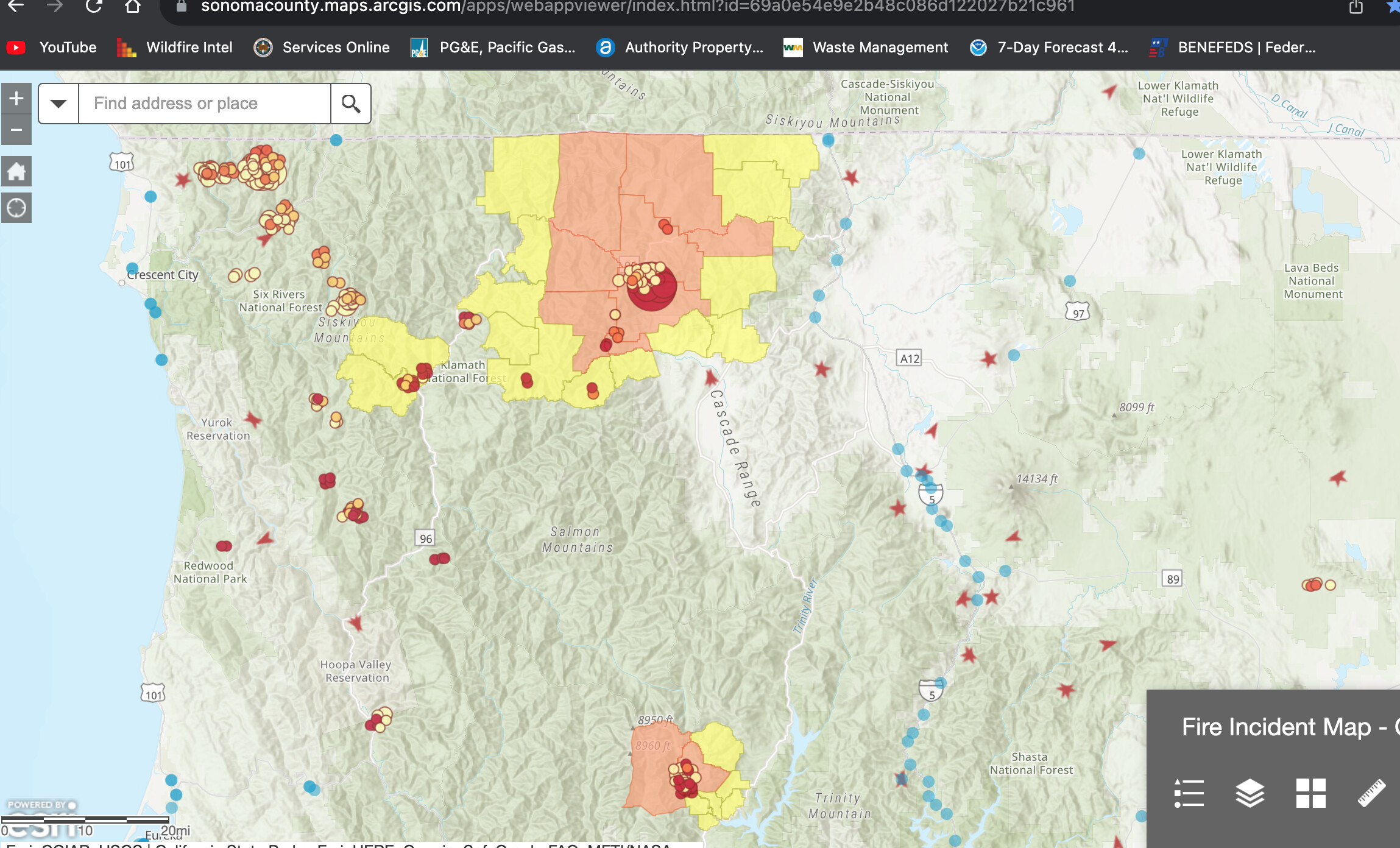
Acreage caught up…
8.409 acres brush and timber, 0% contained per NOPS evening update.
Some intel from this mornings 209 report:
8904 Acres @ 0% Containment
1 Civilian Fatality on 8/18
9 Residences Destroyed (Damage assessment is still ongoing)
Critical Resource Needs: 4 - HEQB, 7 - DIVS, 4 - TFLD, 2-Heli Base Manager, 2- HMGB, 4 HECM. + Overhead
1,261 Personnel Assigned
Type 6 OES ST enroute from Region 5
Complex Acres: 18,483 @ 23% Contained.
The Elliott Fire merged with the Canyon Fire and Three Creeks Fire, which have retained their acreage and have been marked as 100% contained. Additional acreage and actual containment for the new, larger fire is reflected in the Elliott Fire.
The Scott Fire merged with the Gold Fire, which has retained it’s acreage and has been marked as 100%
contained. Additional acreage and actual containment for the new, larger fire is reflected in the Scott Fire.
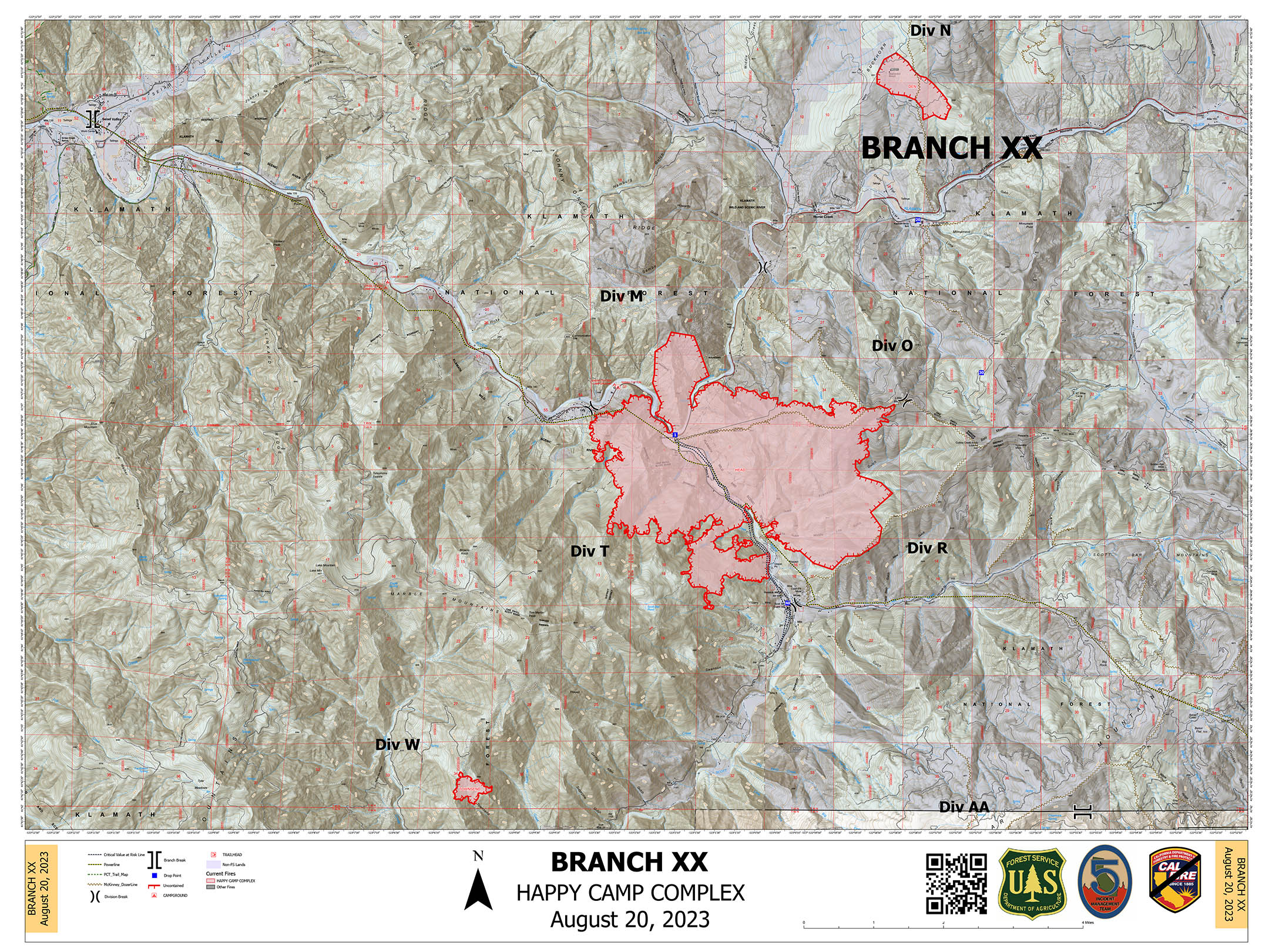
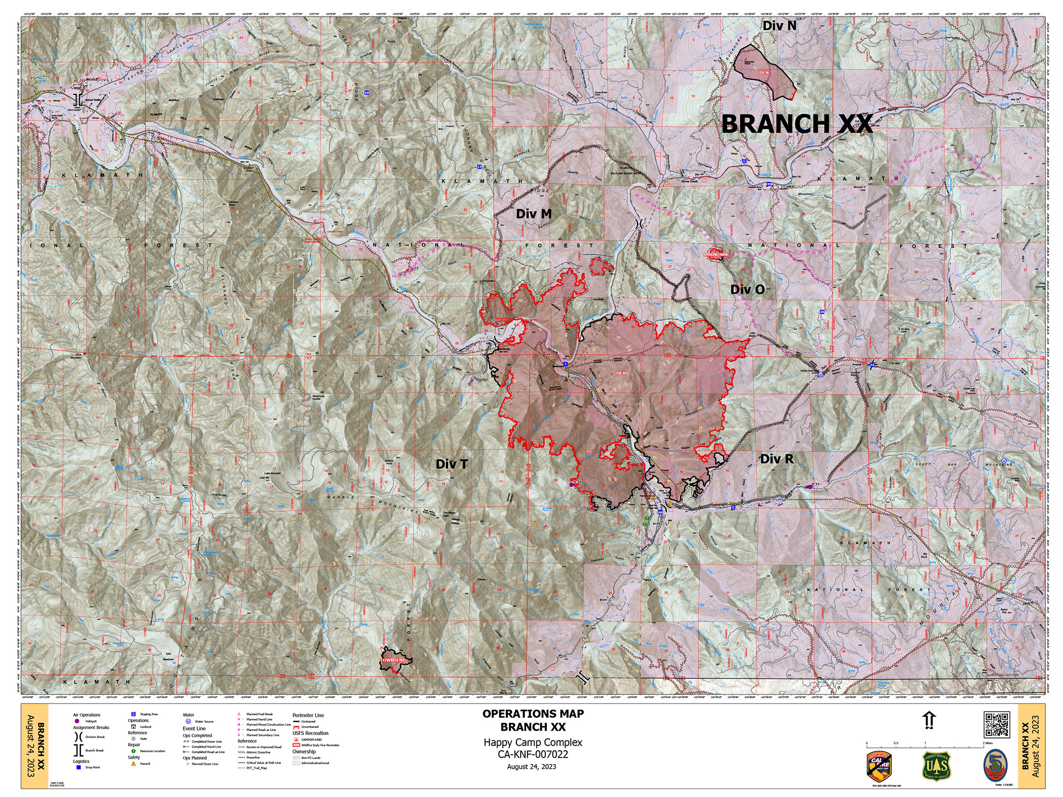
Fires in the Complex:
BLOCK - 0.01 Acres 100% Contained
CANYON - 1,108 Acres 100% Contained
DEN - 294 Acres 100% Contained
ELLIOT - 3,539 Acres 3% Contained
GOLD - 968 Acres 100% Contained
HEAD - 6,739 Acres 29% Contained
LAKE - 199 Acres 5% Contained
MALONE - 438 Acres 7% Contained
SCOTT - 894 Acres 50% Contained
SWILLUP - 1,895 Acres 0% Contained
THREE CREEKS - 320 Acres 100% Contained
TOWNSEND - 81 Acres 100% Contained
UFISH - 1,372 Acres 0% Contained
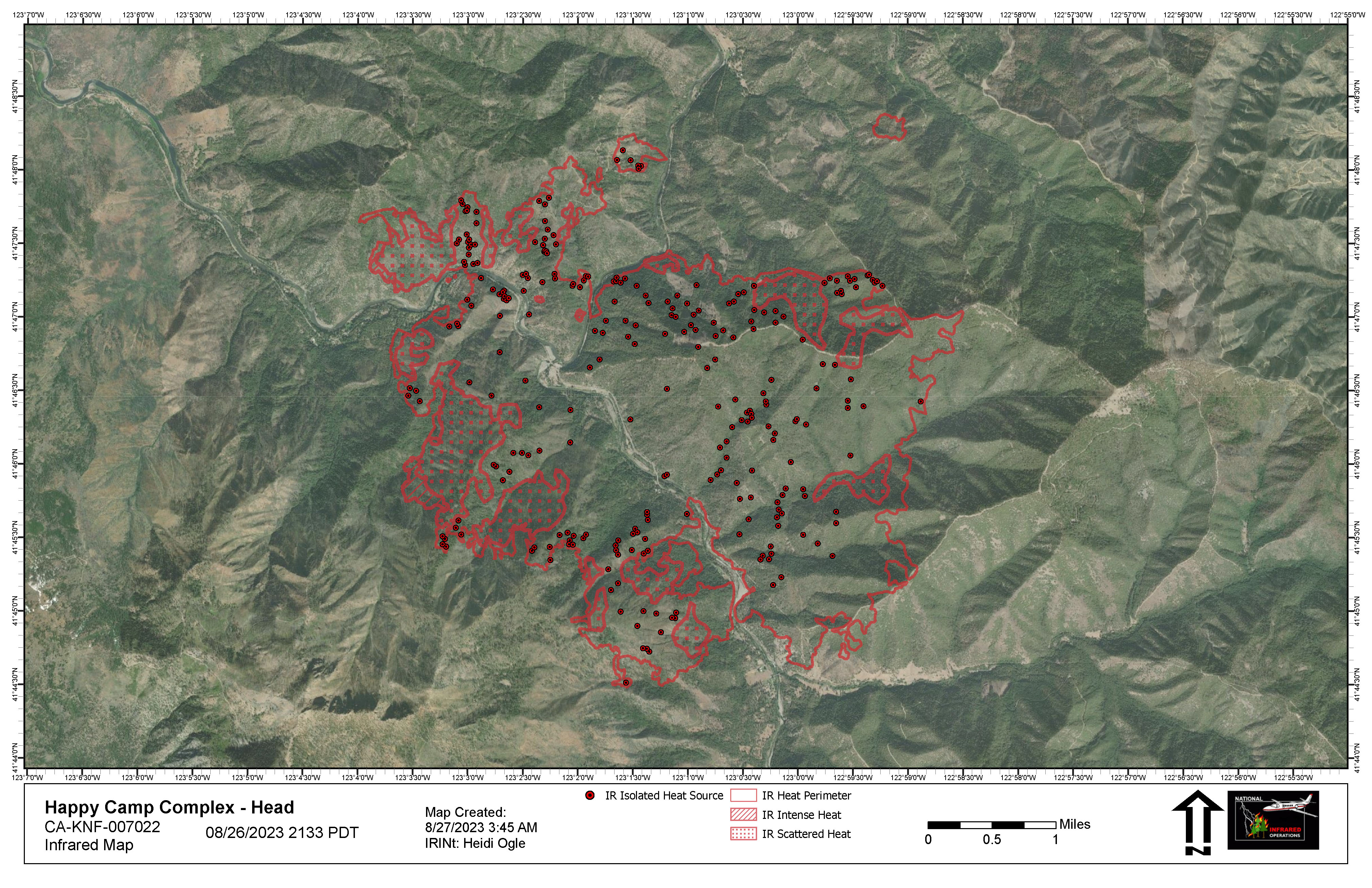
HEAD IR Map:
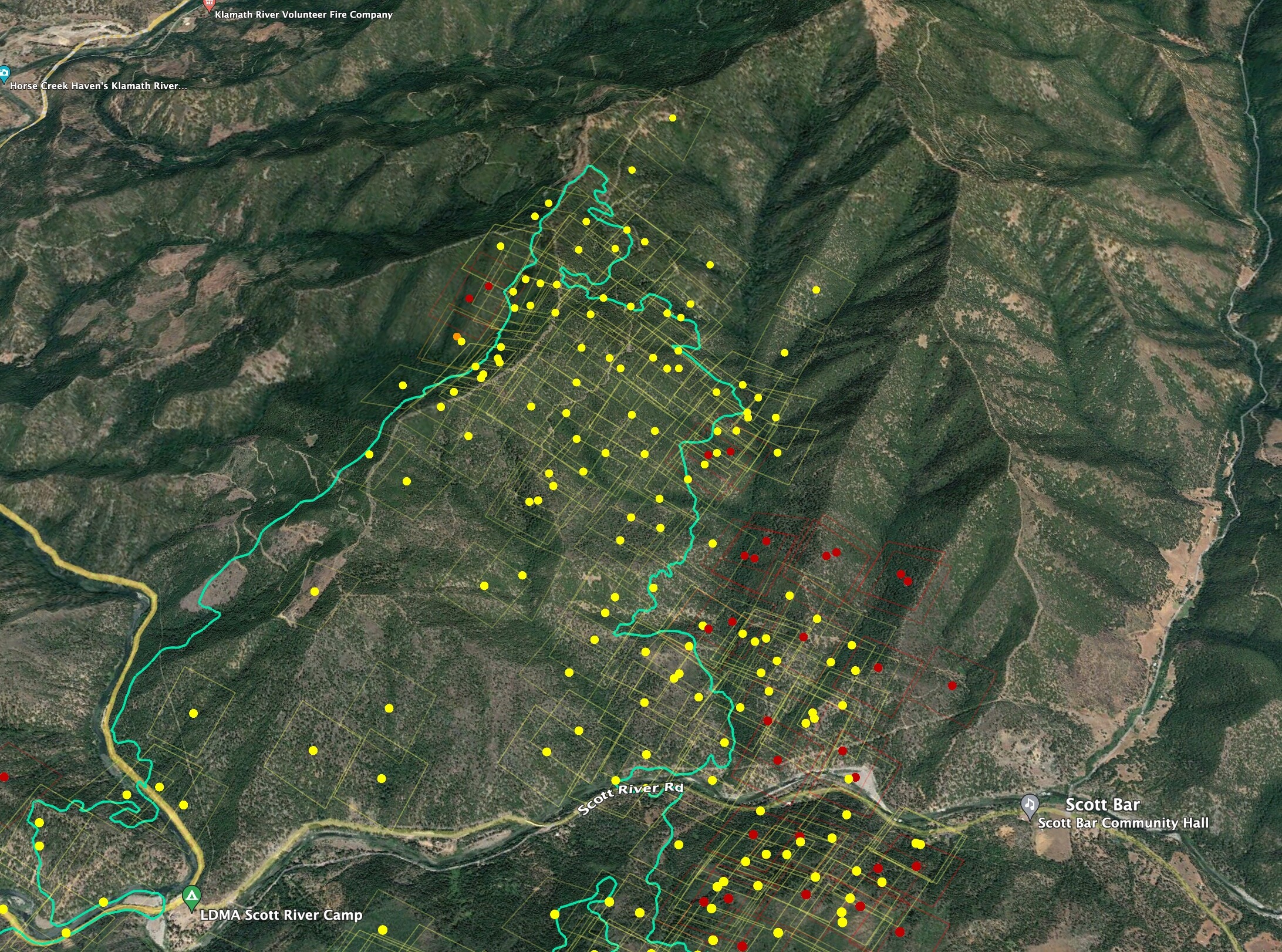
Branch XX HEAD Ops Map:
Enhanced IR map from NIROPS flight last night that shows intense heat more clearly on the western flank.