This thread will be used for ongoing updates to the following fires which will be under the control of CA IMT 5 (Mueller) as of 8/18/23
Current fires assigned to this Complex:
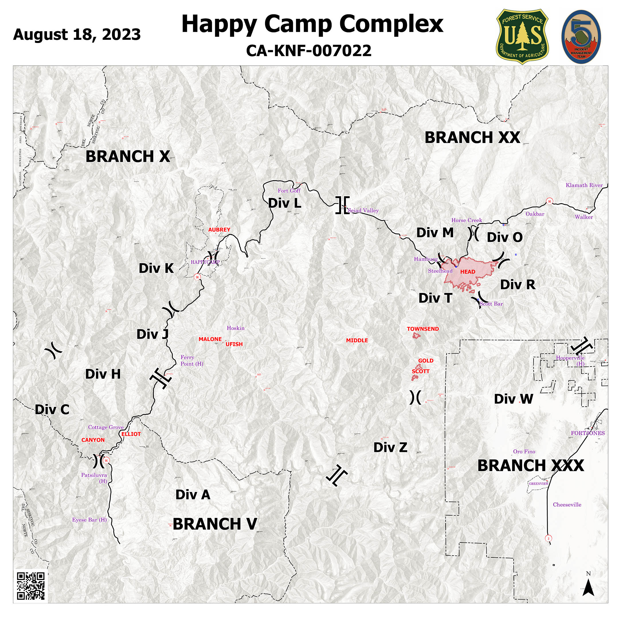
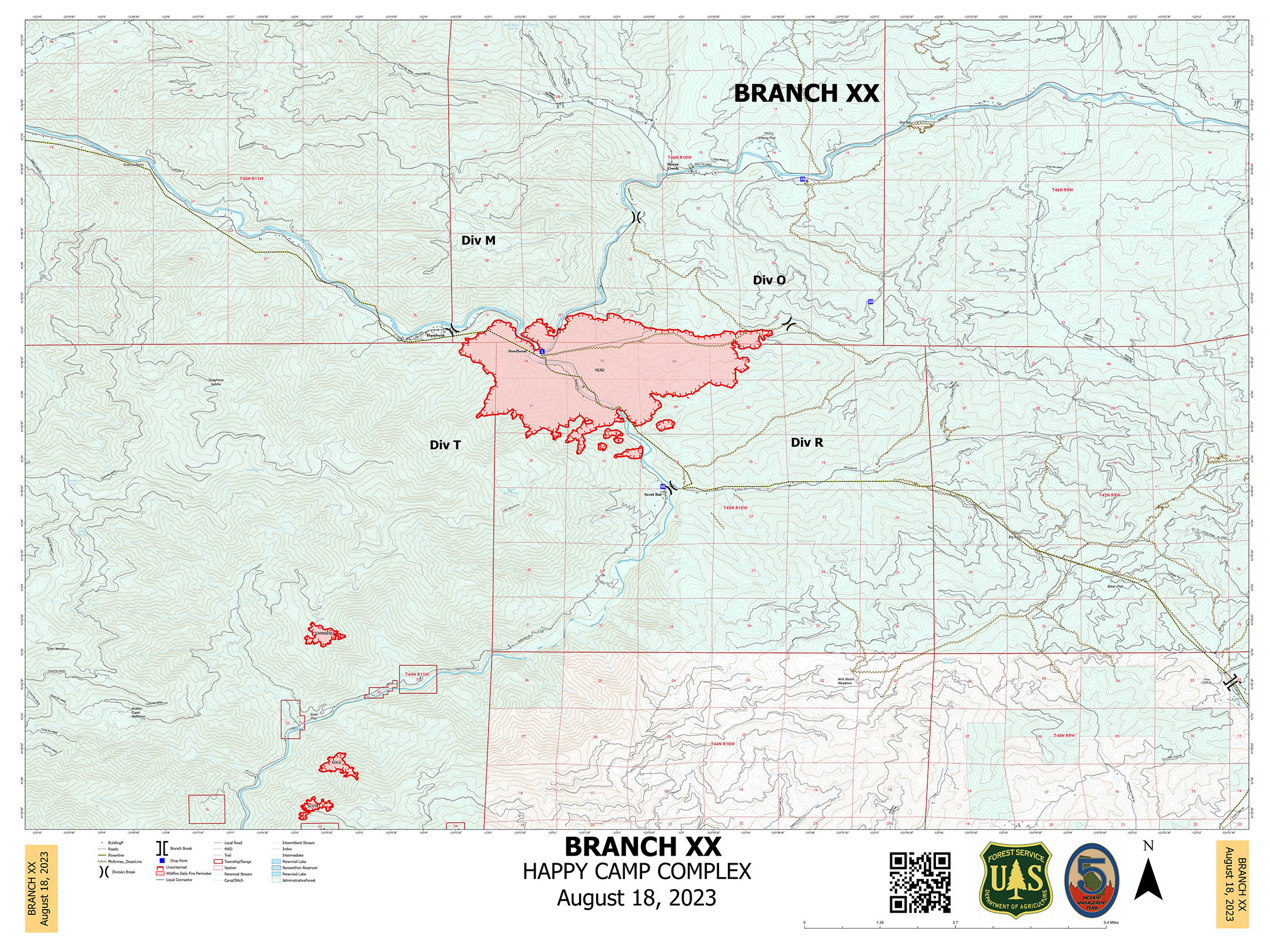
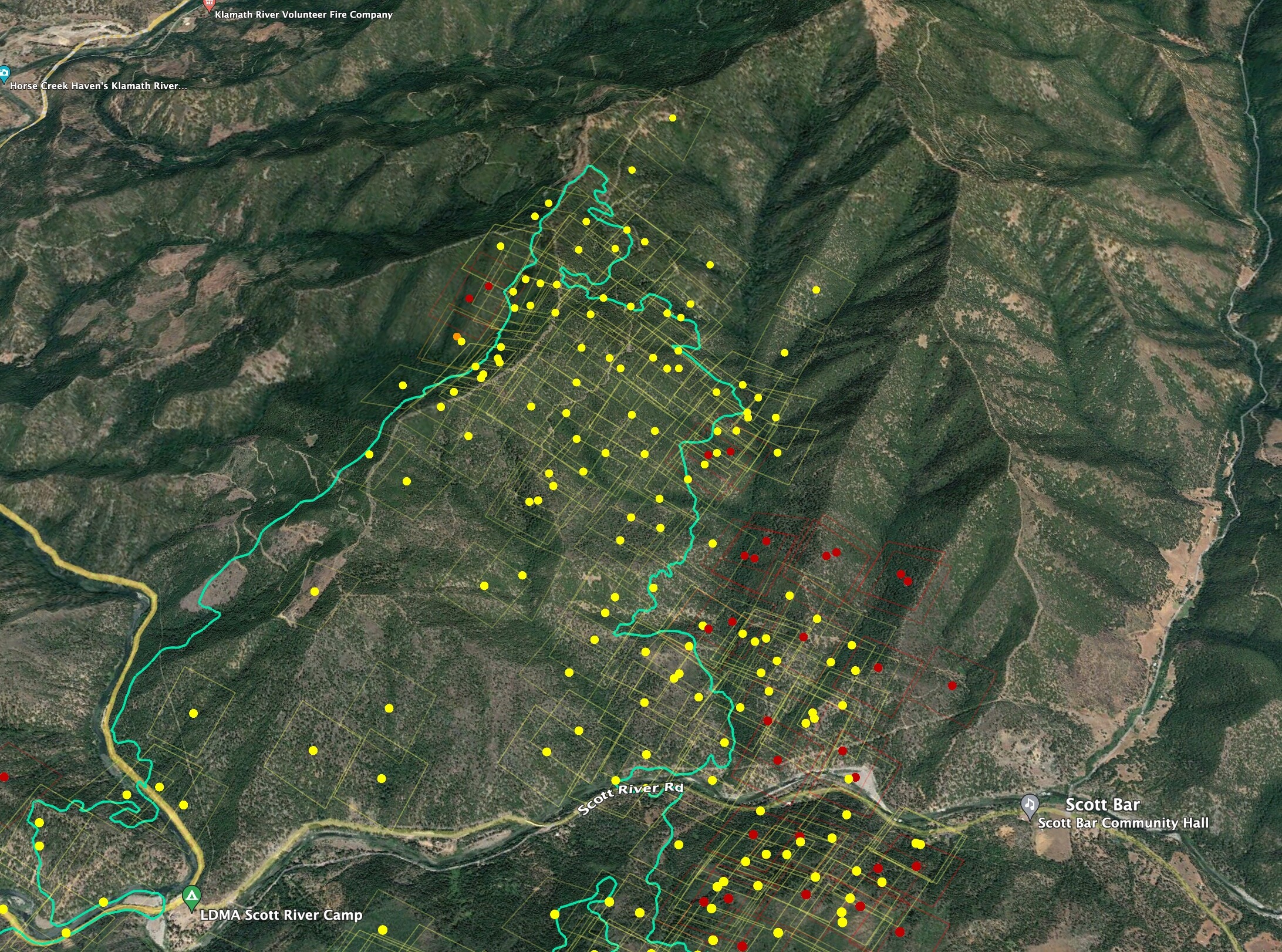
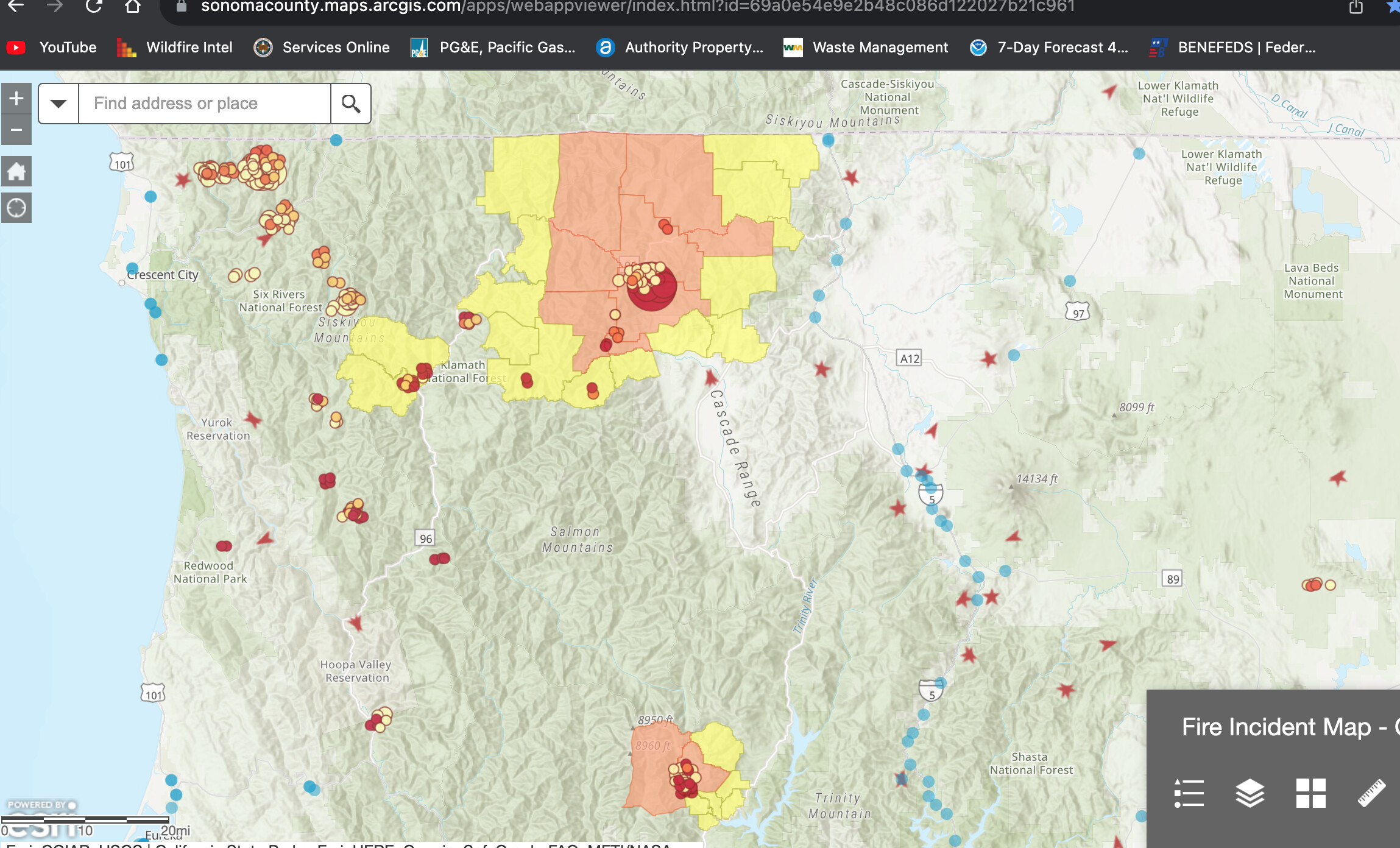
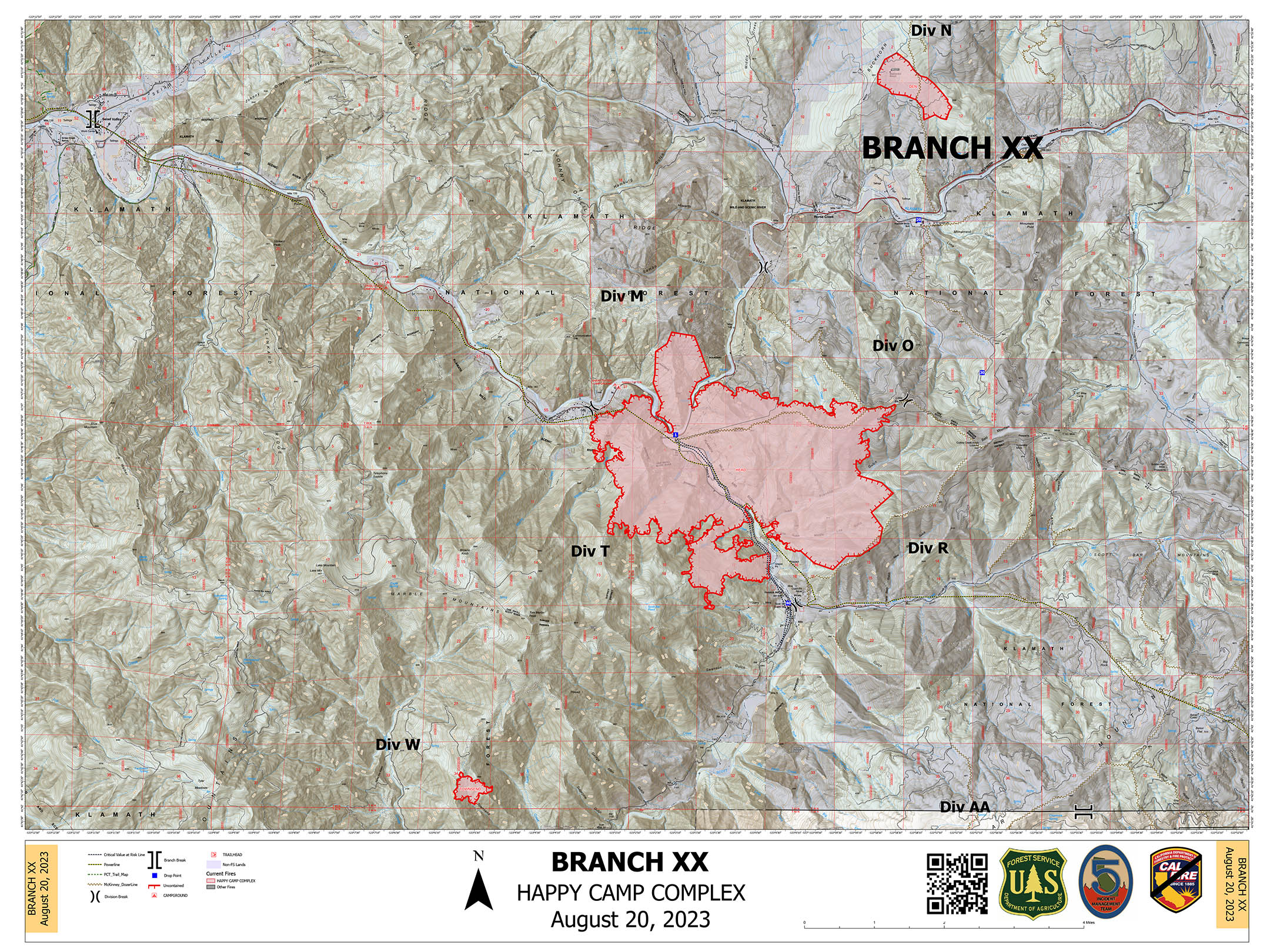
Head Fire - 3,850 acres 0% Contained
Note: The current Head Fire incident and will be closed to further updates. Previous information can be found here: CA-KNF-Head
Camera Link: Fort Jones
Radio Link: Siskiyou County Sheriff and Fire - West
Elliott Fire - 60 acres
Scott Fire - 30 acres
Malone Fire - 15 acres
Structures and power line infrastructures are threatening in the area and there are Mandatory Evacuation Orders in place.
ONCC 2030hrs Update: CA-KNF Happy camp complex:4075 acres brush and timber, 0% contained. Moderate fire behavior reported. Complex fires:( Head-4000 acres, Elliot-60 acres, Scott- 1 acres, Malone- 15 acres). Structures are threatened with Evacuation Orders in place. There is a threat to the Hwy. 96 corridor, high power transmission lines, culturally sensitive sites and industrial timberlands. Road and trail closures are in place. There is a Red Flag Warning in the fire area today for thunderstorms on dry fuels. CA-Type 1,IMT 5 (Mueller) assigned.
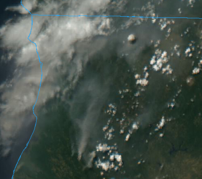
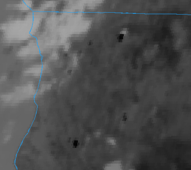
The Head Fire was expected to keep a generally lower profile—“No fire spread is expected outside the current perimeter until fuels dry with sunlight and receive significant winds”—but satellite shows a significant column right now (fire at top). Cameras are mostly smoked out.
Per radio traffic, in Division R (the southeast side of the fire), activity is picking up. It has progressed east of Scott River and Mill Creek Roads to a ridgeline and dozer line. Ground resources are requesting aircraft to try to keep it from coming from the north to the south side of the ridge if visibility allows.
This morning’s Lookout video covers new spread on NW California fires, looks at the complex fire history of the Klamath Mountains, and talks about social dynamics around large fire management in this unique part of the planet. https://youtu.be/Xv0f3_00bkk
I’d imagine with the predicted east winds from the storm and minimal moisture making it up there they’d hold on. But I’m constantly proven that I have no clue how any of that works