Some intel from this mornings 209 report:
8904 Acres @ 0% Containment
1 Civilian Fatality on 8/18
9 Residences Destroyed (Damage assessment is still ongoing)
Critical Resource Needs: 4 - HEQB, 7 - DIVS, 4 - TFLD, 2-Heli Base Manager, 2- HMGB, 4 HECM. + Overhead
1,261 Personnel Assigned
7 Likes
Type 6 OES ST enroute from Region 5
7 Likes
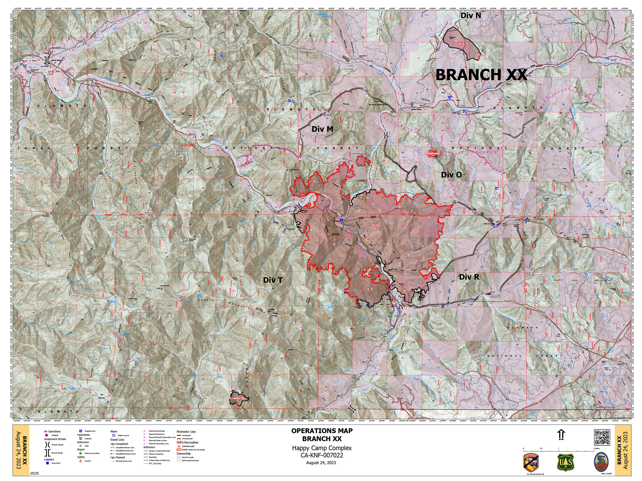
8/24 Ops Map for Branch XX
8/24 Fire History Map for the Complex:
7 Likes
Complex Acres: 18,483 @ 23% Contained.
The Elliott Fire merged with the Canyon Fire and Three Creeks Fire, which have retained their acreage and have been marked as 100% contained. Additional acreage and actual containment for the new, larger fire is reflected in the Elliott Fire.
The Scott Fire merged with the Gold Fire, which has retained it’s acreage and has been marked as 100%
contained. Additional acreage and actual containment for the new, larger fire is reflected in the Scott Fire.
Fires in the Complex:
BLOCK - 0.01 Acres 100% Contained
CANYON - 1,108 Acres 100% Contained
DEN - 294 Acres 100% Contained
ELLIOT - 3,539 Acres 3% Contained
GOLD - 968 Acres 100% Contained
HEAD - 6,739 Acres 29% Contained
LAKE - 199 Acres 5% Contained
MALONE - 438 Acres 7% Contained
SCOTT - 894 Acres 50% Contained
SWILLUP - 1,895 Acres 0% Contained
THREE CREEKS - 320 Acres 100% Contained
TOWNSEND - 81 Acres 100% Contained
UFISH - 1,372 Acres 0% Contained
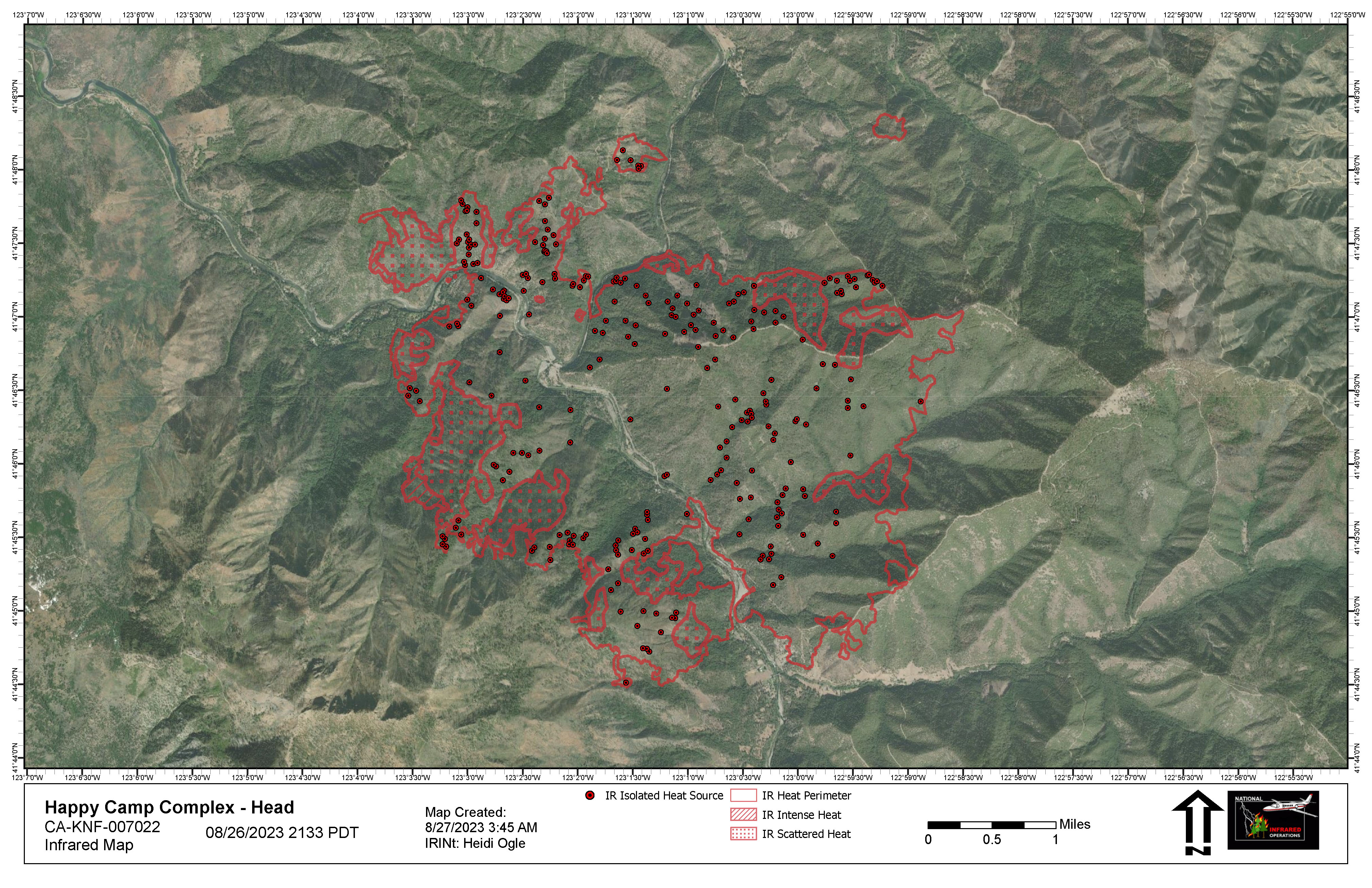
HEAD IR Map:
Branch XX HEAD Ops Map:
4 Likes
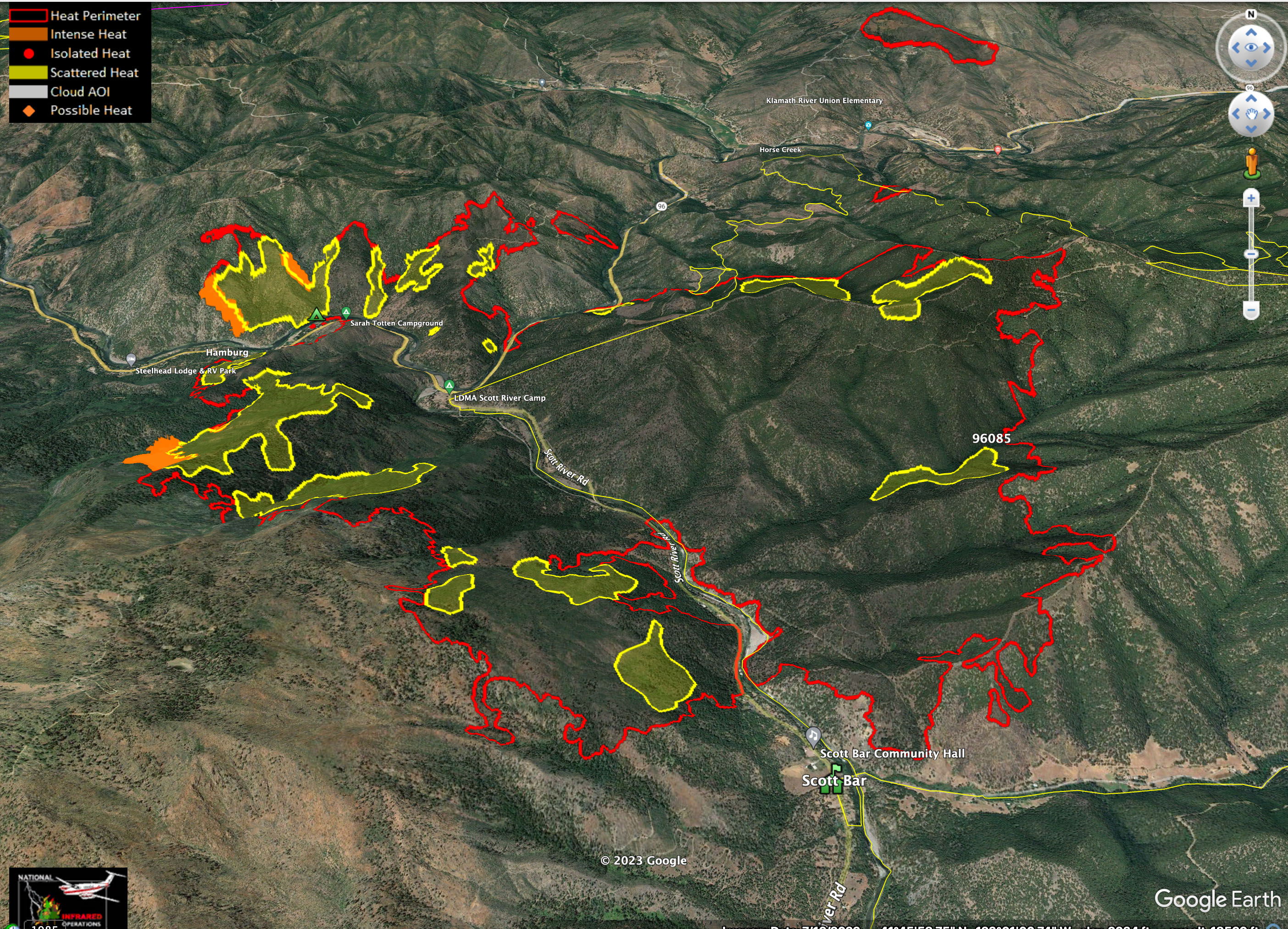
Enhanced IR map from NIROPS flight last night that shows intense heat more clearly on the western flank.
7 Likes