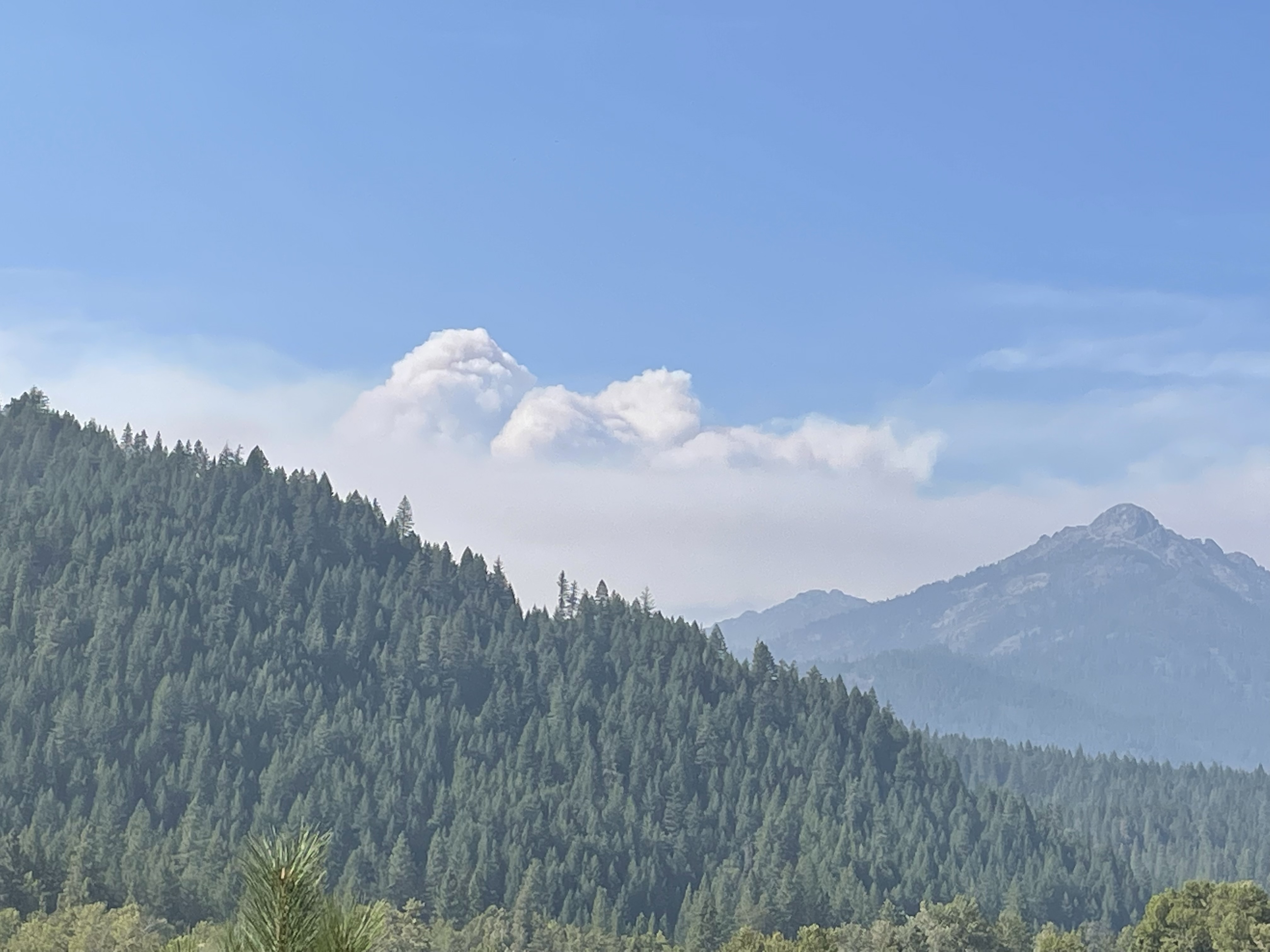
Maybe I got it wrong but, I do believe the upper left corner here is a big movement on the haypress as the plume has developed: (or one of the others in the river complex)
https://rammb-slider.cira.colostate.edu/?sat=goes-17&sec=conus&x=7293&y=3319.89501953125&z=5&angle=0&im=18&ts=1&st=0&et=0&speed=130&motion=loop&maps[borders]=white&lat=0&p[0]=band_02&p[1]=cira_natural_fire_color&opacity[0]=1&opacity[1]=0.5&pause=0&slider=-1&hide_controls=0&mouse_draw=0&follow_feature=0&follow_hide=0&s=rammb-slider&draw_color=FFD700&draw_width=6
1 Like
Team 15 is ordered and will report for in-brief on Sunday 8/15 at 1400 at Etna ICP.
5 Likes
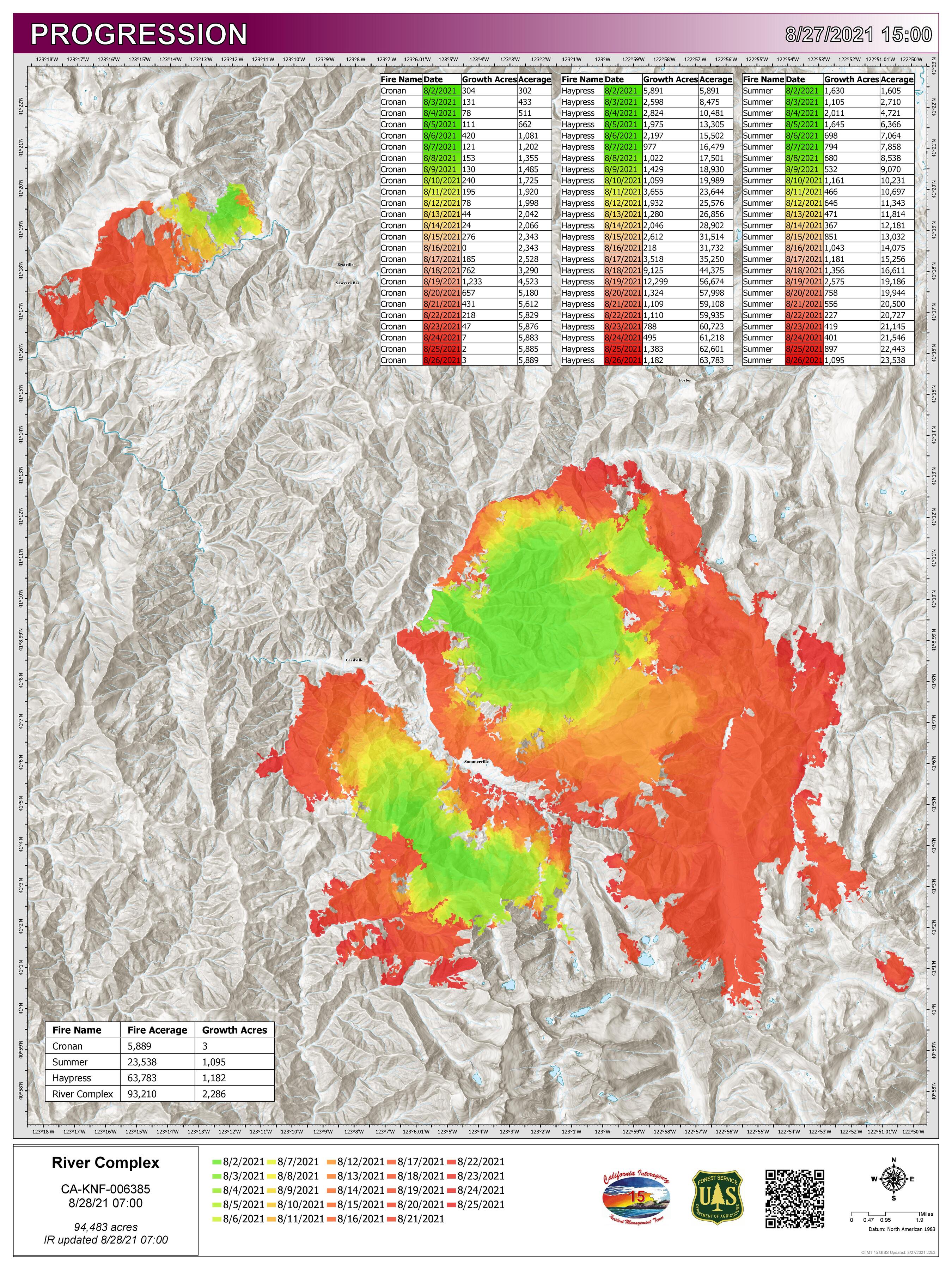
36,954 acres and 10% contained
2 Likes
data package posted for the river complex - maps.takserver.us
2 Likes
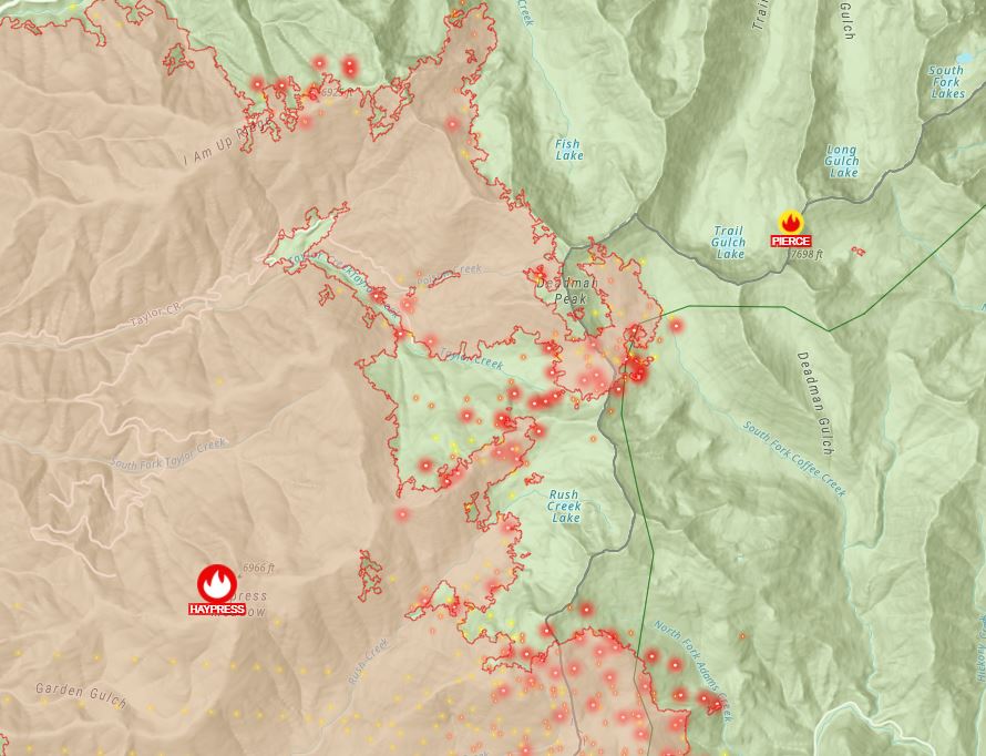
New fire discovered this morning to the east of the Haypress, calling it the Pearce fire and inserting jumpers. This fire will be managed as part of the River Complex.
7 Likes
Two plane loads of jumpers out of RDD to the new start.
6 Likes
Any intelligence on the new Pearce Fire in the complex? Looks like 15 jumpers on it.
3 Likes
Here’s a map. I suspect that the fire is actually located at the IR hotspot to the east of the location marked as Pierce on this map.
3 Likes
From the KNF, the Pierce fire is less than two acres with 15 smokejumpers working to get it contained, controlled and out.
5 Likes
DATA PACKAGE POSTED - MAPS.TAKSERVER.US
1 Like
44,117 acres and 10% contained.
3 Likes
DATA PACKAGE POSTED AT MAPS.TAKSERVER.US
PLEASE BE SAFE
2 Likes
48,214 acres and 10% contained.
64,314 acres and 10% contained.
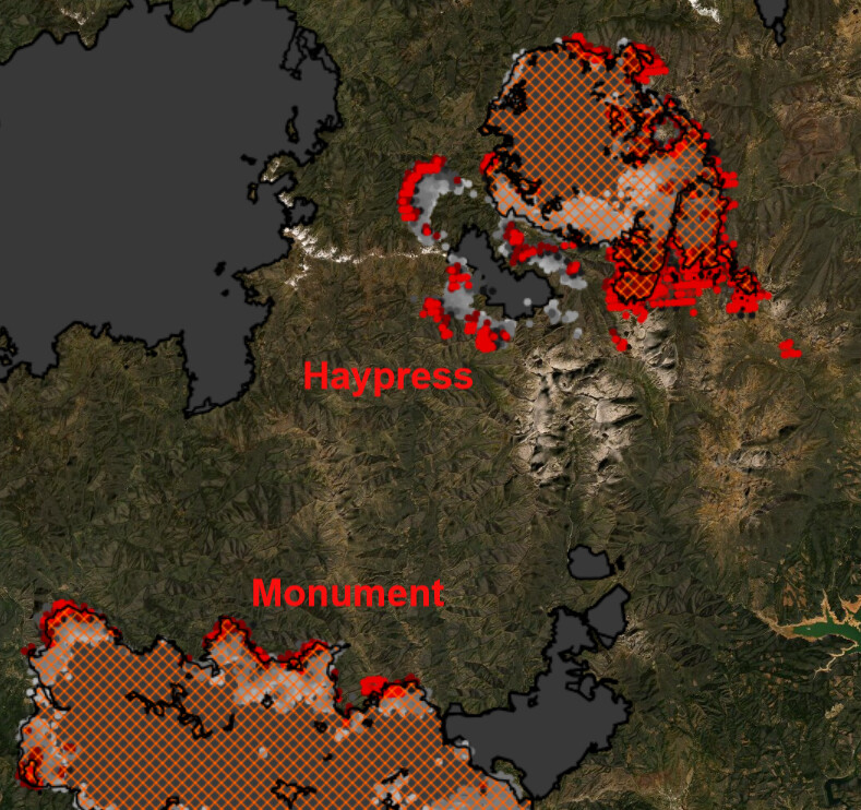
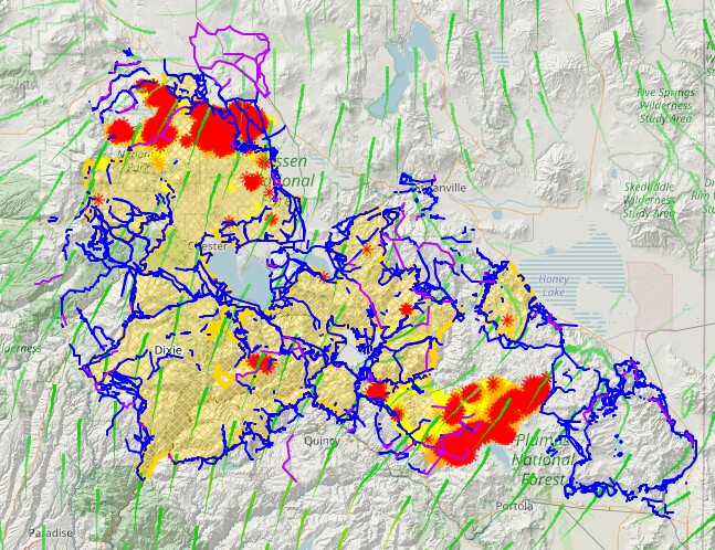
Significant growth on the Haypress, Cronan, and McCash fires today. It seems logical to assume they will become one perimeter at some point. Tomorrow the westerly winds increase and this will bring significant growth potential as the fires have spread south due to the northerly winds opening up more flank.
The Haypress continues to inch closer to the Monument Fire with VIRS/MODIS hits extending south.
1 Like
A post was merged into an existing topic: CA-KNF-RIVER COMPLEX???
KML files filtered from 20210901 data package found here:
https://ftp.wildfire.gov/public/incident_specific_data/calif_n/!2021_FEDERAL_Incidents/CA-KNF-6385_RiverComplex/GIS/IncidentData/
For import into CalTopo, Google Earth, etc. Can’t vouch for how accurate they keep the data vs what’s really on the ground.
Completed Dozer Line:
Completed All Type Of Line:
Planned Dozer And Hand Line:
Here’s an example from Dixie data of what you can create with these in CalTopo. Blue lines are Completed All Type Of Line, Purple are Planned Dozer And Hand Line:
3 Likes
KML files filtered from 20210905 data package found here:
https://ftp.wildfire.gov/public/incident_specific_data/calif_n/!2021_FEDERAL_Incidents/CA-KNF-6385_RiverComplex/GIS/IncidentData/
For import into CalTopo, Google Earth, etc. Can’t vouch for how accurate they keep the data vs what’s really on the ground.
The table contains entries with the following incident names:
[NULL]
(River Complex)
Cronan (River Complex)
Haypress (River Complex)
Knob
Lava
McCash
Monument
MONUMENT
River
river complex
River Complex
Salt
Summer (River Complex)
Completed Dozer Line. There are 429 entries vs 399 yesterday:
Completed All Type Of Line. There are 777 entries vs 719 yesterday:
Planned All Type Of Line. There are 98 entries vs 105 yesterday:
Latest VIIRS along with some of today’s data package:
Red dots = Detection last 24 hours.
Dark Orange dots = Detection Last 48 hours.
Light Orange dots = Detection Last 72 hours.
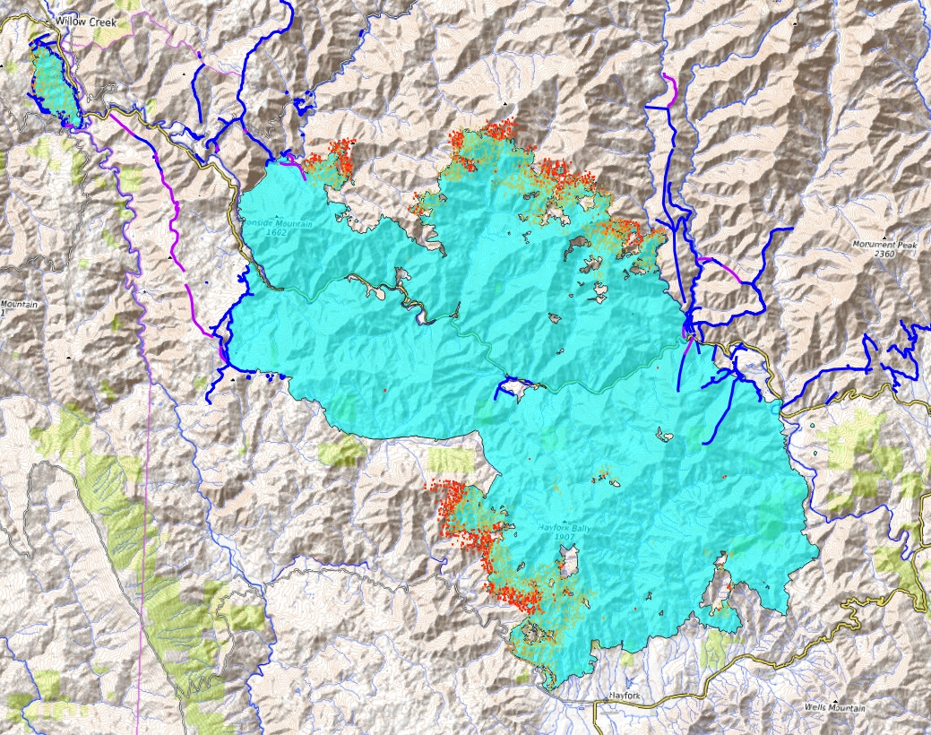
Cyan = Fire Perimeter.
Dark Blue lines = Completed All Types Of Line.
Purple lines = Planned All Types Of Line.
Trinity Alps
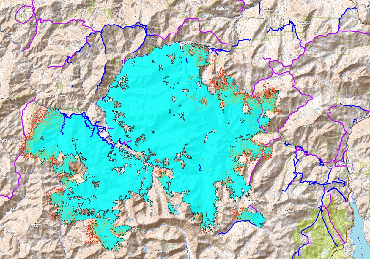
Monument
McCash

KML files filtered from 20210906 data package found here:
https://ftp.wildfire.gov/public/incident_specific_data/calif_n/!2021_FEDERAL_Incidents/CA-KNF-6385_RiverComplex/GIS/IncidentData/
I discovered the data packages are a complete mess from this incident. Lava and Salt info in one day, partly in another day, etc. These files are named v2 with Lava and Salt info removed. References to how many entries make up each KML vs yesterday’s are correct for today AND yesterday’s numbers. Who does this matter to? Probably only me LOL.
For import into CalTopo, Google Earth, etc. Can’t vouch for how accurate they keep the data vs what’s really on the ground.
Completed Dozer Line. There are 405 entries vs 339 yesterday:
Completed All Type Of Line. There are 694 entries vs 603 yesterday:
Planned All Type Of Line. There are 106 entries vs 96 yesterday:
2 Likes