CA-KNF-SLATER

From CHP

1 Like

500+ac long range spotting evacuations in progress

2 Likes

Evacuations as of 1035hrs Per KNF Twitter acct.

Happy Camp, CA–Slater Fire-- Siskiyou County Sheriff’s Department issued the following: “EVACUATION ORDER IN PLACE FOR RESIDENCES ON BOTH WEST AND EAST SIDES OF EAST FORK, INDIAN CREEK, DOOLITTLE CREEK, AND FOREST SERVICE ROADS 17N11, 18N13, AND 17N17A.” Info. line 530-356 9434

2 Likes

Taken from Fort Jones

1 Like

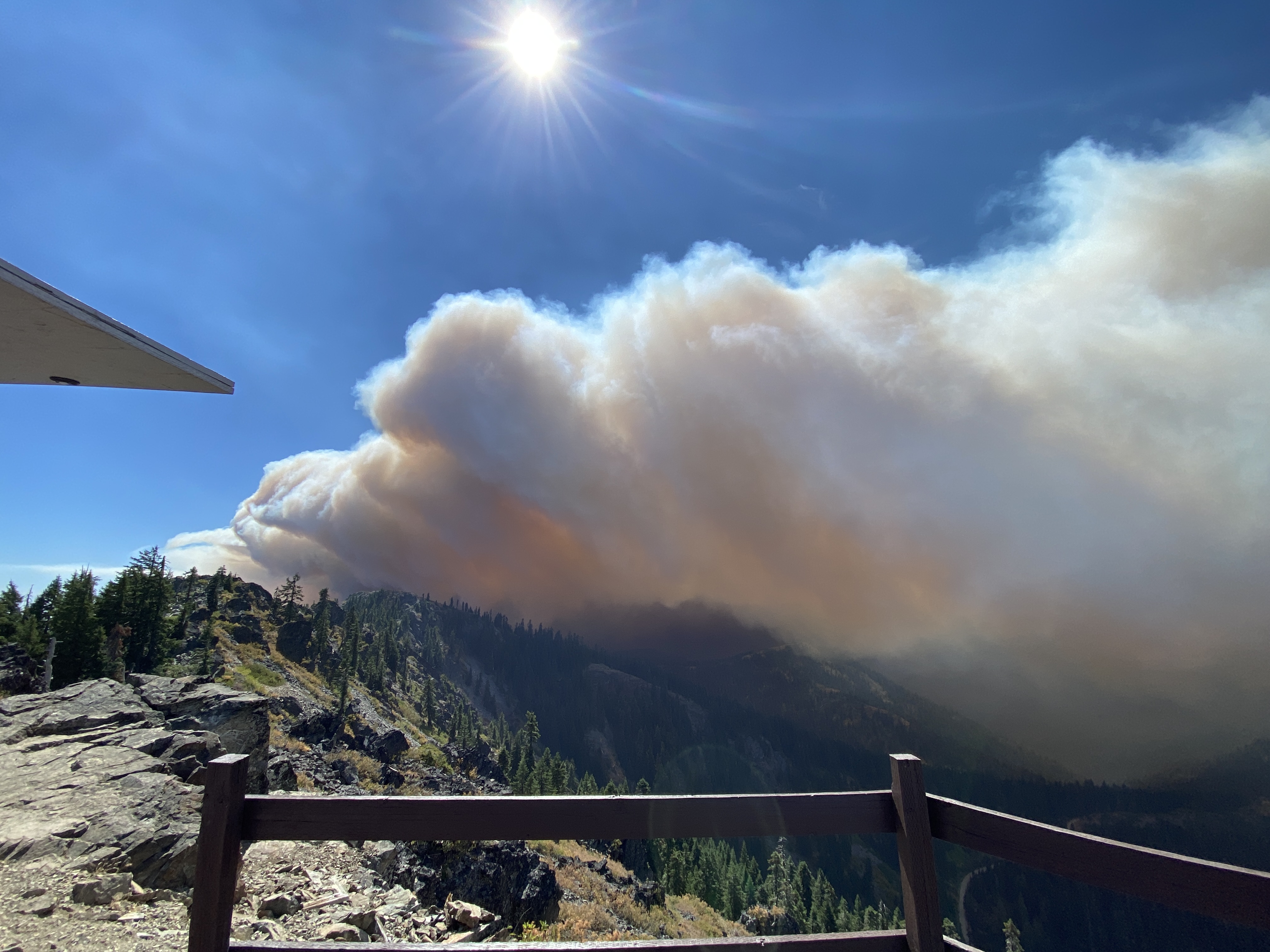
Watching from Bolan Mountain lookout

11 Likes

ONCC News & Notes 1350hrs:

CA-KNF SLATER FIRE: 1000 acres timber, 0% contained with rapid rate of spread. Structures threatened with evacuations in progress for the town of Happy Camp to lower airport road and Elk Creek. An evacuation center is being setup in the town of Seiad. Aircraft have been unable to fly the incident due to strong winds. A Type 2 IMT on order.

How far is from the beaver fire a few years back

Miles and miles. Beaver was past Hamburg on the way to Yreka.

1 Like

27 gusting to 47 from Slater Butte RAWS at 1552hrs. Impressive!

Ok was just trying to get a bearing on the location.

According to the SOPS news and notes page, CIIMT 10 has been reassigned from the Sheep to the Slater.

KNF Twitter at 1830hrs

Happy Camp, CA–Slater Fire is currently at 22,000 acres in size. A number of evacuation orders have been issued for various roads in the area as well as the community of Happy Camp. For the most current evacuation information refer to the Siskiyou County Sheriff’s Facebook.

1 Like

Good to see Team 10 on this fire, they have lots of experience on the Klamath.

Ops Map:

1 Like

I was there yesterday, and I can tell you that that map isn’t very accurate. Not saying that to criticize, just putting it out there for folks who may be looking at it for information on the status of their property.

1 Like

Good point and true I am sure! Normally on in-brief an IR flight would be ordered and a decent map would be generated for the next op period but I would suspect it may be a few days before we get anything close to accurate due to the overwhelming amount of fire activity in the West affecting the availability of IR flights.

1 Like

XSN2396C is enroute to the Incident Forestville, Cloverdale, Schell-Vista, Santa Rosa, Rancho Adobe, with a Sonoma Valley STL. Is there ANYWHERE in the State That isn’t burning…? Heads on a swivel, and LACES for everyone. No lives lost for little/no gain! Be safe, Brothers.

8 Likes

Crescent City radio station is reporting Gasquet under immediate evacuation order and Highway 199 closed at 197 in Hiouchi to the Oregon State line. Evavcuees going to fairgrounds in Crescent City.

2 Likes

New evac’s today due to a new start near Seiad Valley, the Devil fire. I imagine these two fires will be run as a complex, since it is likely they will burn together. Evacuations in place now from Scott River Road west on Highway 96.

Per North Ops:
CA-KNF SLATER FIRE: 90,000 acres timber, 0% contained. Fire behavior remained extreme with long range spotting. Evacuation Orders in remain for the town of Happy Camp as well as Gasquet, and along Klamath River in the fire area. A Red Flag Warning remain for the fire area until 2100 tonight for gusty winds and low humidity. California IMT 10 (Dalrymple) will assume command at 0600 tomorrow morning.

Per Siskiyou S.O.:
Slater Fire Updates

Happy Camp, CA

Mandatory Evacuation Orders have been extended from Clear Creek along Highway 96 to O’neil Creek Campground. The order extends from Highway 96 to the Oregon Border. The Evacuation Orders include the communities of Happy Camp and Seiad Valley.

PLEASE EVACUATE IMMEDIATELY!!!

EVACUATION WARNING:

An Evacuation Warning is in place from O’neil Creek Campground to the mouth of the Scott River.

TEMPORARY EVACUATION POINT LOCATION:

Klamath River Union Elementary School

30438 Walker Rd.

Horse Creek, CA 96050

With Happy Camp under evacuation where is camp going to be? Not a lot of options along Hwy 96.