
State ID: CA
3 letter designator: KRN/CND
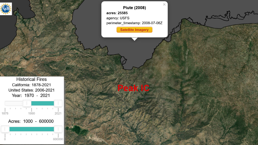
Fire name: Peak
Location: N/O Walker Basin Road; Caliente, CA
Reported acres: 80
Rate of spread: rapid
Report on Conditions: started from lightning on 7/19, now well established and running uphill in grass, brush, oak, and timber in the general direction of Piute Peak. Short range spotting. Threat to FRA. Per KRN unified command with CND.
Structure threat: yes, evacuations for Piute.
Resources: SQF: BC-42 BC-6114 COB-3 DIV-4 E-43 E-45 E-47 E-6646 Kern: PT-49, AA410, T74, T75, T76, T78, T132, HC408
Hazards: steep terrain, hot temperatures, limited fire history in this area.
Weather: SCE Thompson Canyon
Radio channels:
Scanner link: Kern County Fire Departments Live Audio Feed (feed offline)
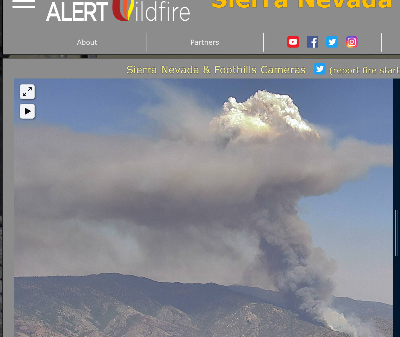
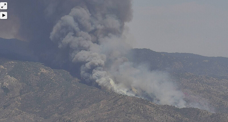
Webcam link: Breckenridge Peak 1
Breckenridge Peak 2
Thumb Mountain 1
El Rancho 1
Bird Springs 2
Agency Website: Peak Fire Information - InciWeb the Incident Information System
TF5230 just dispatched. E336, 345, P11, 16, 51 BC4
Putting up a good header from hwy 99
It’s showing on RAMMB satellite ( Tamarack top and Peak bottom)
https://col.st/QcNoh
Jawbone RAWS is: (its a ways north by 10 miles, maybe. Not finding closer stations.)
Sustained wind 20 gusts to 31out of SW
Temp 90 RH 18
https://wrcc.dri.edu/cgi-bin/rawMAIN.pl?caCJAW
Daily summary and submit info.
Q: Is this Well Peak/Johns Peak? There’s an old well burn scar from 2005 and 2011.
Caltopo is 3 hours behind, Believe this will be the map and heat signature’s will show in 4 hours.
https://caltopo.com/map.html#ll=35.42073,-118.47107&z=13&b=t&o=f16a%2Cr&n=1,0.25&a=mba%2Cfire%2Cmodis_mp
There’s just fire history showing at 1600. Zoom in and out for more detail or bigger area.
There is a fire start north/NE on the Sequoia Admin forest. Near French Meadow on the map.
NE of what the link encompasses. (Zoom out)
It’s up on Caltopo….above link… scan to the right a bit.
Burning up canyon and NE through Cholly Canyon.
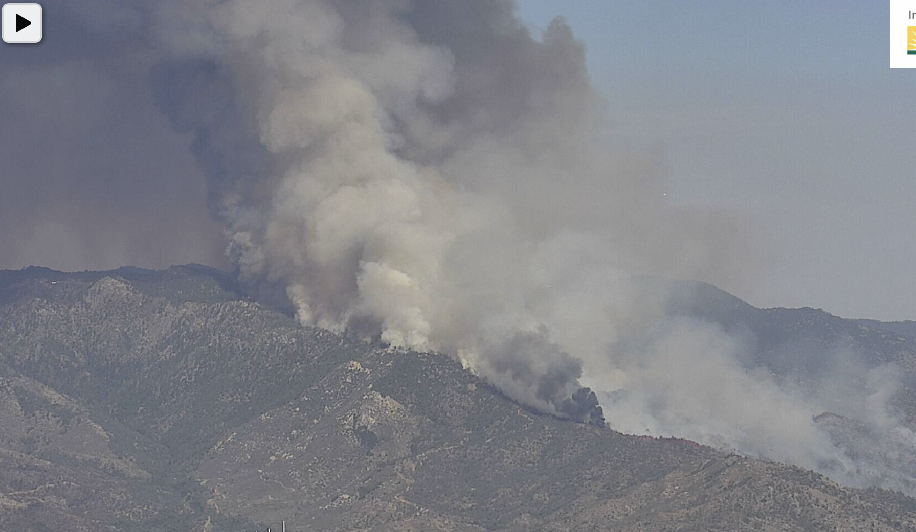
2 tankers back enroute from porterville and the big Hercules looks to be over the fire again today. Cameras are showing some heavier smoke near the ridge today.
http://www.alertwildfire.org/sierra/index.html?camera=Axis-ThumbMtn1&v=81e003f
I heard that yesterday while mobile, couldn’t reply. Tanker activity on the air tactics channel and I heard T132 lift off from Fresno around 0940hrs. So, yes they hit it again.